Gorilla Permits Rwanda — 6 Years of Trusted Service
Rwanda suits long-distance travel better than almost any country in Africa, and its finest expression is the Congo Nile Trail — a route of roughly 227 kilometres that runs along the western edge of the country, following the shore of Lake Kivu from the lakeside town of Rubavu in the north to Rusizi in the south. The trail threads through tea plantations, fishing villages and forest, climbs above the lake on old tracks and footpaths. Delivers some of the most spectacular lake-and-mountain scenery in Africa.
The name says everything about the landscape. The trail runs along the ridge that separates the Congo basin — whose waters flow west into the mighty Congo River — from the Nile basin, whose rivers run east and north toward the White Nile. Standing on the trail, you are on the water divide of a continent: behind you the hills drain toward the Atlantic, ahead of you they drain toward the Mediterranean. Few long-distance routes anywhere have a story quite like that.
Walk or cycle the Congo Nile Trail in stages, with overnight stops in lakeside villages, guesthouses and beach camps along the way. It is the kind of journey that suits a long weekend, a slow week, or the southern leg of a bigger Rwanda itinerary. This guide covers the route, the practicalities and the highlights — and if you want to build it into a larger holiday, our six-day Rwanda gorilla trekking and Lake Kivu safari strings the trail’s northern section into a complete journey.
The Rwanda Development Board developed the Congo Nile Trail as Rwanda’s great long-distance route: a signposted corridor running from the northern lakeshore at Rubavu — the town the whole world knows as Gisenyi — down the entire length of Lake Kivu to Rusizi at the southern end, where the Ruzizi River spills out of the lake toward Lake Tanganyika. In total the route measures about 227 kilometres. Walkers, mountain bikers and, increasingly, road cyclists use it on the sections where the route follows tarmac.
The trail does not follow a single engineered path. For much of its length it follows existing roads, tracks and footpaths — the lanes that fishing communities, tea workers and market traders have used for generations — linked by newer signposted sections that were cut to keep the route close to the lake. This is part of its charm: you are not walking a purpose-built trail so much as travelling the working landscape of western Rwanda, moving exactly as the people of the lake do.
Most trail users split the route into manageable daily stages, each ending in a community that has learned to welcome them. Some sections hug the shoreline, passing beaches and fishing villages. Others climb high above the lake for panoramic views, then drop back to the water. The result is a journey with a rhythm: climb, descend, lake view, village, repeat. After a few days on the trail you will know the hills of western Rwanda the way the people who live in them do.
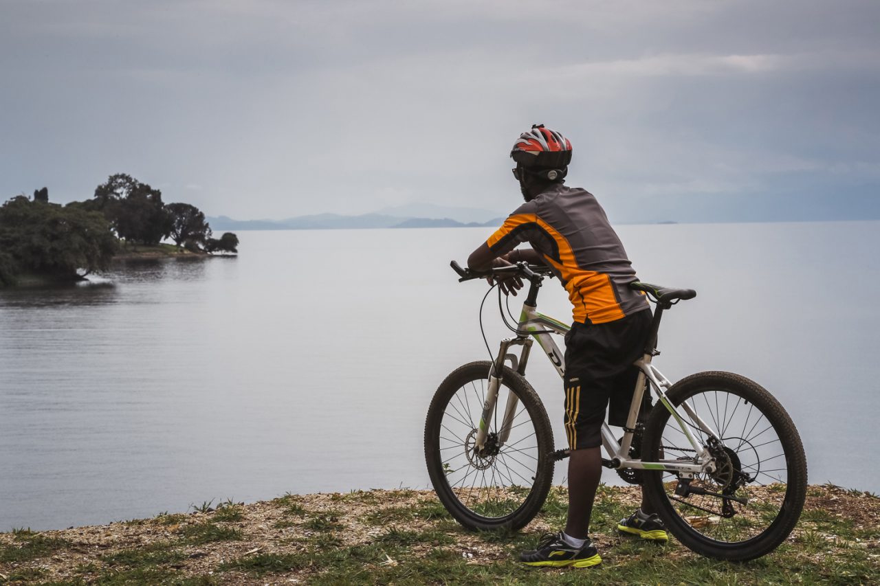
The Congo Nile Trail works beautifully at two speeds. Walkers cover the full route in about a week to ten days, with daily stages of roughly 20 to 30 kilometres. Cyclists — the trail’s most passionate constituency — can ride the entire length in four to six days. Fit riders complete it faster. Both versions share the same route, the same villages and the same views. The difference is simply how much of the landscape you feel in your legs.
Walking has the advantage of intimacy. At walking pace you notice the small things: the tea pickers on the hillsides, the children waving from the schoolyard, the fishermen mending nets at the lake’s edge. The trail’s daily stages are short enough that you arrive in each overnight stop with time to swim, eat well and talk to the people you meet. For most first-time visitors, walking the northern sections of the trail is the perfect introduction to Rwandan hospitality.
Cycling covers far more ground and adds its own drama. The trail’s hills are long and the road surfaces vary — smooth tarmac in places, rough earth and rock in others — which makes a mountain bike the standard choice. The reward is the endless unfolding of the lake as you ride: one viewpoint after another, each bend in the road revealing a new island, a new bay, a new angle on the blue water below. Many riders combine the trail with the wider cycling culture of Rwanda. Our cycling guide can help you plan it.
Whichever pace you choose, the trail’s structure is the same: start in Rubavu, finish in Rusizi (or the reverse). Let the villages along the way look after you. Operators and guesthouses along the route arrange bike hire and porters for walkers. A luggage transfer service moves your bags between overnight stops so you ride or walk light.
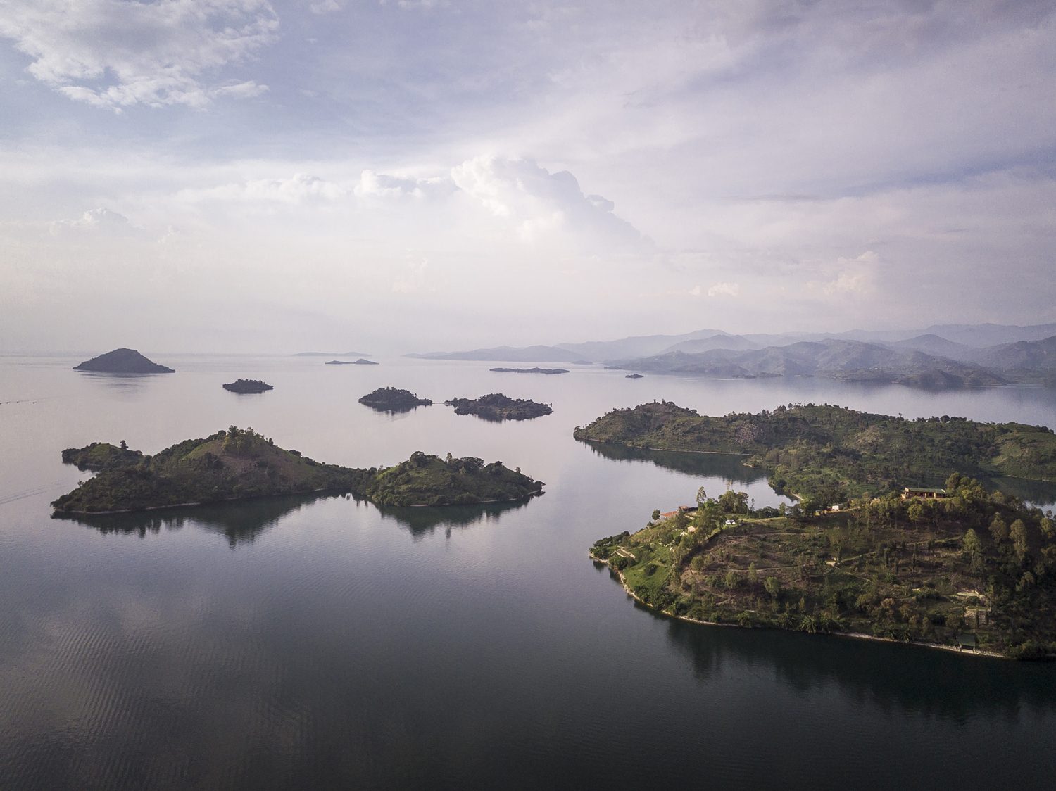
Lake Kivu is the constant companion of the Congo Nile Trail, and no other route in Africa follows a lake quite like it. Kivu is one of the great lakes of the continent, stretching more than 2,700 square kilometres across the western rift. It sits at an altitude of roughly 1,460 metres — high enough that its water is always cool and clear. High enough that the lake feels more like a mountain reservoir than a tropical lake. Islands, bays and beaches dot its shoreline. Green hills ring its deep blue water.
The lake’s setting is extraordinary. On its western shore, across the water in the DRC, rise the forests of the Congo basin. To the north, on clear days, the volcanoes of the Virunga chain appear on the horizon. The trail rides the ridge between this lake and the hills behind it. Means the views change constantly: one moment the lake fills the frame, the next you are deep in a valley of tea or bananas. It is a landscape of constant surprise.
The lake is also a working lake, and the trail passes through the communities that live on its water. Fishermen still push out at dusk in dugout canoes. Women wash clothes on the beaches. Cargo boats move between the lakeside towns. At some villages you will see the singing fishermen, who paddle in unison and sing as they row — a tradition that has become famous far beyond the lake’s shores. The Congo Nile Trail is not a wilderness route in the mountain sense. It is a journey through a living lakeside world. That is very much the point.
The trail’s rewards are spread along its entire length, but a few places stand out. The route maps published by Rwanda’s official tourism board are the best place to start planning stages. Rubavu, at the northern end, is the classic starting point: a busy lakeside town with beaches, a lively promenade and views across the lake to the Congolese town of Goma, with the volcanoes of the Virunga chain lifting the horizon behind it. A swim in the lake at Rubavu, looking across the water at another country, is the perfect way to begin.
Further south, the trail climbs through the tea country that blankets the hills above the lake. These are some of the most beautiful landscapes in Rwanda: endless green terraces of tea, hedged with trees, with the blue line of the lake below. The plantations are working farms. The trail passes through them respectfully — pickers at work, the smell of drying leaves from the processing factories. Long views across the ridged hills toward the water.
Midway along the route, the town of Kibuye — also called Karongi — is the trail’s most celebrated stop. Set on a peninsula of forested hills, with beaches, islands and some of the best sunset views in Rwanda, Kibuye is where many travellers pause for an extra day, hiring a kayak or a boat to explore the lake’s islands. The town also holds the Genocide Memorial that remembers the people who died here in 1994, a sobering and essential part of any visit to western Rwanda.
At the southern end, the trail reaches Rusizi, where the lake narrows and its waters begin their long journey out through the Ruzizi River toward Lake Tanganyika. The town is a frontier place, on the edge of the DRC and Burundi. The sense of journey’s end is strong: you have followed the lake from its northern shore to its outlet. The water you have watched for a week is about to leave Rwanda for good.
The Congo Nile Trail is notable for the quality of its overnight stops. Along the route you will find a mix of lakeside guesthouses, beach camps and homestay-style accommodation run by the communities the trail passes through — many of them established specifically to welcome trail travellers. The standard varies from simple to genuinely comfortable. The welcome is consistently warm. The food is consistently good: fresh fish from the lake, beans, plantains and the rice for which western Rwanda is known.
Reserving accommodation ahead of time is recommended at the popular stops, especially in the high season. It is easy to do through operators who know the trail. If you are walking, a luggage transfer service means you can travel with a daypack while your main bag waits at the next guesthouse. If you are cycling, most guesthouses offer secure storage and basic bike repairs. A support vehicle can be arranged for the full route.
The trail also rewards a little flexibility. Some of the best nights on the route are unplanned: a fisherman who offers a boat ride, a village that invites you to a ceremony, a beach camp that turns out to be the highlight of the trip. Leave room in your plan for the lake to make you an offer.
The Congo Nile Trail can be walked or cycled in any month. The dry seasons — roughly January to February and June to September — offer the most comfortable conditions. In the rainy seasons the trail is muddier and the views less reliable, though the hills are greener and the lakeside is at its most lush. Either way, the trail’s elevation — much of it between 1,400 and 1,900 metres — keeps the walking climate mild, with warm days and cool nights.
For hikers, a reasonable level of fitness is all the trail demands. The daily stages involve genuine climbing. The pace is yours to set. The route is well within the reach of anyone who enjoys a full day of walking. Cyclists should be comfortable with long climbs and technical descents on mixed surfaces. A mountain bike is the honest choice for most of the route, though sections on the northern end have been surfaced for road bikes.
Carry cash for village purchases, travel with a basic first-aid kit and a filter or purification method for water. Expect the weather to change a few times a day. The essentials are straightforward:
The Congo Nile Trail sits at the centre of Rwanda’s greatest travel circuit. To the north lie the Virunga volcanoes and the gorillas of Volcanoes National Park. To the south-west, beyond Rusizi, rise the mountains of Nyungwe, home to chimpanzees and the canopy walkway. And the trail itself threads between them along the lake. A journey that combines the trail with the country’s wildlife highlights is one of the great itineraries of East Africa.
The classic southern route runs from Kigali to the volcanoes, then west to the lake for the trail’s northern stages, then south through Nyungwe to the Kivu coast. It can be walked or cycled over a week to ten days, with gorilla trekking and chimpanzee tracking woven in. For travellers who want the trail without the full logistics, our eight-day Rwanda best adventure safari covers the volcanoes, the lake and Nyungwe with expert guides and support throughout.
However you plan it, the Congo Nile Trail rewards the traveller who takes the time to follow it properly. The lake, the hills, the villages, the tea, the singing fishermen — this is Rwanda’s slowest, most human adventure. The memories it leaves are among the most enduring the country offers. Plan your stages, pack for the hills and start at the lake.