Gorilla Permits Rwanda — 6 Years of Trusted Service
Mount Sabyinyo is the strangest and most spectacular of the Virunga volcanoes — a mountain whose summit you share with three countries at once. Standing 3,645 metres high at the junction of the borders of Rwanda, Uganda and the Democratic Republic of Congo, its summit is split into a series of jagged, tooth-like peaks that give the mountain its name. Sabyinyo comes from the Kinyarwanda word for old man’s teeth, and the description fits: the summit ridge looks like a broken jawbone of stone, gnawed by weather and time.
This is not a gentle mountain. Where Bisoke offers a steady forest climb and Karisimbi a long expedition, Sabyinyo is a steep, technical scramble that demands hands as well as feet, a head for heights and a healthy respect for rock. It is also one of the most rewarding hikes in Volcanoes National Park, with views that take in three nations, the full sweep of the Virunga chain and, on clear days, the smoke of Nyiragongo rising from the Congo basin.
This guide covers everything you need to know about climbing Sabyinyo: the route and the scramble, the border landscape, the wildlife, the practicalities of permits and guides, and how to combine the climb with gorilla trekking. To see the full range of hikes we run in the region, start with our mountain hiking guide.
The defining feature of Mount Sabyinyo is where it sits. The mountain stands on the tripoint where the borders of Rwanda, Uganda and the DRC meet, and its summit ridge actually carries the boundary line — the official border follows the crest of the mountain’s three main peaks. Standing on the top, you are in three countries at once, with rangers’ posts on three sides and three national parks meeting at the summit: Rwanda’s Volcanoes National Park, Uganda’s Mgahinga Gorilla National Park and the DRC’s Virunga National Park.
This tri-border position makes Sabyinyo one of the most sought-after summits in Africa. There are few places in the world where a hiker can stand in three countries simultaneously, and none quite like this — the summit is genuinely wild, with no monuments, no flags, just rock, wind and the extraordinary geography of the boundary. The views are equally extraordinary: to the west, the great mass of Karisimbi and the distant smoke of Nyiragongo; to the east, the cones of Gahinga and Muhabura; and far below, the green valleys of three countries.
The mountain’s geology is part of its character. Sabyinyo is one of the oldest volcanoes in the Virunga chain, long extinct and heavily eroded, and it is precisely that erosion that created the jagged teeth of the summit. Where younger volcanoes like Bisoke still show smooth, conical profiles, Sabyinyo has been weathered into a hardened core of rock — a volcanic ruin that looks ancient even by the standards of a range that is itself young in geological terms.
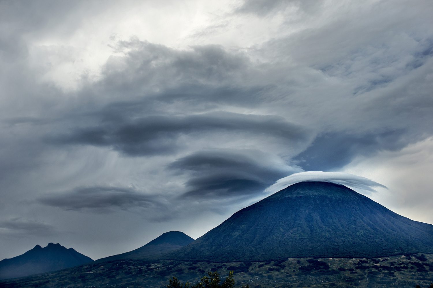
Climbing Sabyinyo is unlike the other volcano hikes in Rwanda. The lower sections follow the familiar pattern — farmland, then bamboo forest, then Hagenia woodland — but where Bisoke’s trail is a steady grind and Karisimbi’s is a long, graded expedition, Sabyinyo ends in a serious scramble. The final assault on the teeth involves steep rock faces, exposed ridges and sections where you climb with hands and feet, using fixed ropes and chains to haul yourself up the worst of it.
The climb is usually done in a single day, and it is not for the faint-hearted. Fit and experienced hikers manage it in around eight to ten hours round trip, but the pace is set by the group, and the technical sections on the upper mountain are slow going. A head for heights is genuinely important: some of the traverses between the teeth sit on exposed ledges, and the guides will take their time bringing the group through. If the weather turns — and it can, at any moment — the scramble becomes significantly harder.
The summit itself is the payoff. The teeth are interconnected, and you reach the highest point by scrambling across from peak to peak, each one with its own view. The official summit sits on the tripoint, and the guides make sure you get the full experience: photographs on the border, views across three countries, and the odd sensation of standing on a boundary that divides a mountain but not its people — the communities on all three sides share the same Virunga landscape and, at lower altitudes, the same gorillas.
The descent is its own adventure. Coming down the scramble is slower than going up, and the lower forest trail, which felt easy in the morning, feels interminable on tired legs. Plan for a long day, start early and let the porters carry the weight — you will be glad of every extra kilogram they shoulder by the time you reach the trailhead.
No climb in the chain offers better views than Mount Sabyinyo. Because the summit sits at the eastern edge of the volcano chain’s high peaks, the panorama opens up in every direction: the whole sweep of the Virunga range to the west, the Ugandan volcanoes to the north-east, and the vast, cultivated green of the Albertine Rift valley falling away to the east. On the clearest days you can see the blue glint of Lake Kivu on the southern horizon and, far to the west, the ever-smoking crater of Nyiragongo.
The view of Nyiragongo is a particular draw. The DRC volcano’s active lava lake glows at night, and on clear evenings the red shimmer is visible from the Sabyinyo ridge — a reminder that this chain of mountains is not a museum of extinct geology but a living volcanic system. From the summit, Karisimbi’s 4,507-metre massif dominates the western skyline, and the teeth of the border mountain sit beneath it like a smaller, fiercer cousin.
Below the summit, the landscape tells the story of the border. On the Rwandan side, the forest of Volcanoes National Park runs down toward the twin lakes of Bulera and Ruhondo; on the Ugandan side, the bamboo slopes of Mgahinga; on the Congolese side, the rolling forest of Virunga National Park. In all three, the same mountain gorillas roam across the boundary as if the line did not exist — the tripoint is, in a very real sense, the heart of the gorilla habitat that spans the three countries.
Photographers should carry a telephoto lens and expect to work quickly, because the views are at their sharpest in the first hours of the morning, before the clouds begin to climb the flanks of the mountain. It is also worth remembering that Sabyinyo’s summit is a working meeting point of the natural world — rangers on all three sides watch the mountain, and the forest below is protected by three national parks at once. Few peaks anywhere combine geology, geography and history quite like it, and standing on the teeth you feel the weight of all three.
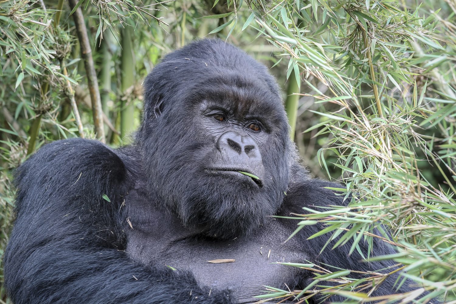
Mount Sabyinyo’s lower slopes are rich in wildlife, and the approach through the forest is often as memorable as the summit. The mountain sits on the edge of the gorilla country, and gorilla groups on the Ugandan side of the border are sometimes seen near the trail in Mgahinga; on the Rwandan side, the volcano’s forest holds its own gorilla families, and fresh signs of their presence — flattened vegetation, dung, torn bamboo — are a common sight for hikers.
Golden monkeys are the star performers on Sabyinyo’s slopes. These striking primates — golden-orange fur, black limbs, delicate faces — live in the bamboo zone that wraps the mountain, and troops of them are frequently encountered in the lower forest. They are among the most photogenic animals in the Virunga chain, and watching a troop of twenty or thirty of them move through the bamboo, chattering and leaping, is a highlight of the approach climb.
Birds add another layer to the forest soundtrack. The mountain’s altitude range, from farmland at the base to moorland at the top, creates a series of habitats that attract an array of species, from the crowned hornbills that boom through the Hagenia forest to the sunbirds that work the giant lobelias at altitude. Hikers who keep their eyes open on Sabyinyo come down with sightings to rival many a dedicated birding safari.
As with the other volcano hikes in Rwanda, climbing Mount Sabyinyo requires a permit issued through the Rwanda Development Board and booked in advance through a licensed operator. Numbers on the mountain are limited each day, and the scramble means the park manages the flow of climbers carefully; in the peak season, permits for Sabyinyo can sell out well ahead of time. The gorilla permits page explains the wider system, and our team can arrange the mountain permit as part of your itinerary.
A ranger guide is mandatory and essential. The scramble sections are technically demanding, the weather is unpredictable, and the forest holds gorillas, buffalo and elephant. The guides know the mountain intimately — every handhold, every weather pattern, every short cut — and they carry the ropes and safety kit that make the teeth climbable. Groups are small, and the guides pace the climb to suit the slowest member.
Porters are available at the trailhead and, on Sabyinyo, they earn their money. The scramble is physically demanding, and a porter carrying your daypack lets you use your hands properly on the rock sections. There is also a practical point: the lower forest trail is long, and having your water, snacks and spare layers on someone else’s back for the descent makes the final hours far more pleasant. Hire a porter, tip them well, and treat the mountain as a full-day expedition.
Sabyinyo combines the demands of a forest hike with the technicalities of a scramble, and the packing list reflects both. The essentials:
Leave anything non-essential at your hotel in Musanze. The climb is a long day with technical sections, and every extra item in your pack is a burden on the scramble. Travel light, move steadily and keep your hands free for the rock.
Mount Sabyinyo is a superb hike in its own right, but it sits in the middle of the world’s best gorilla country, and the two experiences belong together. A gorilla trek in Volcanoes National Park paired with the Sabyinyo climb gives you two completely different ways of experiencing the same forest — one on your knees, one on the summit — and the combination is one of the great two-day itineraries of East Africa.
The standard structure is a three-day Rwanda gorilla trekking safari: a day with the gorillas, a rest evening in Musanze, and a full day on Sabyinyo. The mountain is also a natural partner for the region’s other highlights — the twin lakes of Bulera and Ruhondo lie at its foot, and the golden monkeys of the bamboo zone can be trekked on a separate visit. For hikers with time, adding the Bisoke crater lake climb or the two-day Karisimbi expedition completes the volcano set.
Whatever your itinerary, book the permits early and let the guides set the pace. The mountain has no patience with rushed plans, and the border summit rewards those who come prepared. Contact our team to plan the climb, and take your time on the teeth — there is no view like it anywhere in the Virungas.
Mount Sabyinyo is the most challenging day hike in Rwanda, and that is precisely its appeal. If you want a steady forest stroll, Bisoke or the golden monkey trails will serve you better; if you want a scramble with ropes, exposed ridges and a summit you share with three countries, Sabyinyo is in a class of its own. It demands a reasonable level of fitness, a head for heights and a tolerance for the weather the mountain makes.
It repays every bit of effort. The border summit, the teeth, the views across three nations — this is hiking with a story attached, and it is one of the experiences that stays with you long after the scratches heal. Plan properly, respect the mountain, and you will come down from Sabyinyo with the rarest of souvenirs: a photograph of yourself in three countries at once.