Kayaking Lake Kivu: Paddling Africa’s Highest Lake

There are lakes, and then there are lakes you paddle. Kayaking Lake Kivu puts you in the second kind — one of Africa’s great lakes, a vast inland sea of more than 2,700 square kilometres sitting at an altitude of around 1,460 metres in the western arm of the Rift Valley. Its water is clear, cool and remarkably calm, its shoreline is a maze of islands, bays and forested peninsulas, and its shores are ringed by the green hills that make Rwanda the Land of a Thousand Hills. For a kayaker, it is close to paradise.

Kivu is unusual among Africa’s great lakes in almost every way. It is one of the highest great lakes on the continent — at nearly 1,500 metres above sea level, it sits far above the lowland lakes of the east — and its position in the volcanic rift means its deep waters hold dissolved gases that bubble up in places, a reminder of the geology beneath. The lake has more than a hundred islands, from tiny rocky outcrops to the large island of Idjwi, and its shoreline is shared between Rwanda and the Democratic Republic of Congo.

This guide covers everything you need to know about kayaking Lake Kivu: the best paddling bases, the routes and islands, what you will see along the way, and the official lake guide from Visit Rwanda’s tourism siteay, and how to combine a kayaking trip with the rest of a Rwanda safari. If you are planning a full holiday around the lake, our Lake Kivu destination guide and the six-day Rwanda gorilla trekking and Lake Kivu safari are the best places to start.

Kayaking Lake Kivu: A Great Lake at High Altitude

Lake Kivu belongs to the family of African great lakes — the chain that includes Victoria, Tanganyika and Malawi — but it stands apart from them in almost every way. It is by far the highest of the great lakes, sitting at roughly 1,460 metres in the western branch of the East African Rift, and it is one of the most deeply embedded in its landscape: the hills rise directly from its shores, and the lake fills what is in effect a volcanic basin between the Congo and Nile watersheds.

The lake’s size is hard to grasp from the shore. At more than 2,700 square kilometres it is one of the largest lakes on the continent, stretching about ninety kilometres from its northern end at Rubavu to its southern outlet at Rusizi. Its islands number well over a hundred, and its shoreline — shared between Rwanda and the DRC — runs to hundreds of kilometres of bays, beaches and peninsulas. On its western side the hills of the Congo rise steeply from the water, and the lake has the feel of a mountain lake magnified to a scale that defies the word.

For paddlers, the geography is a gift. For example, the lake’s position in the hills shelters much of its water from the strong winds of the open rift, so its surface is frequently calm — glassy in the mornings, rippled in the afternoons. Its water is clear and clean, drawn from the hills and the springs of the rift, and it stays cool at altitude, which makes swimming and paddling comfortable through the middle of the day. This is not a lake you battle; it is a lake you glide across.

Why Kayaking Lake Kivu Means Paddling Between Islands
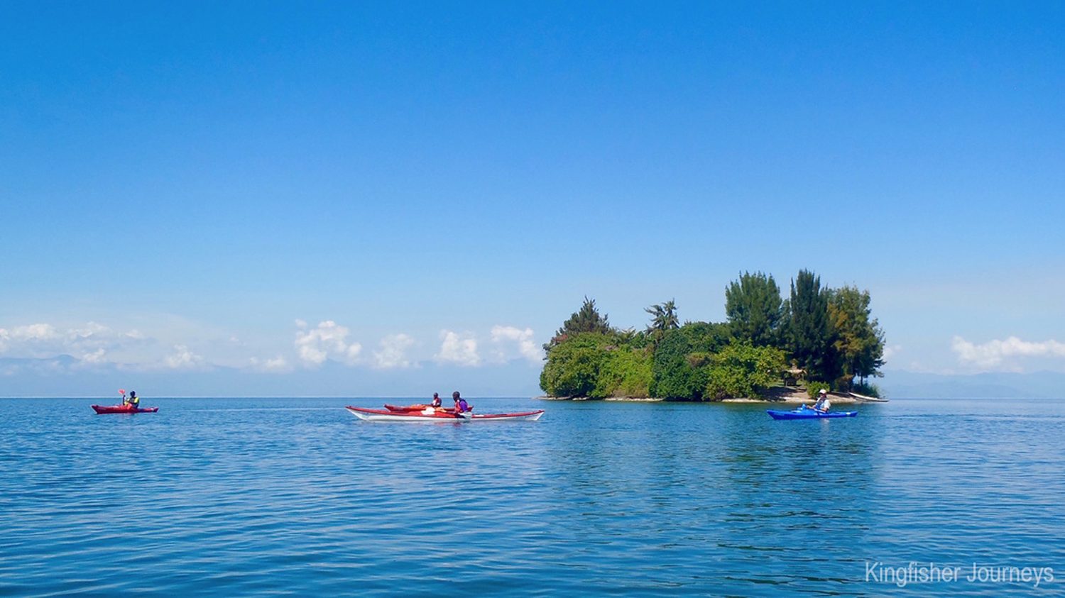
Kayaking Lake Kivu: kayakers paddling the calm waters near Rubavu

Kayaking Lake Kivu moves at the lake’s own pace, which is exactly why it is the perfect way to experience the lake. From a kayak you can slip between the islands, follow the shoreline into coves that are invisible from the road, and approach the lake’s fishing villages the way the lake’s own people do — across the water, quietly. Within an hour of launching, the road and its noise are gone, and the lake becomes a world of water, birds and hills.

The lake’s islands, meanwhile, are the paddler’s playground. Most are uninhabited or lightly settled, covered in forest or grass, and they make perfect destinations for a picnic paddle — launch in the morning, cross a channel, swim off an island beach, paddle back in the late afternoon. The larger islands have villages with their own rhythms: coffee washing stations, banana groves, children who paddle their own small boats. Meeting them from the water is one of the great pleasures of the lake.

Kayaking on Kivu is accessible to everyone. The lake’s calm waters suit beginners, while its size and its many islands give experienced paddlers room to plan real expeditions. Local operators along the lake offer kayaks and guides, and trips range from a two-hour morning paddle to multi-day island-hopping expeditions with camping on the islands themselves. The paddling is gentle; the memories are anything but.

Where to Paddle: Rubavu, Kibuye and the Islands

The best kayaking Lake Kivu has to offer starts in two places. At the northern end, the town of Rubavu — known to everyone as Gisenyi — has a long beach and calm, shallow water that is ideal for a first paddle, with views across the lake to the Congolese town of Goma and, on clear days, the volcanic cones of the Virunga range behind it. A morning paddle at Rubavu, looking across the water to another country, is a gentle introduction to the lake.

The true heart of Kivu kayaking is Kibuye, the town also known as Karongi, in the middle of the lake’s Rwandan shore. Kibuye sits on a peninsula of hills covered in forest, with islands scattered around it and some of the calmest water on the lake. The paddling here is superb: you can cross to the island of Napoleon Hat, circle the pine-forested islands offshore, or simply follow the shoreline’s coves and cliffs. Operators in Kibuye run guided kayak trips, and it is the base for most of the lake’s overnight kayak expeditions.

Multi-day kayaking Lake Kivu is a genuine expedition. A two or three-day route from Kibuye paddles south along the shore, camping on beaches and island forests, meeting fishing villages along the way and finishing at the southern towns of the lake. The pace is set by wind and weather — mornings are calm, afternoons can be breezy — and the guides who run these trips know the lake’s moods. For paddlers who want the full experience, this is the trip to plan for.

Wildlife and Landscapes From the Water
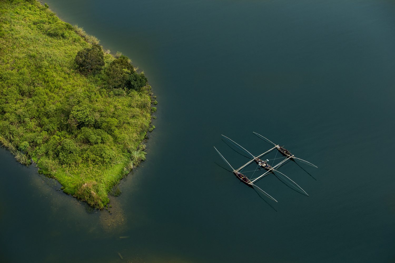
Singing fishermen rowing across Lake Kivu

The lake’s wildlife is visible from a kayak in a way it never is from the shore. Fish eagles sit in the trees along the shore and launch over the water; herons and cormorants work the shallows; flocks of weavers and sunbirds move through the lakeside vegetation. The birdlife of Kivu is rich, and a kayak is the perfect platform for watching it — silent, slow and level with the water.

The landscapes change constantly as you paddle. In the north, the hills are steep and the shore is rocky; in the middle, forested peninsulas and islands break the water; in the south, the hills ease back and the lake opens out. Tea plantations climb the slopes above the lake, their green terraces meeting the blue water, and villages of neat brick houses sit in the folds of the hills. Every bay has its own picture, and every hour of paddling brings a new one.

The people of the lake are part of the landscape too. Fishermen set out in the evenings in dugout canoes, their silhouettes black against the sunset; on some stretches you will see the famous singing fishermen, paddling in unison and singing as they row. From a kayak, you are part of the lake’s traffic — welcome in the villages, greeted from the shore, part of a water-world that has its own customs and its own life.

Islands to Visit: From Tiny Rocks to Idjwi

The islands of Lake Kivu are one of its great attractions, and from a kayak they are all within reach. Small rocky islands rise from the water like green hats, covered in forest and busy with birds; larger islands are farmed and settled, their villages connected to the mainland by boat. A paddle around any of them takes you through water that is completely yours, with the hills of the mainland on one side and the island forest on the other.

The largest island in the lake is Idjwi, which lies on the Congolese side of the water and is one of the largest lake islands in Africa. It is not a typical kayak destination from the Rwandan shore — the crossing is long and the border must be respected — but it is visible from many paddling routes, a long green mass that anchors the western horizon. Within the Rwandan side of the lake, the paddling islands are smaller, closer and easier, and they are the ones most trips visit.

Island stops are where the lake reveals its best side. A beach landing, a swim in the clear water, a picnic under the trees, the silence of a lake with no roads — then a lazy paddle back as the afternoon breeze builds. The islands give Kivu kayaking its structure: you paddle from island to island, and each one is a small adventure in its own right.

When to Go Kayaking Lake Kivu: Seasons and Conditions

Kayaking Lake Kivu is a year-round activity, but the best conditions follow the seasons. In the dry periods — roughly January to February and June to September — the mornings are calm and clear, the water is at its most inviting, and the views of the hills and islands are at their sharpest. In the rainy seasons, however, the lake is still paddlable, but the afternoons bring more frequent showers and the wind can pick up quickly.

The Daily Rhythm of Kayaking Lake Kivu

The daily rhythm of the lake matters more than the calendar. Mornings on Kivu are almost always calm — the classic time to launch — while afternoons often bring a breeze that builds from the south. Experienced paddlers plan their crossings for the morning, use the afternoons for swimming, beaches and island stops, and respect the lake’s moods: Kivu is gentle, but it is still a great lake, and the wind can change in minutes.

Whatever the season, the essentials are simple. The lake’s altitude keeps its water cool, so a light wet suit or a rash vest is comfortable for long swims; the sun at 1,460 metres is strong, so cover up and carry water. Your operator will brief you on conditions before every trip, and the guides keep a close eye on the weather.

All of the lake’s established kayak routes can be arranged through local operators, and travellers who prefer everything pre-booked can fold a kayaking day into a wider itinerary — from a half-day paddle at Kibuye to a multi-day island expedition with camping on the lake. Indeed, the lake is a year-round paddling destination, and the calm of its waters has a way of becoming the calmest part of any Rwanda holiday. To lock in your dates and your guide, book your kayaking trip with our team, or simply contact us and we will fit the lake into your plans.

What to Bring for a Kayaking Trip

Kayaking Kivu does not require much, but the right kit makes the trip better. In addition, operators provide the kayaks, paddles, safety equipment and guides; what you bring is personal:

  • A swimsuit and a towel — you will swim
  • Rash vest or light layer for sun protection on the water
  • Waterproof bag for your phone, camera and valuables
  • Sun hat, sunglasses with a strap, and high-factor sunscreen
  • At least two litres of water, and snacks for the island stops
  • Sandals or water shoes for the beach landings
  • A dry set of clothes for after the paddle
  • Cash for village purchases and tips

Travel light on the water — the kayaks have limited dry storage — and trust the guides to handle the logistics. The lake will do the rest.

Combining Kayaking Lake Kivu With Gorillas and the Trail

Lake Kivu is the centrepiece of western Rwanda, and it combines effortlessly with the country’s other great experiences. The lake is the heart of the Congo Nile Trail, the long hiking and cycling route that follows its shore from Rubavu to Rusizi, and a kayak trip is the perfect complement to a trail journey — a day on the water after days on the hills, or a morning paddle before a day of cycling.

To the north, the volcanoes of the Virunga chain rise beyond the lake, and the gorillas of Volcanoes National Park are a few hours’ drive from the lakeshore. A classic combination is a two-day gorilla trekking tour followed by a few days at the lake — the quiet of the water after the drama of the forest. To the south, the forests of Nyungwe hold chimpanzees and the canopy walkway, and the southern lakeshore makes a natural gateway to them.

The complete western Rwanda journey — volcanoes, lake and forest — is covered in our eight-day Rwanda best adventure safari, and for travellers who want the lake front and centre, the six-day Rwanda gorilla trekking and Lake Kivu safari builds a full holiday around it. Whatever you plan, leave the lake at least a full day: one paddle, one swim, one sunset. It will be the calmest day of your trip.
The Congo Nile Trail: Rwanda’s Great Long-Distance Trek

Rwanda suits long-distance travel better than almost any country in Africa, and its finest expression is the Congo Nile Trail — a route of roughly 227 kilometres that runs along the western edge of the country, following the shore of Lake Kivu from the lakeside town of Rubavu in the north to Rusizi in the south. The trail threads through tea plantations, fishing villages and forest, climbs above the lake on old tracks and footpaths. Delivers some of the most spectacular lake-and-mountain scenery in Africa.

The name says everything about the landscape. The trail runs along the ridge that separates the Congo basin — whose waters flow west into the mighty Congo River — from the Nile basin, whose rivers run east and north toward the White Nile. Standing on the trail, you are on the water divide of a continent: behind you the hills drain toward the Atlantic, ahead of you they drain toward the Mediterranean. Few long-distance routes anywhere have a story quite like that.

Walk or cycle the Congo Nile Trail in stages, with overnight stops in lakeside villages, guesthouses and beach camps along the way. It is the kind of journey that suits a long weekend, a slow week, or the southern leg of a bigger Rwanda itinerary. This guide covers the route, the practicalities and the highlights — and if you want to build it into a larger holiday, our six-day Rwanda gorilla trekking and Lake Kivu safari strings the trail’s northern section into a complete journey.

What Is the Congo Nile Trail?

The Rwanda Development Board developed the Congo Nile Trail as Rwanda’s great long-distance route: a signposted corridor running from the northern lakeshore at Rubavu — the town the whole world knows as Gisenyi — down the entire length of Lake Kivu to Rusizi at the southern end, where the Ruzizi River spills out of the lake toward Lake Tanganyika. In total the route measures about 227 kilometres. Walkers, mountain bikers and, increasingly, road cyclists use it on the sections where the route follows tarmac.

The trail does not follow a single engineered path. For much of its length it follows existing roads, tracks and footpaths — the lanes that fishing communities, tea workers and market traders have used for generations — linked by newer signposted sections that were cut to keep the route close to the lake. This is part of its charm: you are not walking a purpose-built trail so much as travelling the working landscape of western Rwanda, moving exactly as the people of the lake do.

Most trail users split the route into manageable daily stages, each ending in a community that has learned to welcome them. Some sections hug the shoreline, passing beaches and fishing villages. Others climb high above the lake for panoramic views, then drop back to the water. The result is a journey with a rhythm: climb, descend, lake view, village, repeat. After a few days on the trail you will know the hills of western Rwanda the way the people who live in them do.

Hiking or Cycling the Congo Nile Trail: Choosing Your Pace

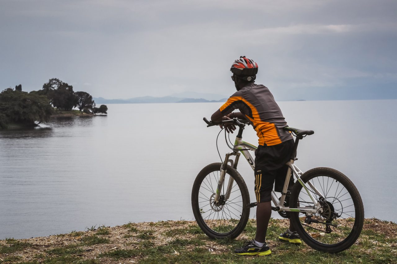
Cycling the Congo Nile Trail above Lake Kivu

The Congo Nile Trail works beautifully at two speeds. Walkers cover the full route in about a week to ten days, with daily stages of roughly 20 to 30 kilometres. Cyclists — the trail’s most passionate constituency — can ride the entire length in four to six days. Fit riders complete it faster. Both versions share the same route, the same villages and the same views. The difference is simply how much of the landscape you feel in your legs.

Walking has the advantage of intimacy. At walking pace you notice the small things: the tea pickers on the hillsides, the children waving from the schoolyard, the fishermen mending nets at the lake’s edge. The trail’s daily stages are short enough that you arrive in each overnight stop with time to swim, eat well and talk to the people you meet. For most first-time visitors, walking the northern sections of the trail is the perfect introduction to Rwandan hospitality.

Cycling covers far more ground and adds its own drama. The trail’s hills are long and the road surfaces vary — smooth tarmac in places, rough earth and rock in others — which makes a mountain bike the standard choice. The reward is the endless unfolding of the lake as you ride: one viewpoint after another, each bend in the road revealing a new island, a new bay, a new angle on the blue water below. Many riders combine the trail with the wider cycling culture of Rwanda. Our cycling guide can help you plan it.

Whichever pace you choose, the trail’s structure is the same: start in Rubavu, finish in Rusizi (or the reverse). Let the villages along the way look after you. Operators and guesthouses along the route arrange bike hire and porters for walkers. A luggage transfer service moves your bags between overnight stops so you ride or walk light.

Lake Kivu: The Water at the Heart of the Congo Nile Trail

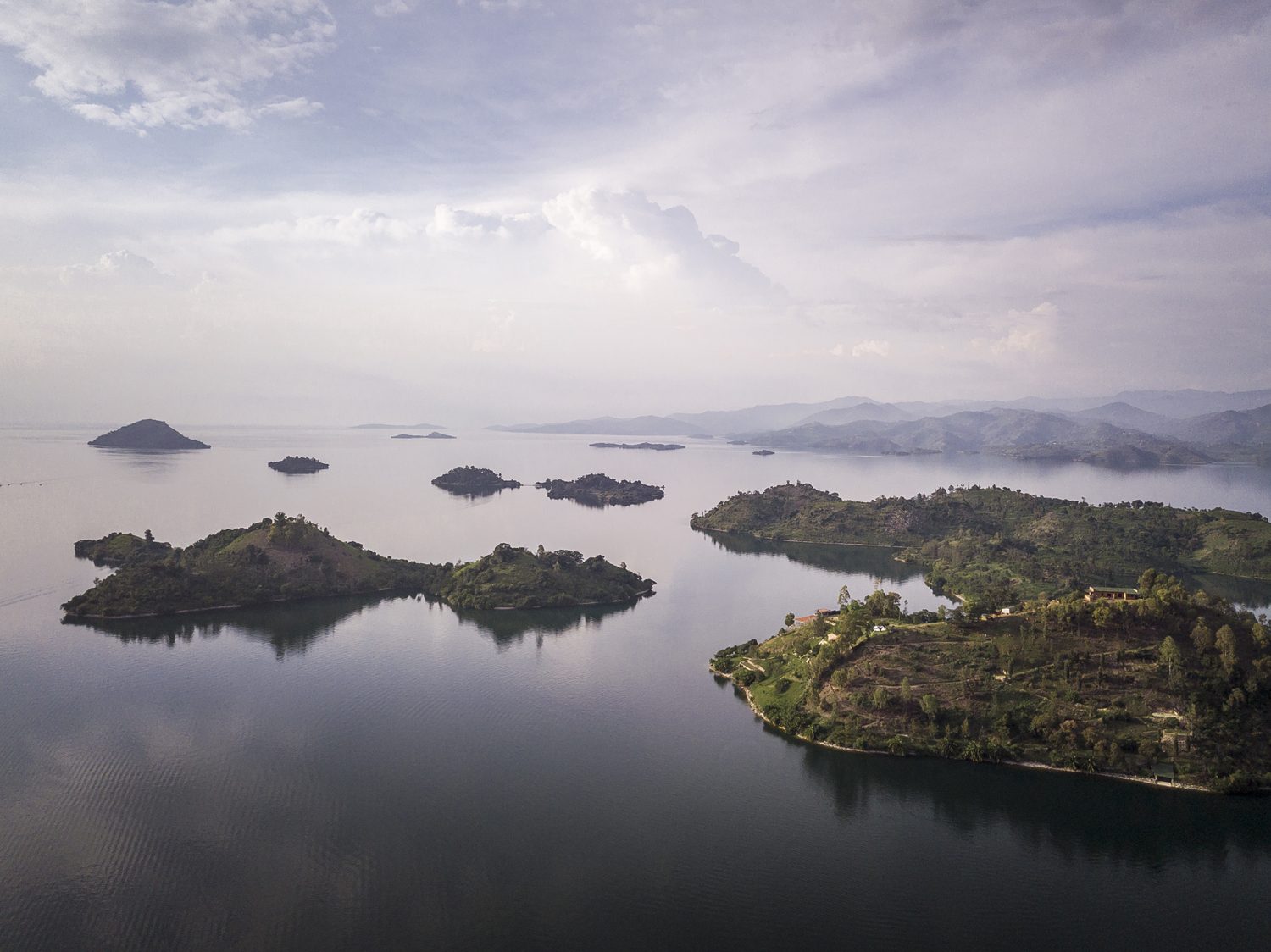
Lake Kivu and its many islands seen from the air

Lake Kivu is the constant companion of the Congo Nile Trail, and no other route in Africa follows a lake quite like it. Kivu is one of the great lakes of the continent, stretching more than 2,700 square kilometres across the western rift. It sits at an altitude of roughly 1,460 metres — high enough that its water is always cool and clear. High enough that the lake feels more like a mountain reservoir than a tropical lake. Islands, bays and beaches dot its shoreline. Green hills ring its deep blue water.

The lake’s setting is extraordinary. On its western shore, across the water in the DRC, rise the forests of the Congo basin. To the north, on clear days, the volcanoes of the Virunga chain appear on the horizon. The trail rides the ridge between this lake and the hills behind it. Means the views change constantly: one moment the lake fills the frame, the next you are deep in a valley of tea or bananas. It is a landscape of constant surprise.

The lake is also a working lake, and the trail passes through the communities that live on its water. Fishermen still push out at dusk in dugout canoes. Women wash clothes on the beaches. Cargo boats move between the lakeside towns. At some villages you will see the singing fishermen, who paddle in unison and sing as they row — a tradition that has become famous far beyond the lake’s shores. The Congo Nile Trail is not a wilderness route in the mountain sense. It is a journey through a living lakeside world. That is very much the point.

Highlights Along the Congo Nile Trail

The trail’s rewards are spread along its entire length, but a few places stand out. The route maps published by Rwanda’s official tourism board are the best place to start planning stages. Rubavu, at the northern end, is the classic starting point: a busy lakeside town with beaches, a lively promenade and views across the lake to the Congolese town of Goma, with the volcanoes of the Virunga chain lifting the horizon behind it. A swim in the lake at Rubavu, looking across the water at another country, is the perfect way to begin.

Further south, the trail climbs through the tea country that blankets the hills above the lake. These are some of the most beautiful landscapes in Rwanda: endless green terraces of tea, hedged with trees, with the blue line of the lake below. The plantations are working farms. The trail passes through them respectfully — pickers at work, the smell of drying leaves from the processing factories. Long views across the ridged hills toward the water.

Midway along the route, the town of Kibuye — also called Karongi — is the trail’s most celebrated stop. Set on a peninsula of forested hills, with beaches, islands and some of the best sunset views in Rwanda, Kibuye is where many travellers pause for an extra day, hiring a kayak or a boat to explore the lake’s islands. The town also holds the Genocide Memorial that remembers the people who died here in 1994, a sobering and essential part of any visit to western Rwanda.

At the southern end, the trail reaches Rusizi, where the lake narrows and its waters begin their long journey out through the Ruzizi River toward Lake Tanganyika. The town is a frontier place, on the edge of the DRC and Burundi. The sense of journey’s end is strong: you have followed the lake from its northern shore to its outlet. The water you have watched for a week is about to leave Rwanda for good.

Where to Stay on the Trail

The Congo Nile Trail is notable for the quality of its overnight stops. Along the route you will find a mix of lakeside guesthouses, beach camps and homestay-style accommodation run by the communities the trail passes through — many of them established specifically to welcome trail travellers. The standard varies from simple to genuinely comfortable. The welcome is consistently warm. The food is consistently good: fresh fish from the lake, beans, plantains and the rice for which western Rwanda is known.

Reserving accommodation ahead of time is recommended at the popular stops, especially in the high season. It is easy to do through operators who know the trail. If you are walking, a luggage transfer service means you can travel with a daypack while your main bag waits at the next guesthouse. If you are cycling, most guesthouses offer secure storage and basic bike repairs. A support vehicle can be arranged for the full route.

The trail also rewards a little flexibility. Some of the best nights on the route are unplanned: a fisherman who offers a boat ride, a village that invites you to a ceremony, a beach camp that turns out to be the highlight of the trip. Leave room in your plan for the lake to make you an offer.

When to Go and What to Know

The Congo Nile Trail can be walked or cycled in any month. The dry seasons — roughly January to February and June to September — offer the most comfortable conditions. In the rainy seasons the trail is muddier and the views less reliable, though the hills are greener and the lakeside is at its most lush. Either way, the trail’s elevation — much of it between 1,400 and 1,900 metres — keeps the walking climate mild, with warm days and cool nights.

For hikers, a reasonable level of fitness is all the trail demands. The daily stages involve genuine climbing. The pace is yours to set. The route is well within the reach of anyone who enjoys a full day of walking. Cyclists should be comfortable with long climbs and technical descents on mixed surfaces. A mountain bike is the honest choice for most of the route, though sections on the northern end have been surfaced for road bikes.

Carry cash for village purchases, travel with a basic first-aid kit and a filter or purification method for water. Expect the weather to change a few times a day. The essentials are straightforward:

  • Comfortable, broken-in footwear for hiking; a well-serviced mountain bike for cycling
  • Sun protection, a hat and sunscreen — much of the trail is exposed
  • A rain jacket; afternoon showers happen year-round on the lake
  • Water bottles and purification tablets or a filter
  • Light clothing for the days and a warm layer for the evenings
  • A swimsuit — the lake’s beaches and bays are part of the experience
  • Cash, a small repair kit for cyclists, and a headlamp for the guesthouses

Combining the Trail With Gorillas and Nyungwe

The Congo Nile Trail sits at the centre of Rwanda’s greatest travel circuit. To the north lie the Virunga volcanoes and the gorillas of Volcanoes National Park. To the south-west, beyond Rusizi, rise the mountains of Nyungwe, home to chimpanzees and the canopy walkway. And the trail itself threads between them along the lake. A journey that combines the trail with the country’s wildlife highlights is one of the great itineraries of East Africa.

The classic southern route runs from Kigali to the volcanoes, then west to the lake for the trail’s northern stages, then south through Nyungwe to the Kivu coast. It can be walked or cycled over a week to ten days, with gorilla trekking and chimpanzee tracking woven in. For travellers who want the trail without the full logistics, our eight-day Rwanda best adventure safari covers the volcanoes, the lake and Nyungwe with expert guides and support throughout.

However you plan it, the Congo Nile Trail rewards the traveller who takes the time to follow it properly. The lake, the hills, the villages, the tea, the singing fishermen — this is Rwanda’s slowest, most human adventure. The memories it leaves are among the most enduring the country offers. Plan your stages, pack for the hills and start at the lake.

Mount Sabyinyo: Where Three Countries Meet

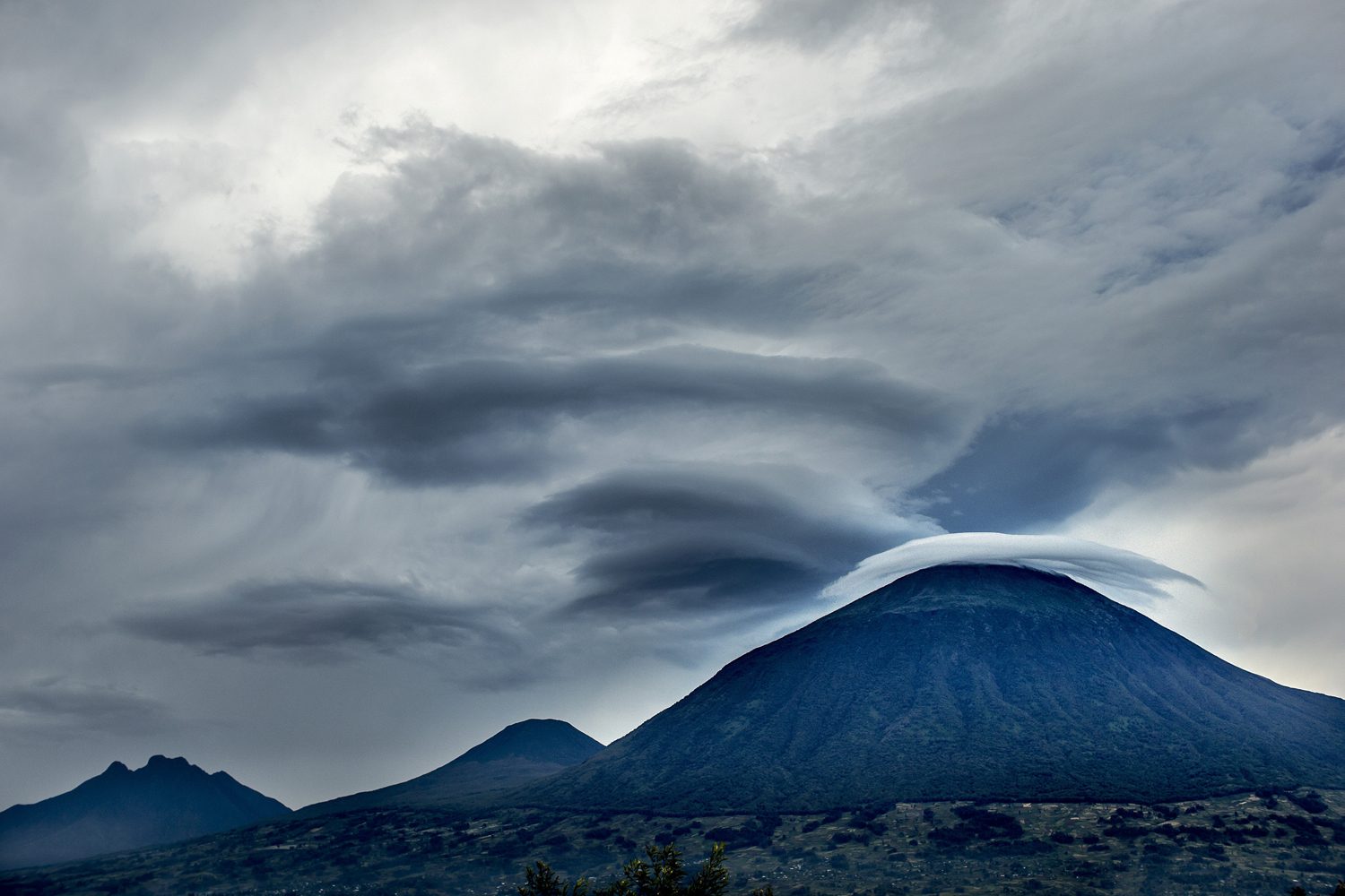
Mount Sabyinyo is the strangest and most spectacular of the Virunga volcanoes — a mountain whose summit you share with three countries at once. Standing 3,645 metres high at the junction of the borders of Rwanda, Uganda and the Democratic Republic of Congo, its summit is split into a series of jagged, tooth-like peaks that give the mountain its name. Sabyinyo comes from the Kinyarwanda word for old man’s teeth, and the description fits: the summit ridge looks like a broken jawbone of stone, gnawed by weather and time.

This is not a gentle mountain. Where Bisoke offers a steady forest climb and Karisimbi a long expedition, Sabyinyo is a steep, technical scramble that demands hands as well as feet, a head for heights and a healthy respect for rock. It is also one of the most rewarding hikes in Volcanoes National Park, with views that take in three nations, the full sweep of the Virunga chain and, on clear days, the smoke of Nyiragongo rising from the Congo basin.

This guide covers everything you need to know about climbing Sabyinyo: the route and the scramble, the border landscape, the wildlife, the practicalities of permits and guides, and how to combine the climb with gorilla trekking. To see the full range of hikes we run in the region, start with our mountain hiking guide.

Mount Sabyinyo: One Summit, Three Countries

The defining feature of Mount Sabyinyo is where it sits. The mountain stands on the tripoint where the borders of Rwanda, Uganda and the DRC meet, and its summit ridge actually carries the boundary line — the official border follows the crest of the mountain’s three main peaks. Standing on the top, you are in three countries at once, with rangers’ posts on three sides and three national parks meeting at the summit: Rwanda’s Volcanoes National Park, Uganda’s Mgahinga Gorilla National Park and the DRC’s Virunga National Park.

This tri-border position makes Sabyinyo one of the most sought-after summits in Africa. There are few places in the world where a hiker can stand in three countries simultaneously, and none quite like this — the summit is genuinely wild, with no monuments, no flags, just rock, wind and the extraordinary geography of the boundary. The views are equally extraordinary: to the west, the great mass of Karisimbi and the distant smoke of Nyiragongo; to the east, the cones of Gahinga and Muhabura; and far below, the green valleys of three countries.

The mountain’s geology is part of its character. Sabyinyo is one of the oldest volcanoes in the Virunga chain, long extinct and heavily eroded, and it is precisely that erosion that created the jagged teeth of the summit. Where younger volcanoes like Bisoke still show smooth, conical profiles, Sabyinyo has been weathered into a hardened core of rock — a volcanic ruin that looks ancient even by the standards of a range that is itself young in geological terms.

The Climb Up Mount Sabyinyo: A Steep Scramble

The summit ridge of Mount Sabyinyo

Climbing Sabyinyo is unlike the other volcano hikes in Rwanda. The lower sections follow the familiar pattern — farmland, then bamboo forest, then Hagenia woodland — but where Bisoke’s trail is a steady grind and Karisimbi’s is a long, graded expedition, Sabyinyo ends in a serious scramble. The final assault on the teeth involves steep rock faces, exposed ridges and sections where you climb with hands and feet, using fixed ropes and chains to haul yourself up the worst of it.

The climb is usually done in a single day, and it is not for the faint-hearted. Fit and experienced hikers manage it in around eight to ten hours round trip, but the pace is set by the group, and the technical sections on the upper mountain are slow going. A head for heights is genuinely important: some of the traverses between the teeth sit on exposed ledges, and the guides will take their time bringing the group through. If the weather turns — and it can, at any moment — the scramble becomes significantly harder.

The summit itself is the payoff. The teeth are interconnected, and you reach the highest point by scrambling across from peak to peak, each one with its own view. The official summit sits on the tripoint, and the guides make sure you get the full experience: photographs on the border, views across three countries, and the odd sensation of standing on a boundary that divides a mountain but not its people — the communities on all three sides share the same Virunga landscape and, at lower altitudes, the same gorillas.

The descent is its own adventure. Coming down the scramble is slower than going up, and the lower forest trail, which felt easy in the morning, feels interminable on tired legs. Plan for a long day, start early and let the porters carry the weight — you will be glad of every extra kilogram they shoulder by the time you reach the trailhead.

Views From Mount Sabyinyo: The Virunga Panorama

No climb in the chain offers better views than Mount Sabyinyo. Because the summit sits at the eastern edge of the volcano chain’s high peaks, the panorama opens up in every direction: the whole sweep of the Virunga range to the west, the Ugandan volcanoes to the north-east, and the vast, cultivated green of the Albertine Rift valley falling away to the east. On the clearest days you can see the blue glint of Lake Kivu on the southern horizon and, far to the west, the ever-smoking crater of Nyiragongo.

The view of Nyiragongo is a particular draw. The DRC volcano’s active lava lake glows at night, and on clear evenings the red shimmer is visible from the Sabyinyo ridge — a reminder that this chain of mountains is not a museum of extinct geology but a living volcanic system. From the summit, Karisimbi’s 4,507-metre massif dominates the western skyline, and the teeth of the border mountain sit beneath it like a smaller, fiercer cousin.

Below the summit, the landscape tells the story of the border. On the Rwandan side, the forest of Volcanoes National Park runs down toward the twin lakes of Bulera and Ruhondo; on the Ugandan side, the bamboo slopes of Mgahinga; on the Congolese side, the rolling forest of Virunga National Park. In all three, the same mountain gorillas roam across the boundary as if the line did not exist — the tripoint is, in a very real sense, the heart of the gorilla habitat that spans the three countries.

Photographers should carry a telephoto lens and expect to work quickly, because the views are at their sharpest in the first hours of the morning, before the clouds begin to climb the flanks of the mountain. It is also worth remembering that Sabyinyo’s summit is a working meeting point of the natural world — rangers on all three sides watch the mountain, and the forest below is protected by three national parks at once. Few peaks anywhere combine geology, geography and history quite like it, and standing on the teeth you feel the weight of all three.

Wildlife on Mount Sabyinyo’s Slopes: Gorillas and Golden Monkeys

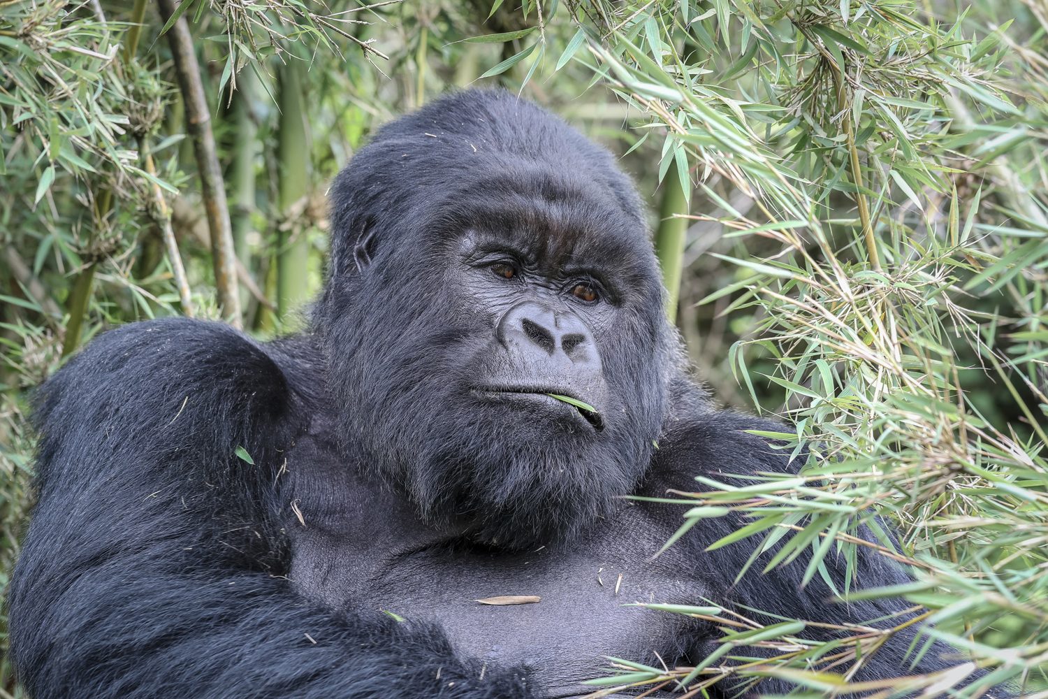
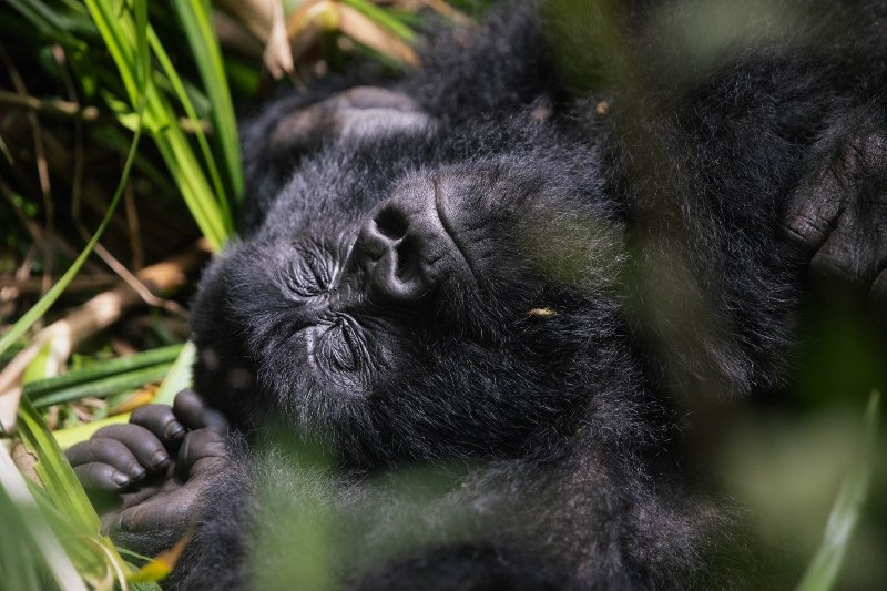
Mountain gorilla in the bamboo forest of the Virunga volcanoes

Mount Sabyinyo’s lower slopes are rich in wildlife, and the approach through the forest is often as memorable as the summit. The mountain sits on the edge of the gorilla country, and gorilla groups on the Ugandan side of the border are sometimes seen near the trail in Mgahinga; on the Rwandan side, the volcano’s forest holds its own gorilla families, and fresh signs of their presence — flattened vegetation, dung, torn bamboo — are a common sight for hikers.

Golden monkeys are the star performers on Sabyinyo’s slopes. These striking primates — golden-orange fur, black limbs, delicate faces — live in the bamboo zone that wraps the mountain, and troops of them are frequently encountered in the lower forest. They are among the most photogenic animals in the Virunga chain, and watching a troop of twenty or thirty of them move through the bamboo, chattering and leaping, is a highlight of the approach climb.

Birds add another layer to the forest soundtrack. The mountain’s altitude range, from farmland at the base to moorland at the top, creates a series of habitats that attract an array of species, from the crowned hornbills that boom through the Hagenia forest to the sunbirds that work the giant lobelias at altitude. Hikers who keep their eyes open on Sabyinyo come down with sightings to rival many a dedicated birding safari.

Mount Sabyinyo Practicalities: Permits and Timing

As with the other volcano hikes in Rwanda, climbing Mount Sabyinyo requires a permit issued through the Rwanda Development Board and booked in advance through a licensed operator. Numbers on the mountain are limited each day, and the scramble means the park manages the flow of climbers carefully; in the peak season, permits for Sabyinyo can sell out well ahead of time. The gorilla permits page explains the wider system, and our team can arrange the mountain permit as part of your itinerary.

A ranger guide is mandatory and essential. The scramble sections are technically demanding, the weather is unpredictable, and the forest holds gorillas, buffalo and elephant. The guides know the mountain intimately — every handhold, every weather pattern, every short cut — and they carry the ropes and safety kit that make the teeth climbable. Groups are small, and the guides pace the climb to suit the slowest member.

Porters are available at the trailhead and, on Sabyinyo, they earn their money. The scramble is physically demanding, and a porter carrying your daypack lets you use your hands properly on the rock sections. There is also a practical point: the lower forest trail is long, and having your water, snacks and spare layers on someone else’s back for the descent makes the final hours far more pleasant. Hire a porter, tip them well, and treat the mountain as a full-day expedition.

What to Pack for Sabyinyo

Sabyinyo combines the demands of a forest hike with the technicalities of a scramble, and the packing list reflects both. The essentials:

  • Hiking boots with excellent grip — the rock sections reward solid footwear
  • Waterproof jacket and trousers; the forest is wet and the teeth are exposed
  • Gloves, preferably with grip — they protect your hands on the ropes and rock
  • Long trousers and a long-sleeved shirt to protect against vegetation and sun
  • Warm mid-layer for the summit, where the wind is constant
  • At least two litres of water and substantial snacks
  • Sun hat, sunscreen and sunglasses — the summit sun is strong at 3,645 metres
  • A headlamp, in case the descent runs late into the afternoon
  • Your passport — the border summit makes it genuinely useful
  • Cash for guide and porter tips

Leave anything non-essential at your hotel in Musanze. The climb is a long day with technical sections, and every extra item in your pack is a burden on the scramble. Travel light, move steadily and keep your hands free for the rock.

Combining Mount Sabyinyo With Gorilla Trekking

Mount Sabyinyo is a superb hike in its own right, but it sits in the middle of the world’s best gorilla country, and the two experiences belong together. A gorilla trek in Volcanoes National Park paired with the Sabyinyo climb gives you two completely different ways of experiencing the same forest — one on your knees, one on the summit — and the combination is one of the great two-day itineraries of East Africa.

The standard structure is a three-day Rwanda gorilla trekking safari: a day with the gorillas, a rest evening in Musanze, and a full day on Sabyinyo. The mountain is also a natural partner for the region’s other highlights — the twin lakes of Bulera and Ruhondo lie at its foot, and the golden monkeys of the bamboo zone can be trekked on a separate visit. For hikers with time, adding the Bisoke crater lake climb or the two-day Karisimbi expedition completes the volcano set.

Whatever your itinerary, book the permits early and let the guides set the pace. The mountain has no patience with rushed plans, and the border summit rewards those who come prepared. Contact our team to plan the climb, and take your time on the teeth — there is no view like it anywhere in the Virungas.

Is Mount Sabyinyo for You?

Mount Sabyinyo is the most challenging day hike in Rwanda, and that is precisely its appeal. If you want a steady forest stroll, Bisoke or the golden monkey trails will serve you better; if you want a scramble with ropes, exposed ridges and a summit you share with three countries, Sabyinyo is in a class of its own. It demands a reasonable level of fitness, a head for heights and a tolerance for the weather the mountain makes.

It repays every bit of effort. The border summit, the teeth, the views across three nations — this is hiking with a story attached, and it is one of the experiences that stays with you long after the scratches heal. Plan properly, respect the mountain, and you will come down from Sabyinyo with the rarest of souvenirs: a photograph of yourself in three countries at once.

Climbing Mount Karisimbi: Rwanda’s Highest Volcano

Climbing Mount Karisimbi means taking on the highest point in Rwanda, a great extinct volcano whose summit rises 4,507 metres above the Virunga chain and, on clear days, looks down over the whole of northern Rwanda into Uganda and the Democratic Republic of Congo. Unlike its neighbour Bisoke, Karisimbi is not a day trip. The climb takes two days and one night, with a camp at 3,700 metres beneath the summit, and it is the most serious and the most rewarding hike in Volcanoes National Park.

Karimbi, as the mountain is known locally, is the second largest of the eight Virunga volcanoes, and its upper slopes carry a rare alpine ecosystem of giant lobelias, moorland and cold nights. The two-day format makes the climb tougher to fit into a short itinerary, but it also makes it safer and far more enjoyable: you gain altitude gradually, sleep in the mountain forest, and walk the final ridge in the first light of dawn, when the summit is often clear and the view stretches across three countries. This guide covers everything you need to know about climbing Mount Karisimbi: the route, the permits, the camp and the cost.

Dawn light over the volcanic peaks of Volcanoes National Park, Rwanda

Why Climb Mount Karisimbi

Bisoke gives you a crater lake in a day. Climbing Mount Karisimbi gives you Rwanda’s highest point, a night under the stars of the high Virunga, and a summit sunrise that hikers describe for the rest of their lives. Where the lower forest trails of the park are all about the gorillas, Karisimbi is about the mountain itself: the changing vegetation zones, the silence above the clouds, and the physical achievement of climbing more than 1,400 metres to the roof of the country.

The mountain is extinct, the remains of an old volcano that once stood far higher than today’s summit, and its name means “white shell” in Kinyarwanda, a reference to the cap of ice that historically covered the peak. The ice is long gone, but the summit still feels arctic in the early morning, and the upper slopes hold a landscape of giant groundsels, lobelia rosettes and mossy rock that is found nowhere else in Rwanda. On a clear day you can see the smoking cone of Nyiragongo, Mount Nyiragongo’s active crater in the Congo, and the whole sweep of the Albertine Rift.

Climbing Mount Karisimbi also passes through the richest wildlife habitat in the park. The bamboo and Hagenia forest of the lower slopes is the territory of mountain gorillas, and while the trekking route stays on the trail, you are walking through the same forest the gorillas call home. Golden monkeys, blue monkeys and black-and-white colobus all live along the route, and the birdlife is exceptional, including the Rwenzori turaco and the handsome francolin.

Mount Karisimbi Fast Facts

  • Elevation: 4,507 metres, the highest point in Rwanda
  • Location: Volcanoes National Park, on the border with the Democratic Republic of Congo
  • Duration: two days, one night, with the camp at 3,700 metres
  • Trailhead: Karisimbi gate, reached by four-wheel-drive from Kinigi
  • Distance: roughly 11 kilometres from trailhead to camp, and about 4 kilometres from camp to the summit
  • Difficulty: the hardest day hike available in the park; altitude and cold are the main challenges
  • Best for: experienced hikers and anyone who wants Rwanda’s highest summit

Alpine moorland and volcanic ridge below the summit of Mount Karisimbi

How the Two-Day Route for Climbing Mount Karisimbi Works

Climbing Mount Karisimbi is organised by the Volcanoes National Park office and must be booked in advance, with a guide and ranger escort required throughout. Day one starts early at the Karisimbi gate, reached by four-wheel-drive from Kinigi over a rough track that becomes impassable in heavy rain. From the gate you walk up through farmland fringes and into the bamboo zone, which gives way around 2,700 metres to a dense, moss-draped Hagenia forest where the giant trees are the size of cathedrals.

The forest thins around 3,300 metres, and the trail climbs through open clearings of alpine flowers before reaching the Karisimbi campsite at 3,700 metres, a small clearing with basic shelters and a cooking area, perched on the shoulder of the mountain. The walk from the gate to the camp covers about 11 kilometres with 1,100 metres of ascent and takes most hikers five to seven hours. Porters, available at the gate, carry tents, food and personal gear, and are essential for a comfortable climb.

The Night at 3,700 Metres

The night at 3,700 metres is the coldest night you will spend in Rwanda. Temperatures drop below freezing after sunset even in the dry season, and the camp sits above the cloud, with views over the dark cone of Bisoke and the lights of Musanze far below. This night of altitude is a deliberate part of the plan: it lets your body acclimatise before the final push to the summit.

Day two of climbing Mount Karisimbi begins early, usually around 3:30 a.m. The route from camp to the summit covers about 4 kilometres but climbs 800 metres, and in the dark it is a slow, steady grind over volcanic rock and moorland. The vegetation disappears entirely above 4,000 metres, leaving bare slopes of scree and lava rubble. Marked by a cairn and a small sign, the summit arrives in four to five hours, in time for the sunrise.

The Summit

The summit of Karisimbi is a broad, flat crater rim rather than a pointed peak, with views that are among the most famous in East Africa. To the north, the jagged triple summit of Sabyinyo and the flat plateau of Gahinga mark the border with Uganda; to the west, the Congo basin stretches out flat and green to the horizon; and to the south, the lakes and terraces of Rwanda fall away towards the Virunga foothills. The sun rising over all of it, with the cold wind on your face, is the moment the two days of effort are about.

Hikers usually spend 30 to 45 minutes at the top, taking photos and resting, before the long descent. The way down retraces the route to camp, where a meal and a rest break are welcome, and continues the same day all the way to the gate. The full descent takes five to seven hours, and most hikers are back at Kinigi by late afternoon. The total distance over the two days is roughly 25 to 30 kilometres, with more than 2,000 metres of accumulated ascent and descent.

Permits, Guides and Costs

Climbing Mount Karisimbi requires a two-day hiking permit issued by the Rwanda Development Board, and unlike the single-day Bisoke permit it covers the overnight on the mountain. Prices vary by nationality and change from year to year, so confirm the current rate when you book; as a guide, foreign visitors should budget several hundred US dollars for the permit, plus guide fees, park fees and the services of porters, which are arranged at the gate in cash.

The climb must be booked through the park office or a licensed operator, and it cannot be attempted independently. Your booking includes the mandatory guide and ranger escort, and most operators bundle transport, the four-wheel-drive transfer to the gate, and the services of a cook. Because the camp is basic and carries no permanent staff beyond the guides, everything for the night is carried up on the first day, which is why porters are so valuable.

Permits for climbing Mount Karisimbi are limited to a handful of hikers per day and sell out well ahead during the dry seasons, so plan months in advance. The park also offers the longer and more technical Gahinga and Muhabura routes on the Ugandan side, but for Rwanda’s highest summit, Karisimbi is the classic. If you are combining the climb with gorilla trekking, book both through the same operator so the permits and the dates line up, and check the gorilla permits page for current guidance on the trek itself.

Best Time for Climbing Mount Karisimbi

The window for climbing Mount Karisimbi comfortably is the same as for the rest of the park: the main dry season from June to September, and the shorter dry spell in December and January. In the rains, from March to May and again in November, the track to the gate becomes difficult or impossible for vehicles, the trail turns to deep mud, and the summit is often clouded in. Even in the dry season, be prepared for afternoon storms and near-freezing nights at the camp.

The early summit start matters because the mountain builds its own weather: mornings are usually clear, while cloud moves in over the upper slopes by mid-morning. Starting the final climb before dawn maximises your chance of a clear summit view and gets you down off the highest ground before the wind and storms pick up. A flexible itinerary with a spare day is worth having, so a weather delay does not wreck the whole plan.

Fitness, Altitude and Safety

Climbing Mount Karisimbi is a serious undertaking. The ascent from the gate to the camp is long and continuous, the second day adds 800 metres of altitude, and the total elevation gain is greater than any other route in the park. Hikers should be comfortable with full-day hill walking and should have done some training with elevation gain. Anyone who is out of shape will find the second day very hard.

Altitude sickness is the main risk. The camp at 3,700 metres is high enough to affect anyone, and the summit at 4,507 metres is well above the altitude at which symptoms become common. Headache, nausea, poor sleep and shortness of breath are all signs to take seriously, and the guides are trained to identify them. If symptoms are severe, the correct response is to descend, and the guides will make that call. Plan for a rest day at lower altitude after the climb, drink plenty of water, and never be ashamed to turn back; the mountain will still be there.

Packing for Karisimbi

  • A sleeping bag rated for sub-zero conditions, or a four-season bag plus liner
  • A warm sleeping mat; the camp ground is cold and hard
  • Base layers, a fleece, and a down or synthetic jacket for the camp and summit
  • A waterproof shell and rain trousers; weather changes fast above the forest
  • Sturdy boots with good tread and ankle support, worn in before the trip
  • Headlamp with spare batteries, essential for the 3:30 a.m. start
  • Water bottles or a bladder with at least three litres of capacity
  • High-energy food: nuts, chocolate, dried fruit and lunch items for both days
  • Sun protection, including high-factor sunscreen and sunglasses, even in winter
  • Cash for porters and gratuities at the gate

Porters carry the bulk of the camping gear, so your personal daypack should hold only the day’s essentials. Layer clothing for the second day: it will be below freezing at the summit start but warm by the time you reach the forest on the way down. The difference in temperature between the gate and the summit can be more than twenty degrees.

Combining Karisimbi with the Rest of the Park

Climbing Mount Karisimbi is a physical investment, so it makes sense to build a sensible order into your itinerary. Most visitors climb the volcano either first, while legs are fresh, or last, after the gorilla trek and the other day hikes. The mountain hiking guide on this site compares all the routes in the park, including the one-day Bisoke climb and the short Muhabura walk, so you can match the difficulty to your schedule.

The classic northern-Rwanda itinerary pairs the Karisimbi climb with a gorilla trek and a day on the twin lakes of Bulera and Ruhondo, which offer canoe trips and village walks in the shadow of the volcanoes. For visitors with more time, the three-day Rwanda gorilla trekking safari can be extended into a full hiking week, and the mountain’s position close to the park headquarters makes it easy to add to any itinerary based in Musanze.

Frequently Asked Questions About Climbing Karisimbi

How fit do I need to be for climbing Mount Karisimbi? Fit enough for a full day of continuous climbing with altitude. Regular hill walking and stair climbing in the months before the trip are the best preparation.

How cold does it get at the camp? The camp at 3,700 metres regularly drops below freezing at night, and the summit can be colder with the wind. A proper sleeping bag is essential.

Is the climb safe? With guides, rangers and the acclimatisation night, the climb is managed safely for prepared hikers. Altitude is the main risk, and it affects everyone differently.

Can I see gorillas and climb Karisimbi on the same trip? Yes, and many visitors do. Book both permits through one operator so the dates line up, and give yourself a rest day after the climb.

Do I need my own tent and sleeping bag? Porters carry the group gear, and most operators supply tents. Your own warm sleeping bag is strongly recommended.

Book Your Karisimbi Climb

Climbing Mount Karisimbi is a genuine expedition, and it deserves proper planning: permits, a guide, porters, warm gear and an itinerary with a spare day. Get those right, and you will stand on the roof of Rwanda, watching the sun clear the Virunga chain, with the whole country below you.

We organise Karisimbi climbs with permits, guides, porters, transport and the mountain camp all arranged in advance, and we can combine the climb with gorilla trekking and the rest of the north. Contact our team to plan your dates, and we will take care of the logistics while you train for the summit. Karisimbi is patient with those who are prepared, and the reward, a sunrise over three countries from 4,507 metres, is worth every step of the climb.

Hiking Mount Bisoke: The Crater Lake Volcano

Hiking Mount Bisoke to the crater lake is the most famous climb in Volcanoes National Park. The cone is perfectly symmetrical, and its summit hides a deep blue crater lake. The lake is reached after a long but rewarding single-day climb from the park headquarters at Kinigi. At 3,711 metres, Bisoke is not the tallest of the Virunga chain, which shares the border of Rwanda, Uganda and the Democratic Republic of Congo. It is, however, the most climbed. The trek takes a single day, and the view over the neighbouring peaks and the dark water of the crater lake is one of the most striking sights in East Africa.

Hiking Mount Bisoke is demanding. The trail climbs more than 1,000 vertical metres through dense mountain rainforest. The thin air at the summit will slow even fit hikers to a steady shuffle. But the effort is the point. This guide covers the trail in detail, the permit costs, and how to pack. It also explains how to combine the climb with a gorilla trekking safari on the same trip, so you can plan the day with confidence.

Hiking Mount Bisoke to the crater lake takes one full day. The crater lake at the summit of Mount Bisoke is roughly 400 metres across, the highest in the Virunga range. Hiking Mount Bisoke rewards you with a crater rim view over five other volcanoes. That crater lake view is the reason the mountain is so popular.

Hiking Mount Bisoke: the cone over the bamboo forest, with the crater lake hidden at the summit

Why Hiking Mount Bisoke Is Rwanda’s Favourite Climb

There are eight major volcanoes in the Virunga range, and six of them lie inside Rwanda’s Volcanoes National Park. Gorilla trekking brings most visitors to the park, but the volcanoes themselves are a growing attraction in their own right, and Bisoke is the entry point for most hikers. The reasons are practical as much as scenic. The trailhead is easy to reach from Kinigi, and the climb takes a single day. You do not need to camp on the mountain to see the crater lake.

The summit rewards hikers with a spectacle that few mountains in Africa can match. The crater at the top of Bisoke holds a lake roughly 400 metres across. Its water is a deep green-blue that looks almost black beneath the rim walls. On a clear day, the lake sits in shadow while the surrounding peaks catch the sun. The wind whips spray from the surface far below. The whole view, from the terraced hills of Rwanda to the flat green mass of the Congo basin, is worth every steep metre of the climb.

Bisoke is also one of the best places in the park to encounter the montane forest and its wildlife. The lower slopes are bamboo thickets where golden monkeys move in noisy troops. Higher up, the trail crosses Hagenia forest draped in moss, where colobus monkeys leap between branches and the rare mountain gorillas sometimes visit. The volcano is sacred to local people. The Rwandan side of the mountain is protected as part of the national park, a UNESCO World Heritage Site along with the other Virunga volcanoes.

Hiking Mount Bisoke: Fast Facts

  • Elevation: 3,711 metres above sea level
  • Location: Volcanoes National Park, northern Rwanda, about 90 minutes by road from Musanze town
  • Trailhead: Nyabigingo gate, also known as the Bisoke trailhead, near Kinigi
  • Distance: roughly 6 to 8 kilometres round trip, depending on the route taken
  • Duration: 5 to 7 hours up and 2 to 4 hours down, usually 7 to 10 hours in total
  • Difficulty: steep and demanding; altitude, not distance, is the main challenge
  • Summit feature: a crater lake roughly 400 metres across, the highest lake in the Virunga range

Hikers on the muddy trail below the Bisoke crater rim

Planning Your Mount Bisoke Hike

You organise the climb through the Volcanoes National Park office in Kinigi, and you must book it in advance. You cannot simply turn up at the gate and start walking. Every visitor needs a hiking permit. Because the number of permits is limited each day, availability can run out weeks ahead during the high season. Most visitors book through a licensed tour operator who handles the permit, the guide and the transport in one package.

The trailhead is at Nyabigingo, on the edge of the park. From Kinigi it is a short drive, and your driver will wait at the gate while you hike. You set out early, usually around 7 a.m. The climb takes most of the day, and the descent should be completed before dusk. At least one armed ranger accompanies each hiker as part of the park’s anti-poaching programme. You can also hire a porter at the gate for a modest fee to carry your pack.

Hiking Mount Bisoke: The Ascent Step by Step

The ascent follows a narrow trail that is muddy for most of the year. You climb through the bamboo zone first, where the stems arch overhead and the path can be slippery even in the dry season. Then you enter Hagenia forest, whose gnarled trees are draped in moss and lichen. The forest grows thinner as you rise. In the final section, above about 3,400 metres, you walk through open meadows of giant lobelia and groundsels that look as though they belong to a different planet. The last push to the rim is a steep, rocky scramble that demands care.

From the rim, the crater lake is a short walk around the edge. Most hikers spend 30 to 60 minutes at the top, taking in the view and eating lunch, before starting the descent. The way down is hard on the knees, and the mud makes it slow. Plan for it to take nearly as long as the climb. The full day, from gate to gate, usually runs between 7 and 10 hours.

Hiking Mount Bisoke: What to Expect at the Crater Lake

The crater lake at the summit of Bisoke is the reason most people make the climb, and it does not disappoint. The water sits in a bowl formed by the collapsed mouth of the volcano, ringed by sheer cliffs that drop from the rim to the surface. Its colour changes with the light, from deep blue to almost black. Cloud often covers part of the lake, which only adds to the atmosphere.

There is no path down to the water, and visitors may not descend into the crater. The national park protects the lake, and the rim is the only viewpoint. The crater lake is the destination, and hiking Mount Bisoke is the journey that earns it. This crater lake sits at the summit of Mount Bisoke, reached after hours of steady hiking through the forest. Standing on the rim is one of the great moments of a Rwandan trip, with the wind coming off the water and the other volcanoes of the Virunga chain around you. On very clear days you can see Mount Karisimbi to the southwest and the smoking summit of Nyiragongo in the Democratic Republic of Congo to the north.

Permits and Costs for Hiking Mount Bisoke

The Rwanda Development Board issues the hiking permit for Mount Bisoke, and it is separate from the gorilla trekking permit. It is far cheaper, but the price varies by nationality and residency status. The park has adjusted its fee structure several times in recent years, so confirm the current rate when you book. As a general guide, foreign visitors should expect the permit to cost several hundred US dollars per person for the day.

On top of the permit, budget for a guide and a porter if you want one. Most package bookings include guides, and in practice they are mandatory. Porters cost a small fee paid in cash at the gate. The drive to and from the trailhead, a packed lunch, plenty of water, and park entry arrangements are normally bundled into the tour price. That is why most visitors book the climb as part of a wider package, such as a two-day Rwanda gorilla trekking tour that pairs the volcano with the park’s gorillas.

Bisoke permits are limited and sell out during the dry seasons, so book well in advance, ideally two to three months ahead for peak dates. The park office at Kinigi opens early on hiking mornings, and permit holders must present identification at the gate before the group departs.

Best Time for Hiking Mount Bisoke

You can climb the mountain all year round, but the two dry seasons are the best windows. The main dry season runs from June to September, with the clearest skies and the driest trails. The shorter dry season in December and January is also good. During the long rains from March to May and the short rains in November, the trail turns to deep mud. Visibility drops, and the summit is more often hidden in cloud.

Even in the dry season, weather on Bisoke changes fast. Mornings are usually clear, with clouds building over the summit by late morning, which is why the early start matters. Temperatures at the trailhead sit in the high teens during the day. On the summit, the wind and altitude can make it feel close to freezing. Rain can arrive at any time of year, and a good rain jacket is non-negotiable.

Packing for Hiking Mount Bisoke

  • Sturdy, worn-in hiking boots with good grip for the mud and loose rocks
  • A warm layer: fleece or a lightweight down jacket for the summit wind
  • A waterproof jacket and trousers; rain is possible all year
  • At least two litres of water; there is no reliable source on the trail
  • High-energy snacks and a packed lunch to eat at the crater rim
  • Sun protection: the sun is intense at altitude even in cloud
  • A headlamp in case the descent runs late
  • Cash for the porter and any gratuities at the gate

Keep the pack light. The porter will carry most of the weight, but you carry what you need for the day. Every extra kilo is felt on the climb. Trekking poles help enormously with the mud and the descent, and many hikers wish they had brought them.

Fitness and Altitude

Hiking Bisoke is a serious physical effort. The 1,000-metre elevation gain from the trailhead to the rim is continuous, with no flat sections to recover on. The altitude above 3,500 metres thins the air dramatically. Hikers who are new to mountain walking should train with regular hill work beforehand and expect to move slowly in the upper section.

Altitude sickness can affect anyone. The common symptoms are headache, nausea and shortness of breath, and if they become severe the only reliable cure is to descend. Take the climb at a steady pace, drink plenty of water, and tell your guide immediately if you feel unwell. The rangers carry basic first aid and can radio the gate in an emergency. There is no shelter and no road on the mountain, so fitness and preparation are your best protection.

Combining the Climb with Gorilla Trekking

Most visitors to Volcanoes National Park come for the mountain gorillas. Bisoke is the perfect companion to a trekking safari because both activities start from Kinigi. The gorilla groups most often visited by tourists, including the Sabyinyo and Amahoro families, roam the forest on the lower slopes of the very volcanoes you will climb. Seeing the gorillas one day and the summit of their home the next is a memorable way to understand the park.

Gorilla permits are expensive and strictly limited, so plan the two activities together. The gorilla permits page on this site explains the current prices and how booking works. Our mountain hiking guide covers all the other volcanoes in the park, from the short Mugabura day hike to the two-day Karisimbi climb. You can build the right combination for your fitness and your schedule. If you want to extend the trip, the twin lakes of Bulera and Ruhondo lie just below the volcanoes. They make a calm and beautiful third day in the north.

For most itineraries, the standard advice is to book the gorilla trek first and the hike second. Tired legs from the mountain should not spoil the encounter with the gorillas. Both bookings should be made through a licensed operator. Permits are released for sale on a rolling basis, so the earlier you confirm your dates, the better.

Frequently Asked Questions

Can beginners hike Mount Bisoke and reach the crater lake? Fit, determined beginners can make it, but it is a hard day. Hiking Mount Bisoke to the crater lake takes most of the day and plenty of water. If you are unsure, train with hill walks beforehand and book a porter to lighten your pack.

How long does the hike take? Most hikers complete the round trip in 7 to 10 hours, with roughly an hour at the summit.

Do I need a gorilla permit for the climb? No. Bisoke requires its own hiking permit, which is separate and cheaper. The gorilla trek is a different activity.

Is the crater lake safe to swim in? No. The national park protects the lake, and there is no path down into the crater. The rim is the only viewpoint.

Can I climb Bisoke and Karisimbi in one trip? Yes, with enough days. Karisimbi is a two-day climb, so plan at least three nights in Musanze for the two mountains.

Book Your Mount Bisoke Hike

Mount Bisoke rewards planning. Book your hiking permit early, arrive at the gate before seven in the morning, and let the mountain set the pace. The crater lake that waits at the top has been a landmark of the Virunga range for millennia, and the view from its rim is one of the finest in Rwanda. Every hiking Mount Bisoke story ends with that crater lake view, and the hike earns it.

We organise Bisoke climbs as part of hiking and gorilla itineraries, with permits, guides, porters and transport all arranged in advance. Contact our team to plan the details, and let us take care of the paperwork while you focus on the summit. A permit in hand is the difference between a plan and a climb, and the crater lake is worth the effort. For official park updates, check the Volcanoes National Park website and the Visit Rwanda tourism board.

Life as a Rwanda Park Ranger: Guardians of the Forest

Before the first trekking group arrives at the park gate, before the mist lifts off the volcano, the Rwanda park rangers who act as guardians of the forest have already begun a long day in the country’s national parks. Trackers are walking into the bamboo to locate the gorilla families. Anti-poaching patrols are moving along the boundary fences. Rangers are checking the previous night’s reports, the equipment, and the weather. By the time visitors meet their guides at the park headquarters, the work of the day has been underway for hours, and the gorillas that the trekkers are about to see have already been found, counted, and checked.

Rangers are the quiet heroes of Rwanda’s conservation story. The mountain gorilla population of the Virunga Massif has risen from a low of around 254 individuals in 1981 to more than one thousand today; the lions and rhinos have returned to Akagera; and the forests of the volcanoes are being restored. None of this happened on its own. All of it is overseen, guarded, and made possible by the men and women who patrol Rwanda’s parks every single day. This article explains who the rangers are, what their work involves, and why they are the true guardians of the forest.

The rangers of Rwanda are the guardians of the forest in the truest sense: they patrol it, they read it, and they defend it every single day. This article tells the story of the Rwanda park rangers who make the country’s wildlife miracle possible, from the dawn trackers to the anti-poaching patrols. By the end, you will know exactly whose hands the future of the gorillas rests in.

Rwanda Park Rangers’ Morning in the Forest

A ranger’s day starts long before dawn, and these morning walks are the core of what Rwanda park rangers do, because they are the guardians of every gorilla family’s day. In Volcanoes National Park, the first task is to find the gorillas: the monitoring teams, usually working in pairs, track each family from the nests of the previous night to the place where it has settled for the day, checking for injuries, illness, new births, or any sign of trouble. It is a walk that happens every morning, in rain and in cold, across steep volcanic slopes at altitudes of three thousand metres and more, and it is the foundation of the entire trekking system that brings visitors to the park.

The Physical Demands

The physical demands are considerable, and they make the Rwanda park rangers among the fittest guardians in Africa. The Virunga volcanoes are steep and slippery, the forest at high altitude is dense and wet, and the climate swings between chill winds and drenching storms. On a single morning a team may climb many hundreds of metres of altitude, push through bamboo thickets, and cross ravines that leave fit hikers breathless. The rangers do it daily, at dawn, in uniform, and they do it knowing that a missed sign could mean a gorilla family in distress going unnoticed.

For the visitor, the ranger is the face of everything: the guide who leads the trek, the expert who explains gorilla behaviour, the escort who keeps the group at the correct distance and the peace of the forest. But the real work happens out of sight. By the time a trekking group is shown a gorilla family at nine in the morning, the trackers have been climbing since before five, have located the animals, confirmed their health, and radioed the information that makes the trek possible. The visitor sees the result of hours that belong entirely to the rangers.

Rwanda Park Rangers: Anti-Poaching and the Savannah Patrols

Beyond the gorilla families, the rangers run the protection of the entire park, and the patrols are the long defence that the Rwanda park rangers lead as the guardians of four decades of progress. Anti-poaching patrols sweep systematically through the forest, hunting for snares, watching for boundary crossings, and responding to any alarm. In the mountains, gorilla poaching has become rare, thanks to decades of enforcement combined with community programmes, but the work never stops: snares are still set for other animals, and each patrol is a step in the long defence of four decades of progress.

In Akagera National Park the mission is different in kind but equally urgent, and the park’s official website describes the patrol work and the canine unit. There the rangers guard a vast savannah against elephant poaching, the setting of snares that kill antelopes, and the risks that come from a park surrounded by farmland. Akagera’s anti-poaching teams include a canine unit, and its patrols cover long distances on foot and by vehicle, because the park’s wildlife, including the rhinos reintroduced in 2017 and 2019, is the target of the strongest commercial pressure in Africa: the rhino horn trade.

Technology has transformed the work, but the Rwanda park rangers remain the guardians who read the forest. Modern park management in Rwanda uses vehicles, radios, GPS tracking, and coordinated operations centres to cover terrain that cannot be walked in time. But the soul of protection remains human. The ranger on the ground is the one who reads the sign, who knows the sounds and the silences of the forest, who follows a suspicion through the mud, and who is prepared to stand between an animal and the person hunting it.

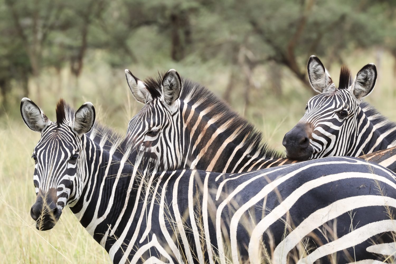
Zebra on the plains of Akagera National Park, patrolled daily by the rangers

The Trackers: Guardians Among the Rwanda Park Rangers

One of the most distinguished roles in the ranger family is the tracker, and the trackers are the oldest guardians among the Rwanda park rangers. Trackers in Volcanoes National Park have, in a deep sense, grown up with the forest: they can read a broken branch, a night nest, a twist of bamboo stem, the entire code through which a gorilla’s movement is written, and they know each family and each silverback by name. Their morning reports, recording where every family is, how large it is, and whether any member is sick or missing, are the collected intelligence that the conservation programme runs on.

Some trackers carry decades of experience. The older generation began their work when the gorilla population was at its lowest and the forest was a battleground, and they have watched, over forty years, the population rise from the low hundreds to more than a thousand. There is a bond between the veteran trackers and the silverbacks they follow each day that cannot be photographed, only described: two old companions at opposite ends of the species scale, each of whom has spent a lifetime reading the other’s world.

None of this is academic. The trackers’ information determines where the trekkers go, which families the veterinarians check, and when a group must be left alone. When a respiratory cough is reported in a silverback, it is the trackers who confirm it. When a new baby gorilla is born, it is the tracker who sees it first; when a gorilla disappears, it is the tracker who goes looking. The entire apparatus of gorilla conservation rests on these trained eyes and legs.

Rwanda Park Rangers as Guardians of Community Conservation

Rwanda’s rangers are not only the force on the boundary; they are the bridge to the people across it, and the Rwanda park rangers are the guardians of that trust. Many of the rangers come from the very communities that border the parks, so that when a farmer sees a ranger walking past, it may be the same child who went to school in the village, now in uniform. That trust is one of the most precious assets of the protection system, and the work of the guardians extends far beyond the fence.

In the village fringe, the rangers explain the buffer zone: why the beehive fences are built, how crop damage from elephants is handled, what the revenue-sharing money pays for when it returns to the villages. When a farmer loses maize to an elephant, the local ranger is usually the first official to arrive, and the way the issue is handled decides whether the community grumbles against the park or supports it. The ranger, in that sense, holds in his hands a piece of the entire model: for the village to be on the park’s side, the ranger must be on the village’s side.

The change in the relationship is measurable. Once, the park was a rival for the land; now, the villages defend the ranger’s office, the schoolchildren draw the gorillas, and parents speak of a career in the uniform as an ambition for their children, a story that Rwanda’s official tourism board tells to visitors. Enforcement is still there, but it is now supported by community goodwill. Where there is goodwill, the protection multiplies: the rangers patrol the forest, and a thousand eyes in the villages watch the boundary with them.

Rangers crossing the high forest slopes of Volcanoes National Park on the morning patrol

Women of the Wild

A striking change in the ranks of the Rwandan rangers is the growing number of women, who now serve among the Rwanda park rangers as some of the guardians the communities trust most. In the savannah parks such as Akagera, women serve among the patrol units and the anti-poaching teams, and in the volcanoes, women are a visible part of monitoring and guiding. A profession that once belonged almost exclusively to men is now one of the most diverse in Africa, and Rwanda has become a regional example of what it means to open the ranger’s uniform to women.

The women’s careers have changed what local girls see as possible. A girl who grows up in the shadow of the mountains, whose family farms the hard-won fields, who hears the rangers’ stories at the village well, can now imagine herself in the uniform. The ranger story in Rwanda is therefore not only a story of animals; it is a story of hope among the communities, of parents who now take for granted that a daughter can guard the forest.

The diversity strengthens the whole force. In the villages, the women rangers often have the first and deepest conversations, and the schools respond warmly when a woman in uniform visits. The patrol that includes women commands a different kind of trust and a different network, and it reflects the people it serves and the country it protects. The forest needs all hands, and Rwanda’s provinces are all on deck.

The Long Years and the Quiet Risks

The long years are the quiet price the Rwanda park rangers pay as guardians of the forest, and for all its beauty, the ranger’s work is a long river of risk. In the volcanoes, the weather is a harsh enemy of its own; in the savannah, the elephants are heavy and unpredictable, the buffalo are vigilant, and the rhino, the rarest and the most dangerous, will treat the careless visitor as a threat. The men and women of the patrols walk every day, through a forest that has its own dangers, and they walk it knowing that no patrol ends with a total guarantee.

The Rewards of the Work

There is no reward in the ranger’s life without consequence. The pay is modest for the nobility of the role, and the life of patrol imposes long absences from the village, the family, the farm. Yet the rangers who have spent their entire careers in the forest stay for the love of it: for the day when a silverback they protected as an infant returns to them as an adult, for the day a child in the village asks to become a ranger, for the day they count the gorillas and the number has grown again.

That tireless work is why the guardians of Rwanda’s parks deserve more than respect; they deserve the support of every visitor. Many of them have lost colleagues, men and women, and their history with poachers runs deep. The rangers do not do it for the glory; they do it because the forest is their whole life’s meaning, and because they have understood that conservation is not a campaign with an end date. It is a long, daily, uncounted labour, and it never ends.

  • Dawn monitoring of every gorilla family, every day of the year.
  • Anti-poaching patrols and snare sweeps across the parks.
  • Community engagement and buffer-zone support.
  • Guiding and protection of trekkers in the forest.
  • Reporting and data collection that drives conservation decisions.

The Rangers You Meet on Trek

When you climb toward the mist in Volcanoes National Park, or follow a lion track across the plains of Akagera National Park, you will be in the hands of the rangers, the same guardians of the forest described throughout this guide. The man who raises a machete to clear the path, the woman who reads the bent bamboo, the tracker who announces the gorillas to the group, the anti-poaching captain who secured the boundary before the first engine started, they are all part of the same family, and the family carries the forest.

The trekking that supports conservation in Rwanda pays for the rangers’ salaries, their training, and their equipment, with the Rwanda Development Board overseeing the park budgets, because the permits and fees that a trip brings are a significant part of what keeps the protection intact. It is not just the view that the visitor pays for: it is the patrol, the veterinary team, the monitoring teams, and the trackers that the forest needs.

Rangers on patrol in Akagera National Park, where elephants roam the restored savannah

A Final Word

So when your trek ends and you shake the hand of the guard who guided you, stop and think of the work that made it possible. Before dawn, in the rain, in the cold, it is the rangers who were already there. They walked in the dark so that you could walk in the light. They came to the mountain daily so that the gorillas could have a home. Rwanda, the small country with the huge hearts of its guardians, protects the forest with everything it has.

And for a moment, at the end of your trip, do something simple: meet the rangers, thank them, shake their hands. You are holding in that hand the life of the forest, the slow careful years of the men and women who have held the line before you. The rangers are the guardians of the forest, they are what the whole miracle stands on, and they deserve a place in the story you take home with you.

The Albertine Rift: Africa’s Greatest Biodiversity Hotspot

Africa keeps its secrets in its folds, and nowhere is Albertine Rift biodiversity richer than in the chain of mountains running through the western part of the continent, from the Virunga volcanoes of Rwanda and the mountains of Uganda down through the eastern Democratic Republic of Congo, Burundi, and Tanzania, this chain of mountains and valleys is one of the most remarkable places on the planet. It is the western branch of the great East African Rift, a geological scar where the continent is slowly pulling apart, and its mountains, forests, and lakes have produced a concentration of life found almost nowhere else.

Conservation scientists call the region a biodiversity hotspot because Albertine Rift biodiversity holds an exceptional number of species found nowhere else, while facing exceptional threats. The region is home to the mountain gorillas of the Virunga Massif, the chimpanzees of Nyungwe, the golden monkeys of the volcanoes, and hundreds of endemic birds, frogs, butterflies, and plants. For the traveller, this is the great prize of a Rwanda safari: in one small country, the Albertine Rift delivers more unique wildlife than most continents. This article explores what makes the Rift so special, what lives there, and why it is worth protecting.

Albertine Rift Biodiversity: A Tear in the Earth’s Surface

The story of the Albertine Rift begins with geology. Tens of millions of years ago, the African continent began to split along the line of the East African Rift, a process that is still pulling the earth apart today. In the west, the rift formed a chain of highlands, volcanoes, and deep lakes, including Lake Kivu, Lake Edward, and the great Lake Tanganyika, one of the oldest and deepest lakes on Earth. The mountains rose, the rift valleys sank, and the landscape became a patchwork of steep slopes, cool forests, and isolated peaks.

That isolation is the key to the region’s richness. When a mountain range rises, it creates separate worlds: the animals and plants on one peak are cut off from those on the next, and over long periods they evolve along their own paths. The Albertine Rift’s many isolated highlands became, in effect, a chain of islands in the sky, each with its own evolving community of life. This is why the region holds hundreds of species that exist nowhere else: they evolved on these specific slopes, at these specific altitudes, in these specific pockets of forest.

Elevation adds a second layer of diversity. On a single Rift mountain, the habitat changes from lowland rainforest at the base to cloud forest in the middle, to bamboo, then heath, then alpine meadows at the summit. Each band of altitude has its own species, so a hike up a Rift mountain is a journey through several distinct ecosystems in a single day. The result is a stack of different worlds, and Rwanda’s volcanoes and Nyungwe Forest are two of the best places on Earth to see the whole vertical sequence.

Albertine Rift Biodiversity: The Most Endemic Species in Africa

When conservationists rank the world’s biodiversity hotspots, the Albertine Rift regularly appears at or near the top. Albertine Rift biodiversity contains more endemic vertebraterate species than any other region of mainland Africa, and its endemism is not limited to animals: hundreds of plants grow only in the Rift, from giant lobelias on the high peaks to forest trees found only in particular valleys. For biologists, the region is a living laboratory, and new species are still being described from its forests today.

The endemic animal list is a who’s who of African rarities. Among the mammals are the mountain gorilla, found only in the Virunga Massif and the adjacent Bwindi forest, and the golden monkey, a bright-coloured relative of the blue monkey that lives in the high bamboo forests of the volcanoes. Among the birds, the Albertine Rift is legendary among birders, with dozens of species confined to its forests, from the striking Rwenzori turaco to the secretive Albertine owlet, and the region is a target destination for birdwatchers from around the world.

Amphibians and butterflies complete the picture. The Rift’s moist forests and mountain streams harbour many frog species found nowhere else, and its butterfly populations are among the most diverse in Africa. For the visitor, the sheer volume of life is part of the wonder: a walk through Nyungwe or the volcano slopes passes plants, birds, insects, and sounds that exist nowhere else on the planet. This is not a generic African forest; it is a unique piece of the earth’s biological inheritance.

Albertine Rift Biodiversity’s Stars: Mountain Gorillas

The most famous residents of the Albertine Rift are, of course, the mountain gorillas. The Virunga Massif, the chain of volcanoes that straddles Rwanda, Uganda, and the Democratic Republic of Congo, is one of only two places on Earth where the subspecies survives, and Rwanda is the heart of its conservation story. The population has grown from a low of around 254 animals in 1981 to more than one thousand today, one of the most celebrated recoveries in the history of conservation.

The gorillas are the Rift’s flagship species, the animals that put the region on the world’s conservation map. They live in the forest band between roughly 2,500 and 4,000 metres, feeding on bamboo, leaves, and fruits, and they are so deeply embedded in the Rift’s ecology that protecting them means protecting the whole ecosystem they depend on. The gorilla’s survival is therefore a proxy for the health of the Rift itself: when the forest is healthy enough for gorillas, it is healthy enough for everything else.

For the visitor, the gorillas are the experience of a lifetime. A trek in Volcanoes National Park is an encounter with the Rift at its most magnificent, and you can plan it on the park’s own websiteent, and the gorilla permit that funds the trek is the same money that keeps the Rift’s conservation machine running. The gorillas are not just a sight; they are the reason the world cares about this strip of mountains, and the reason the region’s other endemic species have a future at all.

A silverback mountain gorilla in the bamboo forest, flagship of Albertine Rift biodiversity

Golden Monkeys and Other Primates

Beyond the gorillas, the Rift is rich in other primates, and the most charismatic is the golden monkey. Named for the bright orange-gold patches on its back and limbs, the golden monkey lives in the high bamboo forests of the Virunga volcanoes, and a trek to see it is one of the most delightful experiences in Rwandan conservation. The monkeys move in lively troops, feeding on bamboo shoots and leaping between stems, and seeing them is a completely different encounter from the quiet majesty of the gorillas.

The Rift’s primate diversity extends much further. Nyungwe National Park, in the south-west of Rwanda, protects one of Africa’s largest montane rainforests, and its primate community is astonishing: thirteen primate species, including the eastern chimpanzee, the L’Hoest’s monkey, the owl-faced monkey, and troops of hundreds of Angola colobus monkeys that travel through the canopy like waves. For scientists, Nyungwe’s primate population is one of the richest in the world for a forest of its size, and for visitors it means a safari that is never short of wildlife.

The chimpanzees of Nyungwe are the second great ape of the Rift. The chimpanzee tracking experience in Nyungwe is one of Rwanda’s defining activities: following the calls of a community through the ancient forest, finding the animals in the branches, and watching a close cousin of humanity at home. That a single small country can offer both mountain gorillas and chimpanzees, the two most famous apes of Africa, is entirely down to the diversity of the Albertine Rift.

The Birds of the Rift

For birders, the Albertine Rift is a pilgrimage destination. The region is recognised as an Endemic Bird Area, one of the richest in Africa, and a skilled birding trip through Rwanda’s forests and mountains can deliver a list of endemic species that is the envy of the continent. The Rwenzori turaco, with its crimson wings and green crest, the handsome francolin, the Grauer’s warbler, and the shy Albertine owlet are among the prizes, and each is a species that exists only in this narrow strip of mountains.

Nyungwe is the crown jewel of Rift birding, with hundreds of species recorded in the forest and its borders, including many endemics. The forest’s canopy walk, one of the tallest in Africa, puts birders at eye level with the treetops, and a day on the forest’s network of trails can produce sightings that birders spend lifetimes chasing elsewhere. The eastern savannah and the lakes of the Rift add waterbirds and plains species, giving Rwanda a bird list that combines montane rarities and savannah classics in one compact country.

The birds matter beyond the aesthetic. Endemic birds are among the most sensitive indicators of forest health, and their presence in the Rift’s forests is a sign that the ecosystem is still functioning. Bird conservation in the Rift is therefore forest conservation, and the same protected areas that shelter the gorillas and chimpanzees shelter the birds. For the traveller, it means that every forest walk is also a birding walk, whether or not you came for the birds.

A troop of colobus monkeys moving through the canopy of Nyungwe Forest

The Forests Above the Waters

Albertine Rift biodiversity is not only about mountains and forests; it is also about water. The Rift’s highlands feed some of the most important lakes and rivers of central Africa, and its forests are the sponges that hold and release the water. Nyungwe, at the head of the Rift’s watershed in Rwanda, is the source of two of Africa’s great river systems: the Nile and the Congo, a fact that gives its protection continental significance. Rain that falls on Nyungwe’s canopy eventually reaches the Nile Valley or the Congo Basin, and the forest’s health is felt across half of Africa.

The lakes of the Rift add their own biodiversity. Lake Kivu, which borders the volcanoes and the Nyungwe highlands, is one of Africa’s great lakes, and its waters are home to species found nowhere else. Lake Tanganyika, further south, is a world-famous centre of aquatic evolution, with hundreds of unique fish species. The Rift’s valleys also support wetlands and rivers that host waterbirds, otters, and a web of life that connects the mountains to the lakes.

For the traveller, this means the Rift experience extends beyond the forest. The gorilla trekking and Lake Kivu journeys are among the most beautiful journeys in East Africa, joining the misty volcanoes to the terraced shores of the great lake. The Rift, in other words, is not a single ecosystem but a whole living landscape, and Rwanda is its most accessible showcase.

  • Mountain gorillas, found only in the Virunga Massif and Bwindi.
  • Golden monkeys of the high bamboo forests of the volcanoes.
  • Eastern chimpanzees of Nyungwe’s montane rainforest.
  • Hundreds of endemic birds, including the Rwenzori turaco.
  • Unique amphibians, butterflies, and plants of the Rift’s mountains.

Threats to Albertine Rift Biodiversity and the Hope of Protection

For all its richness, Albertine Rift biodiversity is under severe pressure. Its human population is among the densest in Africa, its forests have been cleared for agriculture over generations, and its mountains have been fragmented into islands of green in a sea of farmland. The endemic species of the Rift, evolved in isolation, are uniquely vulnerable: with nowhere else to go, a species that loses its forest loses its only home. The region’s status as a hotspot is as much a warning as a celebration.

The hope lies in the protected areas. Rwanda has created a network of national parks and forests that preserves the core of its Rift heritage: Volcanoes National Park for the gorillas and golden monkeys, Nyungwe for the chimpanzees and the watershed, Akagera for the eastern savannah, and the Gishwati-Mukura forests in the west. Each park is surrounded by the community programmes, revenue sharing, and tourism funding that give the local population a reason to keep the boundaries green.

Conservation in the Rift has also gone international. The region’s parks are managed with partners, its wildlife is monitored by scientists from many countries, and its funding draws on tourism from around the world. The money that trekking brings flows into the same system: permits, park fees, and responsible tourism are the economic engine that keeps the Rift’s species alive. The Rift is one of the few places on Earth where a holiday genuinely pays for the survival of a unique ecosystem.

Discovering the Rift Yourself

The Albertine Rift is not an abstract scientific concept; it is the landscape you see from almost anywhere in Rwanda. The green mountains, the terraced hills, the mist that settles in the valleys, the volcanoes on the northern horizon, all of it is the Rift, and all of it is alive with the special richness of the region. A Rwanda safari is, in the deepest sense, an Albertine Rift safari, and every corner of the country adds a piece of the story.

Start with the mountains: the gorillas and golden monkeys of the volcanoes, and plan your route with Rwanda’s official tourism board, then the chimpanzees and colobus of Nyungwe, and add the savannah of Akagera for contrast. Between them, these parks cover the full range of Rift life, and our itineraries are designed to do exactly that. Whether you have time for one trek or a two-week expedition, contact our team and we will build a trip that shows you the Rift at its richest.

Albertine Rift biodiversity is Africa’s greatest because it is a landscape of islands in the sky, a chain of mountains where life evolved in isolation and multiplied in splendour. To walk its forests is to walk through millions of years of evolution, through the home of the gorillas and the source of great rivers, through one of the most precious pieces of the natural world. It is here, in these mountains, that the rarest species of Africa survive, and it is here, thanks to the visitors who care, that their future is being secured.

Reforestation and the Virunga Ecosystem: Protecting the Gorilla Forest

When a mountain gorilla wakes up in the mist, the first thing it does is eat, and the Virunga reforestation ecosystem is what keeps its table full. The forest around it provides the bamboo shoots, the leaves, the wild celery, and the fruits that make up its daily diet, and the gorilla family rarely travels far from the green heart of the Virunga Massif. The forest is not just the gorilla’s home; it is the gorilla’s supermarket, pharmacy, nursery, and fortress. But that forest has not always been secure. For much of the twentieth century, the Virunga ecosystem was shrinking, eaten away by farming, cattle, and the needs of a growing population, and the gorillas were shrinking with it.

The recovery of the mountain gorilla population, from a low of around 254 individuals in 1981 to more than one thousand today, is usually told as a story of anti-poaching and tourism. It is also, quietly, a story of reforestation. Trees have been replanted, bamboo restored, boundaries stabilised, and degraded land returned to the forest, and none of it would have happened without the communities who live at the edge of the park. This article explores the reforestation of the Virunga ecosystem, why it matters, and how it is protecting the gorilla forest for the future.

The Virunga Ecosystem Under Pressure

The story of the Virunga reforestation ecosystem begins with pressure. The Virunga Massif, a chain of eight volcanoes shared by Rwanda, Uganda, and the Democratic Republic of Congo, once wore a continuous cloak of forest from the lowland slopes to the high bamboo zone. For centuries, the forest held its ground. But in the twentieth century the pressures multiplied: human populations grew rapidly, farmland was needed, and the forest, seen as unused land, was the easiest source of it. In Rwanda, the slopes of the Virungas were progressively cleared for fields, and the famous boundary between farm and forest became a line of conflict rather than a line of protection.

The damage was not only to the trees. As the forest shrank, the gorillas lost habitat, food, and the corridors that connected their groups. Soil washed down the bare slopes, springs dried up, and the rivers that fed the surrounding farmland ran with mud. The destruction of the forest hurt everyone: the gorillas above the line, and the farmers below it. The lesson was written in the landscape: a forest is not a rival to farming, it is the infrastructure that farming depends on.

By the 1970s and 1980s, conservationists were documenting the losses and pushing for a reversal. The first parks had been gazetted in the colonial era, but their boundaries meant little when they were not enforced and the forest they protected was not defended. The turnaround required a change in both law and attitude: the park boundary had to be respected, and the land beyond it had to be farmed better, so that no one needed to push into the forest to survive.

The Great Reforestation of the Virunga Ecosystem

Reforestation in the Virunga ecosystem is not one project but many, carried out over decades by the park authorities, conservation organisations, scientists, and, above all, communities. The work began with the most degraded areas: bare slopes inside the park boundary where the soil had been exposed, and buffer zones where forest had given way to exhausted fields. The replanting was methodical, with nurseries growing indigenous species, bamboo, and the pioneer trees that could stabilise the soil and shade the return of the forest.

Bamboo deserves special mention, because it is the gorilla’s staple food and the fastest way to restore a degraded slope. Bamboo grows quickly, holds the soil with its dense root systems, and provides the tender shoots that gorillas eat in season. Large areas of the park have been replanted with bamboo, both for the gorillas and for the stability of the mountainside, and the sight of a young bamboo forest recovering where cattle once grazed is one of the quiet victories of the park’s restoration.

The replanting is matched by an equally important subtraction: the removal of the pressures that caused the loss. Grazing inside the park has been controlled, illegal cultivation has been cleared, and the boundary has been surveyed and marked so that everyone, farmer and ranger alike, knows where the line runs. Reforestation works when it is paired with protection, and the Virunga programme has treated the two as one job.

The Virunga reforestation ecosystem: restored forest slopes of Volcanoes National Park

The Communities Behind Virunga Reforestation

The deepest insight of the Virunga restoration is that trees grow best when the people who plant them are paid, which is why the communities are the true owners of the Virunga reforestation ecosystem. Around the park, community nurseries raise indigenous seedlings, and households are employed to plant and care for them, earning an income from the restoration itself. The money, much of it channelled through the revenue-sharing model that returns ten percent of park tourism income to neighbouring communities, gives families a reason to watch the young trees survive.

This is where reforestation meets social policy. A family that plants trees on a degraded hillside is not only restoring the forest; it is feeding its children with the wages. A village whose school was built with park funds, and whose fields are protected by beehive fences, has no interest in letting the forest slip back. The restoration of the Virunga ecosystem is inseparable from the restoration of the mountain economy, and both have been paid for, in large part, by gorilla tourism.

There are also practical alternatives being offered to the practices that used to destroy the forest. Energy-saving stoves reduce the demand for firewood, improved farming techniques raise yields so that less land is needed, and alternative income projects, from beekeeping to handicrafts, give households ways to earn without cutting trees. The result is a cushion of alternatives around the park: people who do not need the forest for survival are people who will defend it.

Why the Virunga Ecosystem Matters Beyond the Gorillas

The Virunga reforestation ecosystem is a water system as much as a wildlife home. The forest of the Virungas is not only the gorillas’ home; it is the region’s water system. The volcanic slopes catch the rain and release it slowly into the streams and rivers that irrigate the tea fields, the farms, and the towns of the region, including large parts of Rwanda. When the forest is intact, the water flows clear and steady; when it is cleared, the soil erodes, the rivers flood in the rains and run thin in the dry season, and the damage reaches far beyond the park boundary.

There is also the climate. A standing forest holds carbon, keeps the hillsides cool, and moderates the rainfall of the mountain region. The Virungas are among the most important water towers of East Africa, and their forest cover is a climate service for millions of people who will never see a gorilla. Reforestation here is therefore not a luxury of conservation; it is an investment in the region’s water, agriculture, and climate resilience.

And of course there is the biodiversity. The Virunga forest is home to the mountain gorillas, the golden monkeys, and hundreds of bird, butterfly, and plant species, many of them found nowhere else on Earth. Every hectare restored is a hectare returned to that community of life, and every corridor of young trees is a route by which species can move and survive. Reforestation in the Virungas is the most literal form of protection: it is building the house that the gorillas live in.

Ecosystem Corridors and Connections in Virunga

Corridors are the connective tissue of the Virunga reforestation ecosystem. Restoring the forest inside the park boundary is only half the work; the other half is reconnecting the fragments. Over the decades, the Virunga forest was broken into pieces, and isolated populations of wildlife lost the ability to move, mix, and recover. Reforestation programmes have therefore focused on corridors: strips of restored habitat that link the forest blocks, allowing animals and plants to travel between them and giving the ecosystem a resilience it lost when the pieces were separated.

The gorillas themselves are the best evidence of the value of connection. The habituated families of Volcanoes National Park move across the slopes within the protected area, and their ranges depend on the quality and continuity of the forest. Where bamboo has been restored and corridors replanted, the gorillas have moved in. The relationship is measurable: plant the forest, and the gorillas will come.

None of this is fast work. A bamboo stand takes years to mature; a forest corridor takes a generation to look like a forest. The people who began the replanting in the 1980s are only now seeing the full canopy, and the generation that maintains it will not see the finished landscape. Reforestation is an act of faith, and the Virunga ecosystem is being restored by people who are planting trees they will never sit under.

A silverback mountain gorilla feeding in restored bamboo forest

What Virunga Reforestation Has Achieved

The measurable results of the Virunga reforestation ecosystem are already visible. The park boundary is more stable than it has been in decades, the bamboo zone has expanded, and the forest cover of the Rwandan side of the massif has stabilised and, in places, grown. The gorilla population, which once had to squeeze into a shrinking refuge, now occupies a healthier forest, and the monitoring teams report families ranging across areas that were bare slopes a generation ago.

The ecological signs are everywhere for those who know how to read them. Springs that had dried up are flowing again, the streams that leave the park run clear, and the birdlife of the restored areas has returned. The restoration has also reduced the conflict at the boundary: with the forest’s edge stable and the buffer projects working, elephants and buffalo are less likely to push into farms, and farmers are less likely to push into the forest.

The achievements are measured in more than hectares. They are measured in the health of the gorilla population, in the water that reaches the farms, in the jobs created by the nurseries, and in the changed relationship between the park and the people around it. Reforestation in the Virungas has moved from emergency repair to long-term stewardship, and the forest that the gorillas need is growing again.

  • Community nurseries raising indigenous trees and bamboo seedlings.
  • Replanting of degraded slopes inside the park boundary.
  • Restoration of wildlife corridors between forest blocks.
  • Energy-saving stoves to reduce the demand for firewood.
  • Payment for planting and care, channelled through revenue sharing.

The Work Still to Do

None of this means the job is finished: the Virunga reforestation ecosystem is not a campaign with an end date, it is a permanent responsibility. The Virunga ecosystem is under permanent pressure, and the restoration must continue to hold the line that past generations drew. New degraded areas need attention, the corridors need ongoing care, and the buffer zone needs ever-better alternatives for the people who live there. Reforestation is not a campaign with an end date; it is a permanent responsibility of the park and its partners.

The funding for this permanent work flows, in large part, from the same source: tourism, with the replanting programmes supported by partners including the International Gorilla Conservation Programme. The gorilla permits that visitors buy, and the conservation programmes that trekking supports, help pay for the nurseries, the planting teams, the boundary patrols, and the community projects that keep the forest intact. Every visitor who walks into the bamboo is, whether they know it or not, financing the next generation of trees.

There is a hopeful arithmetic at work here. More gorillas bring more visitors; more visitors bring more funding; more funding brings more forest; and more forest brings more gorillas. The Virunga ecosystem has become a virtuous circle, and the circle is held together by one simple act: planting a tree where the forest once stood. That act, repeated thousands of times by the communities of the volcanoes, is reforestation, and it is the quiet half of the gorilla success story.

Seeing the Restored Forest for Yourself

The best way to appreciate the Virunga reforestation ecosystem is to walk through its results. A trek in Volcanoes National Park takes you through the bamboo zone, past the young plantings and the mature stands, and into the forest that the replanting saved. The 3-day gorilla safari is the classic way to do this, and the golden monkey trek offers a gentler walk through the restored canopy.

Even from the road, the restored forest is visible: the trail maps and park updates published by Rwanda’s official tourism board show how far the replanting has spread. From the road you can also see the sharp line where the fields end and the green begins, the stands of bamboo marching up the slopes, and the mist that settles on the canopy. The visitor who understands what they are seeing, a forest that was nearly lost and is coming back, will read the landscape differently. What looks like ordinary green is actually a working restoration, financed by every permit sold and guarded by every patrol that walks the boundary.

Reforestation is not glamorous conservation, but the forest is growing back, everyone who treks here is part of the planting, and the Virunga reforestation ecosystem is the quiet engine of it all. It does not make the headlines that a new lion or a new baby gorilla makes. But it is the foundation under everything else: the forest is the stage on which all the other stories are played. The next time you watch a silverback feeding in the bamboo, remember that the bamboo may have been planted by a community member who was paid by a visitor’s permit. The forest is growing back, and everyone who treks here is part of the planting.

Community Conservation in Rwanda: Sharing the Gorilla Wealth

There is a school in a village on the edge of Volcanoes National Park whose classrooms were built with money from gorilla permits. A few valleys away, a clinic was stocked with the same funds, and in the fields beyond it, beehive fences funded by tourism protect crops from elephants that would otherwise raid them at harvest time. None of these places is inside the national park. All of them exist because of it. This is the quiet genius of Rwanda’s community conservation model, a system in which the people who live closest to the wildlife are also the people who benefit most from it.

The idea is simple on paper and revolutionary in practice: if conservation is to survive, it must pay its own way, in places and not just in the abstract. For decades, national parks across Africa struggled because the people around them saw only the costs of protection, lost farmland, restricted access, and the danger of wild animals, while the benefits flowed elsewhere. Rwanda decided to change that arithmetic. Under a revenue-sharing scheme that returns ten percent of park tourism income to neighbouring communities, the gorilla economy now pays the people who protect it, and the results can be seen in classrooms, clinics, water systems, and the attitudes of a whole generation.

Community conservation in action: trekkers with a mountain gorilla family in the Virunga forest

How Community Conservation Funding Works

Whenever a visitor buys a gorilla permit or steps into one of Rwanda’s national parks, a share of the money does not stay with the park administration. Since 2005, Rwandan law has required that ten percent of the revenue collected from tourism in and around the parks be returned to the communities that border them, through a process of selection, planning, and payment that is designed to be transparent; the money is administered by the Rwanda Development Board and the projects are chosen by the communities themselves. The ten percent figure is fixed and public, and the projects it funds are chosen by the communities themselves, not dictated from the capital.

The rationale is economic as much as it is ethical. Communities that receive tourist money have a direct stake in the survival of the tourism industry, and that industry depends on the survival of the park and its wildlife. When a village’s school is repaired with gorilla permit revenue, the perceived value of the gorilla changes. The animal becomes not a nuisance that tramples crops and blocks the forest, but an asset whose continued existence keeps the money flowing. Poaching becomes a threat to the income of the village, not just to the law.

This is the inverted incentive that makes Rwanda’s model work. Instead of asking communities to protect the forest for the sake of the forest, it pays them to do so. The result is a rare thing in world conservation: a system in which local people become the loudest defenders of the park. Farmers who once might have quietly tolerated a snare now report it; herders who once grazed their cattle on park land now help patrol the boundary; and children who grow up seeing the money the park brings are the next generation of rangers and guides.

Where the Money Goes: Schools, Clinics and Clean Water

These projects are community conservation in its most practical form: they are chosen locally, and the priorities of the mountain districts have been remarkably consistent over two decades: schools, health, water, and ways to make a living without the forest. A village that asks for a classroom gets a classroom; a village whose children walked two hours for water gets a borehole and a piped system. The schemes are small in the national budget, but they are large in the life of a mountain village, and they are the difference between a community that tolerates the park and one that embraces it.

Health is where the tenth plays its most quietly crucial role. Park environments sit at the edges of rural life, and the clinics built by revenue sharing improve care for thousands of people who previously had to travel long distances for treatment. Vaccination campaigns, clean water, and better nutrition for children improve the health of the community that lives alongside the wildlife, and a healthy community is a stable one. The gorillas do not cure malaria, but the funding that protects them helps pay for the clinic that does.

The infrastructure also reaches the household economy. Road and market improvements from revenue sharing open routes that were impassable before, letting farmers take their harvests to market more easily and buy at better prices. Every improvement raises the visible worth of the park in the sum of the household budget and, in doing so, reinforces the message that conservation and prosperity are the same project.

Livelihoods and the Buffer Zone

Livelihood support is the quiet half of community conservation, because money is not the only form of sharing. The model also invests in livelihoods, so that communities can earn without cutting the forest or hunting its animals. Around the parks, revenue-sharing funds and partner projects support beekeeping, which produces honey and, at the same time, the famous beehive fences that keep elephants out of the crops. They support livestock, tree nurseries, mushroom farming, and cooperatives, and they help small businesses such as handicrafts and guesthouses that serve visitors.

Tourism itself is the largest livelihood provider of all. The porters who carry bags at the trailhead, the guides, the drivers, the lodge staff, the market sellers in Musanze and the artisans who sell souvenirs, all of them work because visitors come. Revenue sharing multiplies that effect by putting the income directly into community hands, and it is why a single trekking day in the Virungas can touch the lives of dozens of households before the visitor returns to Kigali.

In the villages of the buffer zone, the combination of jobs and funded projects has changed the relationship with the park boundary. The beehive fences protect the maize; the clinic treats the children; the cooperative pays for the school fees; and the forest, which once looked like a rival for the land, looks like a partner. That is the buffer zone working as it should: a strip of villages that are prosperous enough to want the park, and secure enough to defend it.

A mother gorilla with her family in Volcanoes National Park

  • Schools and classrooms for communities bordering the parks.
  • Health centres and clean water systems in the buffer zone.
  • Beehive fences and crop-protection support for farmers.
  • Livestock, cooperatives, and small-business funding.
  • Roads and markets that link villages to the wider economy.

How Community Conservation Makes Poaching Unattractive

The clearest measure of the model’s success is what has happened to poaching. The link between income and wildlife safety is the core of community conservation: when communities have a financial stake in the park, the incentives of the illegal economy weaken. A family that earns from tourism or revenue-sharing projects is less tempted by the money a poacher offers; a village that has seen its school built by the park is quicker to report a stranger laying snares; and a young person with a job in the visitor economy has no reason to risk prison for a bushmeat sale.

This is not to say the problem has vanished. Poaching still happens, and the anti-poaching teams still work hard every day. But the context has changed: today the rangers who sweep the forest for snares are supported by communities that largely share their goals, and informants are more common than they were a generation ago. The combination of enforcement and incentive is what conservationists call a conservation economy, and Rwanda is its most successful example in Africa.

There is also a direct social dividend. As the visible benefits of the park spread, the tolerance for poaching has fallen in village courts and family conversations. Parents who once saw the forest as a hunting ground now see it as their children’s employer. The social pressure against poaching, which no law can create, has grown naturally out of the sharing of the wealth.

Community Conservation Beyond the Virungas

The same community conservation principles apply in the east and the south-west, because the revenue-sharing principle is not limited to the gorillas. The same ten percent model applies across Rwanda’s national parks, including Akagera National Park and Nyungwe National Park, and the communities along each boundary receive their share. The elephants of Akagera and the chimpanzees of Nyungwe are not as famous as the gorillas, but they are governed by the same economics: their tourism must reach their neighbours, or they will have no future.

In the east, around Akagera, the return of the lions and the rhinos is part of the same narrative. Communities have watched the tourism income from the Big Five grow, and the park has become an employer and a partner in rebuilding after years of decline. In the south-west, the communities around Nyungwe earn from the chimpanzee treks and the canopy walk, and their schools and clinics carry the same funding signature. The principle has become national: a park that does not share is a park that will not survive.

Other African states have borrowed the Rwandan revenue-sharing scheme, and international conservation organisations point to it as one of the most successful in the field. But the model is not exported easily, because it depends on two things Rwanda possesses in abundance: a secure park system and a government that keeps its promises to the communities. The tenth is not a theory, it is a bond, and the trust it builds is Rwanda’s most valuable conservation asset.

The scale of the programme is significant for a small country. Over the years, revenue sharing has funded hundreds of projects around the parks, and the sums involved have grown as tourism has grown. Every increase in visitor numbers translates directly into more money for the villages, which is why the districts themselves now champion the parks: a school built by the park is a lesson in economics that no campaign can match.

What Community Conservation Has Achieved

The results of community conservation can be counted in the classic conservation currency: the mountain gorilla population of the Virunga Massif, which has grown from a low point of around 254 individuals in 1981 to more than one thousand in the last census. They can also be counted in the classrooms and clinics that dot the park boundaries, in the beehive fences along the elephant routes, and in the pride with which village councils report their projects. Conservation has become a source of prosperity, and prosperity has become a guardian of conservation.

The model is not finished. Communities still ask for more: more schools, more clinics, more direct employment, and a faster flow of the benefits they have been promised. The government and its partners continue to refine the system, improving transparency and pushing more of the decision-making into the villages. Conservation, like any living system, is always being improved, and the Rwandan model is no exception.

The key measure of success is one that statistics cannot fully capture: the attitude of the neighbours. Ask a farmer on the edge of the Virungas what the park means, and the answer today is rarely a complaint about confiscated land. More often it is a calculation, an account, of what the forest has brought the village: the school, the clinic, the water, the jobs. That change in attitude, from resentment to ownership, is the real product of revenue sharing.

How Your Visit Supports Community Conservation

Every trekking visit supports conservation and communities in Rwanda, because the price of your permit funds the tenth that reaches the villages. That is the direct line from your boots to the school roof. If you want to see the full circle, spend time in the villages as well as the forest: visit the market in Musanze, hire a porter, buy from the cooperatives, and stay in the community projects that have grown up around the parks.

A longer itinerary gives you the whole picture. Our 6-day gorilla and Lake Kivu safari combines the volcano slopes with the lakeside communities of the west, and our 3-day gorilla safari covers the classic trekking experience. Whenever you come, and however you travel, contact our team and we will make sure your visit is arranged with local guides, local lodges, and the community in mind.

Rwanda’s conservation story is often told as a story of gorillas. The deeper story is a story of people: the people who share the forest’s edge, who keep the beehives, who fill the classrooms, who guard the boundary, and who have learned, through a simple act of accounting, that the wild places are worth more alive than dead. That is the community conservation model, and it is why the gorillas are still here.

Rhinos Return to Rwanda: Akagera’s Big Five Story

There is a moment in every safari where the vehicle falls silent. It happened in Akagera National Park in May 2017, when a crate was opened and the first eastern black rhino set foot on Rwandan soil in a decade. The park’s staff, who had worked for years to make that moment possible, watched as the animal walked into the enclosure, its great horn swinging low, its feet finding the ground of a country that had once been its home. The rhinos return to Rwanda had begun.

The rhinos’ return to Rwanda completed a transformation that had been years in the making. Akagera, a park that had been badly degraded by conflict and neglect, had already welcomed back lions in 2015, and with rhinos it would finally claim the full Big Five: lion, leopard, elephant, buffalo, and rhino. This article tells the story of how the rhinos returned, why it matters, and what it means for travellers who want to see them.

An Extinction in Slow Motion

Rhinos were once a natural part of Akagera’s wildlife. The park’s savannahs and woodland, stretching along the Akagera River on Rwanda’s eastern border with Tanzania, provided exactly the habitat the animals need: open grassland, dense thickets, water, and relative isolation. But in the 1990s, during Rwanda’s civil conflict, the park’s protection collapsed, and the rhinos were among the first casualties, hunted by poachers and lost in the chaos of the times.

The loss of the rhinos was devastating for the park’s ecology and its reputation. Rhinos are what conservationists call ecosystem engineers: their grazing shapes the savannah, their dung spreads seeds, and their wallows create waterholes used by other species. Their disappearance was both a symptom of Akagera’s decline and a cause of further degradation, and it would take more than two decades to reverse.

For Rwanda, the rhino’s absence was also a national wound; however, the rhinos’ return became a national goal. The country had built its international reputation on conservation, with the mountain gorillas of the Virunga volcanoes as its flagship, but the eastern savannah, the other half of Rwanda’s wildlife heritage, had lost its most spectacular large animal. Restoring the rhino became a symbol of the country’s broader recovery, a statement that Rwanda’s wild places could be rebuilt just as its cities had been.

Elephants walking through Akagera National Park, sharing the land with the rhinos that returned to Rwanda

The Long Road Back: Rhinos Return to Rwanda

In fact, the foundation for the rhinos’ return to Rwanda was laid by the same partnership that brought back the lions. When African Parks took over the management of Akagera in 2010, in partnership with the Rwanda Development Board, the first job was security: rebuilding the park’s law enforcement capacity, ending illegal grazing, and re-establishing a credible anti-poaching presence across the reserve. Without that security, no reintroduction could possibly succeed.

By 2016, the park was ready for its next challenge. The plan was audacious: to bring eastern black rhinos back to Akagera, sourced from European zoos that held them as part of coordinated breeding programmes. Black rhinos are notoriously difficult to translocate, and the project involved years of planning, veterinary preparation, and international diplomacy, with each rhino’s health, temperament, and genetics assessed before the long journey began.

In May 2017, the first group of eastern black rhinos arrived, flown from Europe to Rwanda and transported overland to Akagera. The release, the culmination of the rhinos’ return to Rwanda, made the country one of the few in Africa to have restored a rhino population from scratch. The animals were released into a secure area of the park, with rangers monitoring them around the clock in the first weeks.

The Challenges of Rewilding

Rewilding rhinos is never simple, and Akagera’s pioneers faced serious challenges in their first months. The rhinos had spent their lives in the controlled environments of European parks, and the transition to a wild African savannah was enormous: new food, new terrain, new predators to consider, and no fences between them and the wider world. The park’s team had to learn to track and manage animals that were both rare and valuable beyond measure.

There were losses. In the first years after the reintroduction, some of the translocated rhinos died, from the stress and hazards of their new environment. Each loss was a painful reminder of the stakes, and each prompted a careful review of the management programme: diet, monitoring, territory, and the rhinos’ interactions with the park’s other wildlife. Conservation, the park’s managers knew, is a discipline of failures corrected.

But the programme was also learning, and the park persisted. Meanwhile, in 2019, a second group of eastern black rhinos arrived from Europe, reinforcing the rhinos’ return to Rwanda and broadening the genetic base of the new herd. The arrivals signalled confidence: the first rhinos had survived, the park had proven it could manage them, and the international community was willing to invest more animals in Rwanda’s future.

The Rhinos of Rwanda Today

Consequently, the rhinos of Akagera are a functioning wild population, proof that the rhinos’ return to Rwanda worked. They have settled into the park’s thickets and open plains, and sightings, while never guaranteed, have become increasingly regular as the animals have grown comfortable in their territory. The park’s rhino monitoring team follows them daily, a dedicated unit whose members know each animal’s identity, history, and favourite haunts, and whose reports guide the management decisions that keep the population safe.

The rhinos’ presence has completed the park’s ecological restoration. With lions and rhinos both restored, Akagera’s wildlife community is, for the first time in decades, essentially whole: the full suite of large mammals that the ecosystem evolved to support, from the grazing herds to the apex predators, is back in place. The park’s annual wildlife counts show healthy and growing populations across the board, a confirmation that the restoration is working.

Security remains the rhinos’ best friend and the park’s greatest expense. Akagera’s anti-poaching teams are among the best-equipped and best-trained in the region, with rangers, trackers, and a canine unit, and the rhino monitoring team never rests. The rhinos of Akagera are arguably among the most carefully guarded wild animals in Africa, a level of care that is the price of their survival.

Antelope on the Akagera plains, part of the ecosystem the rhinos help to shape

The Big Five Is Complete

With the rhinos in place, Akagera achieved something historic: it became one of the only parks in East Africa where visitors can see all of the Big Five in a single game drive. Lion, leopard, elephant, buffalo, and rhino now all roam the same savannah, and with them the park claims its place among Africa’s serious safari destinations.

The achievement transformed the park’s fortunes. Visitor numbers have grown steadily since the rhinos arrived, new camps and lodges have been built, and Akagera has become a must-include destination on Rwanda itineraries. The economic effect has rippled into the surrounding communities, where jobs in guiding, hospitality, and park management have multiplied, and where the park’s success has become a source of local pride.

The completion of the Big Five also changed Rwanda’s positioning as a travel destination. Rwanda now offers a combination that very few countries can match: mountain gorillas in the north, Big Five safaris in the east, and chimpanzees in the south-west, all within a few hours’ drive of each other. For the traveller, it means a single trip can cover experiences that elsewhere would require three separate safaris.

Seeing the Rhinos Return in Rwanda

For the visitor, the rhinos of Akagera are the ultimate reward of patient game driving. The park’s mornings and evenings are the best time to search, when the animals move to open ground, and the experienced guides who work the park know where the rhino territories lie. A sighting of an eastern black rhino, its massive shoulders and prehensile lip close enough to photograph, is one of the great experiences of African wildlife, and in Akagera it is a realistic ambition, not a distant fantasy. Finally, for those who wait, the rhinos’ return to Rwanda delivers one of the great moments of African wildlife.

Beyond the rhinos, an Akagera National Park safari delivers the full East African experience: elephants in the woodlands, giraffes on the floodplains, zebras and antelope in their thousands, hippos and crocodiles in the lakes, and the famous lions of the park’s prides. The park’s variety is remarkable for its size, and its accessibility, a few hours from Kigali, makes it the easiest Big Five destination in Africa.

Our Akagera safaris are designed around the park’s rhythms, with expert guides, comfortable stays, and game drives timed for the best light and the best wildlife activity. If you are combining the east with the volcanoes, contact our team and we will build an itinerary that includes gorilla trekking and a Big Five safari in one seamless trip.

  • Daily monitoring of every rhino by a dedicated field team.
  • Armed anti-poaching patrols and a specialist canine unit.
  • Veterinary oversight and genetic management of the growing herd.
  • Community engagement that keeps the surrounding farmland informed.
  • Infrastructure such as patrol roads and vehicle access across the park.

A Symbol of What Rwanda Can Do

The rhinos of Akagera are more than a conservation success; they are a statement about Rwanda itself. A small country, recovering from a history of conflict, has rebuilt one of Africa’s great wildlife sanctuaries from the ground up, restored its lions and its rhinos, and made conservation a central part of its national identity. The rhinos’ horns, worth a fortune on the illegal market, remain on their heads, protected by a system that works.

The story is also a lesson in patience. The rhinos did not come home because of a single heroic act; they came home because a government and a management team spent years rebuilding the foundations: security, law enforcement, community trust, and tourism, and only then flew the animals in. Conservation in Akagera was built in the right order, and that is why it has lasted.

When you stand at the park’s lookouts, watching the sun fall over the floodplains, consider what you are seeing: a place where extinction was reversed, where the Big Five is a reality, and where the animals you photograph are the beneficiaries of one of the boldest restoration programmes in modern conservation history. Ultimately, the rhinos’ return to Rwanda is complete, and they are here to stay.

The Human Story Behind the Horn

Behind the rhinos’ return to Rwanda is a human story that rarely makes the headlines. The negotiations with European zoos took years, with each partner park weighing genetics, health, and the political realities of sending their animals to Africa. The veterinarians who prepared the rhinos for travel spent months monitoring their health and conditioning. The Rwandan team that received them rebuilt a section of the park, constructed the enclosures, and trained the monitors who would follow the animals for the rest of their lives.

In the communities around Akagera, the arrival of the rhinos was met with a mixture of pride and practical interest. The park had become an employer, a source of infrastructure, and a partner in education and health projects, and the rhinos were the clearest sign yet that the reserve’s future was bright. School visits to the park grew, local media celebrated the arrivals, and the rhinos became a fixture of regional identity, proof that the land around the Akagera River was home to something the whole world valued.

None of that happens without the quiet, unglamorous work of the park’s staff. The trackers who find the rhinos each day, the rangers who guard the perimeter, the managers who plan the patrols, and the vets who check the animals’ health all operate far from the cameras. They are the reason the reintroduction survived its difficult first years, and they are the reason the rhinos’ future is secure. Their work is the real engine of the comeback.

What the Rhinos Need From Visitors

The rhinos of Akagera have simple requirements from those who come to see them: patience, respect, and distance. Rhino viewing is not like a zoo visit. The animals move on their own schedules, they disappear into thickets for hours, and they are most active in the cool of the morning and evening. The guides who know the territories will work hard to find them, but a safari is an exercise in attention, not certainty, and the reward for patience is one of the rarest sights in Africa.

Respect means following the rules of the park: staying in vehicles, keeping noise down, and never approaching the animals. Black rhinos are notoriously wary and short-sighted, and a vehicle that crowds them or a sudden sound can trigger a charge. The park’s rules exist for the animals’ welfare first and the visitor’s safety second, and every guide in Akagera will insist on them for good reason.

When you plan your trip, give the park time. A single day can work, but two days give you the morning and evening game drives that dramatically improve your chances, and they give the park’s landscapes, lakes, and floodplains time to reveal themselves. The rhinos are the prize, but the park around them, the birds, the hippos, the antelope, the lions, is the experience. Come for the Big Five, stay for the whole picture, and leave knowing that your visit, like your permit, is part of the system that keeps the rhinos safe.