The Nyungwe Canopy Walkway: A Walk Above the Rainforest

For most of the time you spend in a rainforest, you see the forest from below: the trunks of the giants, the curtains of the lianas, the flood of light far above your head. In Nyungwe, Rwanda has built a way to change that view. The Nyungwe canopy walkway is a suspension bridge of about 160 metres, strung some 70 metres above the forest floor, crossing a deep gorge at the level of the treetops in one of Africa’s oldest rainforests.

The walkway is the highest structure of its kind in the wider region, and it has become the symbol of the park, the image on every postcard and every itinerary. But no photograph prepares you for the moment you step out onto the deck: the slow sway of the bridge, the ocean of green canopy far below you, the birds flying at eye level, and the long quiet of the forest around you.

This guide covers the walkway in detail: what it is, what the crossing feels like, what you will see, the practical details of visiting, and how the canopy fits into a wider exploration of Nyungwe and Rwanda. For the bigger picture of the park’s trails, waterfalls and wildlife, our Nyungwe destination guide is the ideal starting point.

What the Nyungwe Canopy Walkway Is

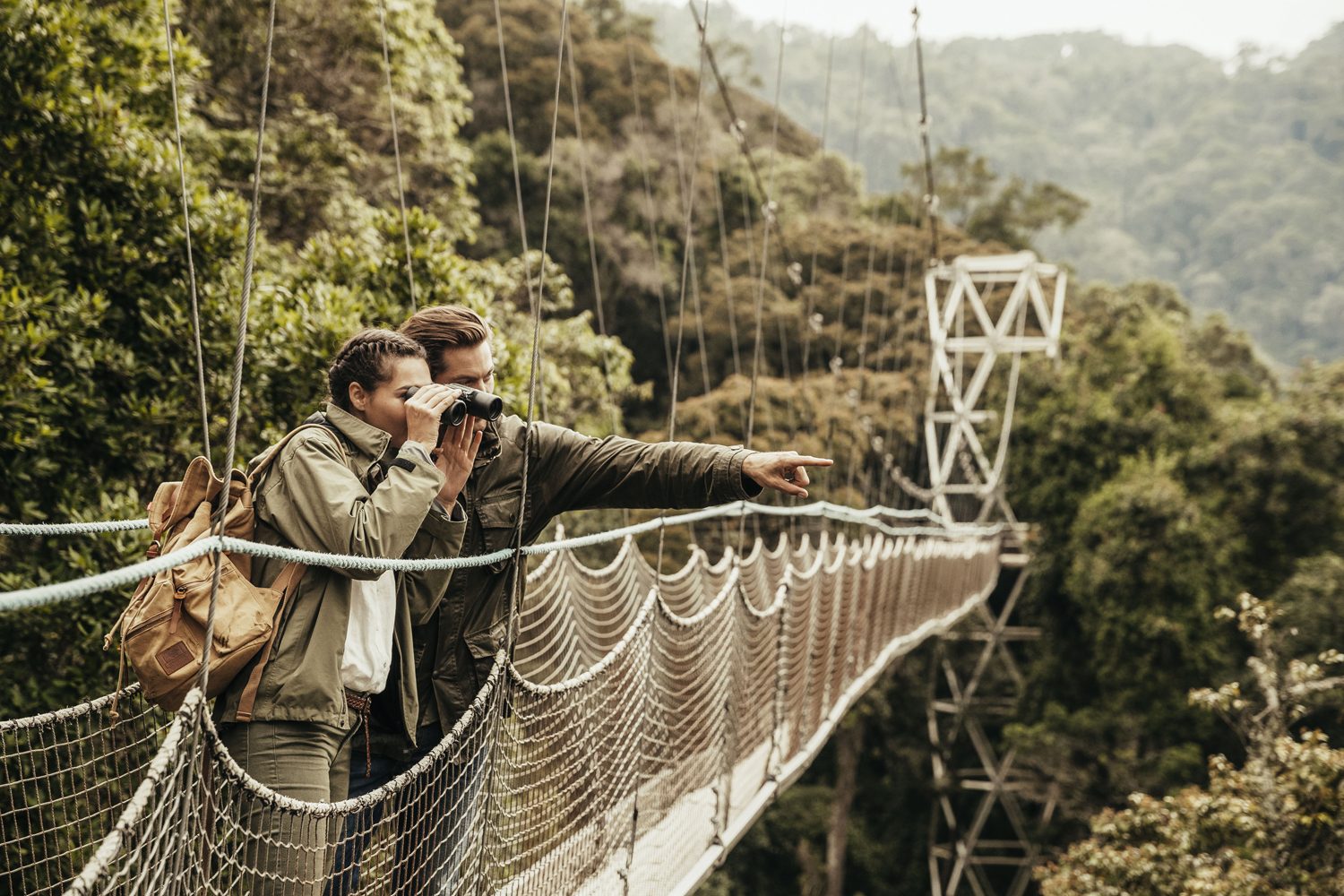
The Nyungwe canopy walkway is a long suspended footbridge that carries visitors across a forested gorge at the height of the tree crowns. The bridge measures about 160 metres in length and stands roughly 70 metres above the floor of the forest below, high enough that the canopy looks like a solid, rolling plain from the deck. It is built from timber planks, strong cable and rope, suspended between the great trees of the gorge and engineered to move gently with the wind.

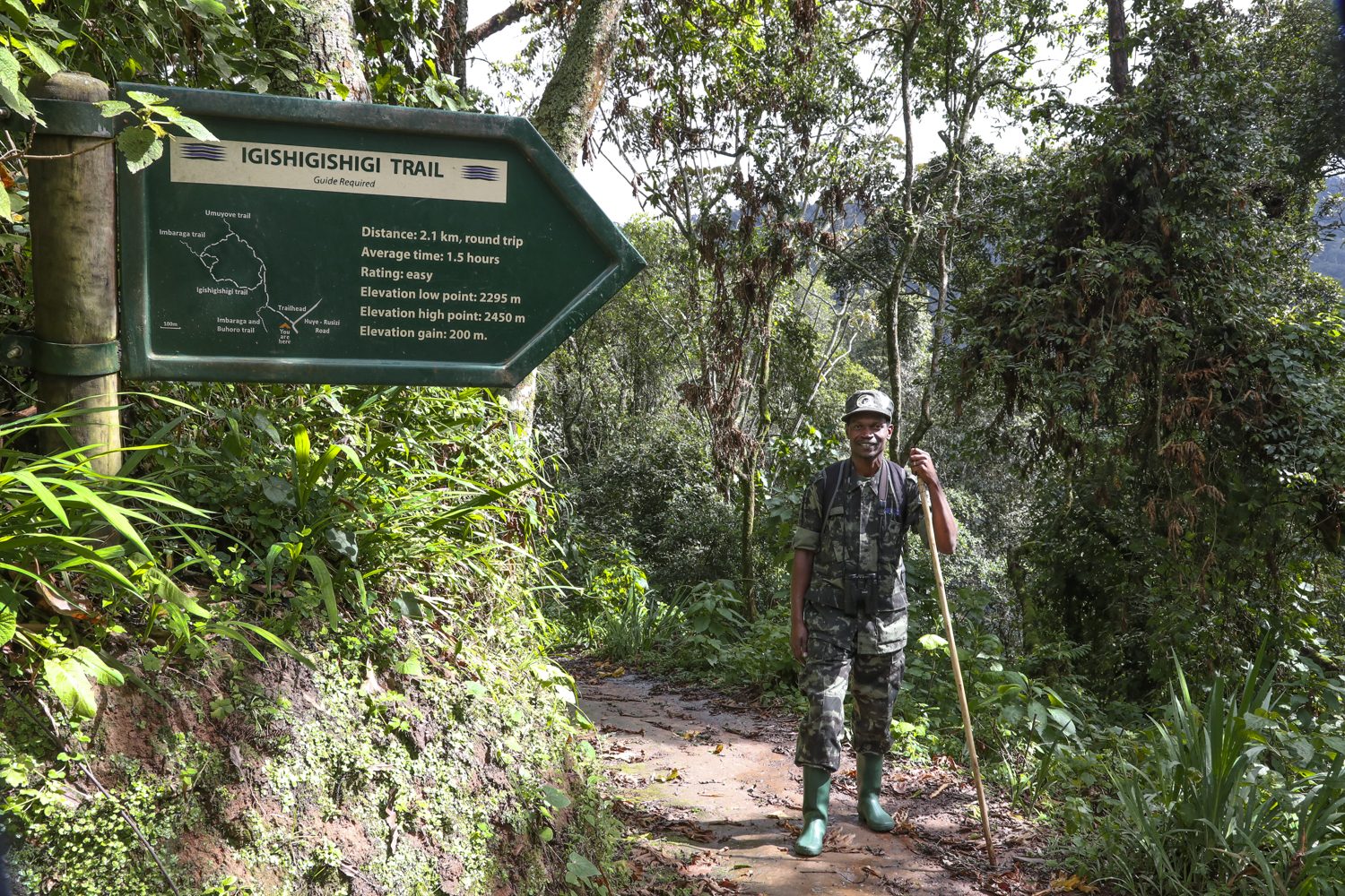
The bridge sits at the end of the Igishigishigi trail, a beautiful twenty-minute walk through the forest from the Uwinka visitor centre. The trail climbs gradually to the rim of the gorge, where a safe platform gives onto the bridge itself, and the crossing leads into the forest on the far side before the path loops back through the trees. The full circuit, trail plus bridge, takes about two hours at a relaxed pace.

The bridge was built with a double purpose. The first is access: before it existed, the forest canopy at Nyungwe was effectively unreachable, an entire habitat of birds, monkeys and plants visible only from below. The second is conservation: the walkway gives the park an unforgettable attraction whose future depends on the forest staying intact, and the visitor fees it generates help protect the very trees it crosses. Rarely has tourism and preservation worked so closely together.
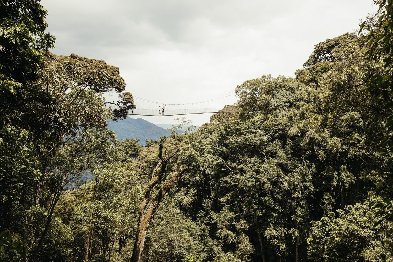
Looking along the Nyungwe canopy walkway from the platform

Crossing the Nyungwe Canopy Walkway

A view from the high deck of the Nyungwe canopy walkway

Stepping onto the Nyungwe canopy walkway is the moment you remember. The deck is firm underfoot, but it moves: a slow, easy sway that sets into a rhythm as you walk, and through the gaps between the planks you see the forest floor a long way down. For most people the first steps are the hardest; for almost everyone, the far half of the crossing is pure delight. The sway becomes soothing, the height becomes a privilege, and the green world of the canopy opens up around you.

The views are the whole point. From the deck you look across the gorge at the crowns of the great trees, each a platform of leaves and flowers; below you the forest falls away in layers to the stream at the bottom of the gorge; and all around, the birds move at your level, a perspective that no amount of ground-level walking can ever give. In the mornings, when the mist hangs in the valley, the bridge appears to float above the clouds, and the photographs are unforgettable.

The crossing is carefully managed. Groups are kept small, the bridge is crossed in single file, and the rangers are firm about the simple rules: no running, no jumping, nothing dropped, and no drones or selfie sticks at the height. The height is genuine and the sway is genuine, and visitors who are nervous should know that the structure is engineered to the highest standards and crossed by the rangers many times every day. Most people who are hesitant on the first step are smiling by the far side.

Life in the Canopy

The canopy is the busiest habitat in the rainforest. It is here, among the crowns of the great trees, that most of the forest’s fruit and flowers are found, and it is here that its animals do almost all of their living, energy concentrated in the leaves and light above the shaded floor. From the Nyungwe canopy walkway you are a guest at the table of the canopy: monkeys move through the branches at your level, birds pass close enough to hear their wings, and the whole soundscape of the forest surrounds you.

The monkeys are the stars. Black-and-white colobus leap between crowns with ease, their long white tails streaming behind them, and troops of blue monkeys chatter their way across the bridge line. If you are lucky, and quiet, you may see the chimpanzees making their way through the trees, or catch the passing of a great blue turaco as it crosses the gorge. A pair of binoculars and a little patience turn the ten minutes on the bridge into the richest hour of the day.

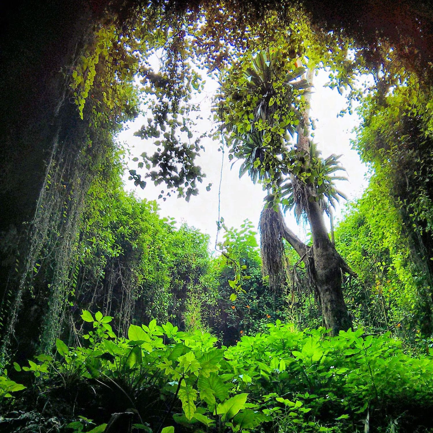
The plants of the canopy are just as remarkable. Every large branch is hung with ferns, mosses and orchids, the epiphytes that live entirely in the air of the treetops, and the ancient trees themselves support whole gardens in their crowns. From the bridge, for the first time, you understand the forest not as an assembly of trunks but as a layered world: floor, understorey, canopy and sky, all of it interconnected and alive.

The Trail That Leads to It

The Igishigishigi trail that brings you to the bridge is one of the finest short walks in the park in its own right. It climbs through old-growth forest where some of the tallest trees in Nyungwe stand, crosses clear streams on small bridges and gives a proper sense of the forest’s scale before you step out above it. The path is easy and well maintained, and the ranger leading the group will point out the medicinal plants, the nesting birds and the tracks of the animals along the way.

Plan the crossing for the morning. The light is level and soft then, the birds are at their most active, and the mist that gathers in the gorge makes the bridge into something out of a story. The whole excursion, the drive from the gate, the trail, the crossing and the return, fits easily in half a day, leaving the afternoon free for lunch among the tea or for another trail in the forest.

Planning Your Nyungwe Canopy Walkway Visit

The Nyungwe canopy walkway is reached from the Uwinka visitor centre in the heart of Nyungwe, itself reached by a scenic drive through the tea country of the far west of Rwanda. The park and its trails can be visited for a few hours or a few days; a single park entry covers the first day, and the canopy is usually booked as part of that same entry to make the most of the time. Permits and ranger fees are sorted by your tour operator, or check the park’s official website for current entry details; the walkway is the most straightforward of the park’s activities to arrange.

Because Nyungwe sits high, the weather on the bridge changes fast: cool and misty in the morning, warm and sunny at midday, with the chance of rain at almost any hour. Dress in layers, wear sturdy shoes for the short woodland walk, and carry a light rain jacket even if the sky is blue. The forest makes its own weather, and a downturn on the bridge in light drizzle, with the leaves turned to silver, is one of the experiences you will not forget.

The bridge is suitable for most visitors, including children and older, well-mannered travellers; the walk is short and the structure is secure. It is less suitable for those with a serious dread of heights: the height is real. If you are at all uncertain, walk the trail for the forest and watch the crossing from the platform; the forest itself is, after all, a gift, and the canopy is a privilege rather than a test.

What to Bring

  • Sturdy, comfortable shoes for the short forest walk
  • A rain jacket; the forest weather changes quickly even on blue mornings
  • Binoculars, to be a courteous guest of the canopy on the crossing
  • A camera with a good zoom for the kingfishers, the colobus and the view
  • Water and light snacks for the two-hour circuit
  • A secure pocket or lanyard for your phone, and a little cash for snacks and the ranger tip

No special gear is needed for the walk: no harness, no helmet, no climbing school. Leave drones and selfie sticks at base, secure anything that could fall from the bridge, and bring the list above and nothing more. The forest and the bridge will do the rest, and the view has a way of doing the whole lifting itself.

How the Nyungwe Canopy Walkway Is Built

The Nyungwe canopy walkway is a suspension structure of boards, steel spans and support towers, long enough to cross the gorge in a series of linked sections. The deck sags and gives beneath your feet, which is the point: the whole platform moves with the treeline, swaying gently in the air. Maintenance is checked each morning by the park, and because the system is inspected to a very high standard, the walk is safe even for people who do not love heights, provided they keep their eyes on the canopy and off the gap.

Visitors cross in small groups led by a ranger, and the pace is leisurely. The wooden deck creaks as you walk, the wind moves the trees, and above the gorge a great column of air separates the bridge from the streams of the forest floor far below. The numbers matter less than the sensation of walking through the top of the forest rather than simply above it, with the crowns of the trees at the level of your chest and the bird calls rising all around you.

The walkway is a small part of a much larger park, and for many visitors it is the bright introduction to Nyungwe’s network of trails. Combine the visit with the longer walks and the chimpanzee trek, and book your Nyungwe day through our team so the timing of the walkway and the rest of the forest is in good hands.

Nyungwe Beyond the Walkway

The Nyungwe canopy walkway steals the headlines, but it is only the most famous of a range of ways to know the forest. The park offers long day trails to waterfalls, lakeside viewpoints and the quiet stretches of the canopy, and the best rhythm for a visit is one highlight per day: a morning on the walkway, a day on the trails, a chimpanzee trek. The Nyungwe National Park guide sets out all of it, and the two-day chimpanzee tracking safari adds the great primate day to a walking itinerary.

Two days in Nyungwe is the comfortable minimum for a rounded visit, and three allows the park to show its full range. The canopy walkway gives the forest its famous image, and the trails give it its depth; together they make one of the best walking destinations in Africa. Book your walkway crossing with our team, and then climb down from the canopy to meet the rest of the forest on its own terms.

The Canopy and the Rest of Nyungwe

The Nyungwe canopy walkway is the headline, but the forest of Nyungwe has many highlights, and the canopy fits naturally into a longer stay. The classic combination is the walkway on one morning and a chimpanzee tracking session on another; the two are the great experiences of the park, treetops one day, apes the next. Our two-day Nyungwe chimpanzee safari centres on the apes, and the walkway is easy to add to the schedule on the drive in or out.

The waterfall trails and the summit walks of the park lie within reach of the same base, and a couple of full days in Nyungwe lets you meet the forest in all its moods. For travellers building a bigger Rwandan itinerary, the eight-day Rwanda best adventure safari combines the rainforest with the volcanoes of the north and the lakes of the Kivu region in the right order. The lessons of the canopy, the forest, the water and the mountains together make a picture of Rwanda that is hard to beat.

Standing on the bridge in the morning, with the mist above the green ocean and the calls of the forest sounding from below, is one of the defining images of Rwanda. The canopy walkway is quick to visit and impossible to forget, a few minutes above the trees that stay with you for years. Book your Nyungwe day with our team, walk the Igishigishigi trail, and step out over the gorge; the forest has been waiting a long time to show you this view.
The Trails of Nyungwe: Waterfalls, Canopies and Old-Growth Forest

Nyungwe forest trails and waterfalls define the green heart of south-west Rwanda: a vast rainforest that has stood on the mountains of the western rift for millions of years, making it one of the oldest forests in Africa. Its surface is rugged, its rainfall is generous and its interior is one of the richest storehouses of life on the continent: a forest where waterfalls, swamps and valleys lie beneath a great canopy, and where the calls of chimpanzees echo through the morning mist.

The forest is protected as a national park, and the best way to enter it is on foot. Unlike the open savannah of the east, Nyungwe is a world of close trees and bright streams, and its great gift to the visitor is a network of marked forest trails: paths that lead into the interior, past giant trees and hanging orchids, beneath the canopy and beside the roar of the waterfalls. The trails of Nyungwe open up a whole country of walking.

People often come to Nyungwe for the chimpanzees, but it is the forest itself they remember. This guide covers the walking side of the park: the principal Nyungwe forest trails, the waterfalls, the canopy walkway, the wildlife you will meet and the practicalities of planning your days on foot. For an overview of the park and its animals, our Nyungwe National Park guide is the best place to begin.

Nyungwe Forest Trails: A Forest That Outlasted the Ice Ages

Nyungwe is not just a forest; it is a survivor, and its forest trails and waterfalls are, in fact, the best way to meet it. Scientists describe the rainforest here as one of the oldest in central Africa, a block that persisted through the great swings of climate that turned much of the continent to savannah. This is the ecological memory of the region, a place where the mountain passes have stood as a refugium for hundreds of thousands of years while the forests around them shrank and grew.

The park covers close to a million hectares wrapped around the crest of the rift, lying between about 1,600 metres in its valleys and close to 3,000 metres at its highest summit. Its position on the water divide, moreover, makes it vital to the whole country: the rain that falls on Nyungwe drains in two directions, toward the Congo basin in the west and the Nile system in the east, supplying springs, rivers and wetlands for millions of people and animals beyond the park.

That mix of age, altitude and isolation has produced extraordinary richness. Nyungwe is home to more than a thousand species of plant, several hundred species of birds, dozens of mammals and more than a dozen species of primates, among them chimpanzees, several kinds of monkey and the notable colobus. Every step on the trails passes species that have been living in this forest since before humans set foot in it.

The Network of Nyungwe Forest Trails

The greatest strength of Nyungwe as a hiking destination is, for example, its forest trails and waterfalls, which let visitors choose their own level of adventure. The walks range from short loops of an hour or two to full-day expeditions, and each one leads through a different face of the forest: the deep and quiet of the primary forest, the bright clearings and their ferns, the steep ravines of the big streams.

  • The Igishigishigi Trail, the short climb into a deep forest gorge, site of the canopy walkway
  • The Isumo Trail, the walk along the ridge and down to the park’s great waterfall
  • The Kamiranzovu Trail, a plateau route through the mysterious valley of the Kamiranzovu stream and swamp forest
  • The Bigugu Trail, the long climb to the highest summits of Nyungwe with views out over the whole park
  • The Banda, Cyamudongo and Karamba Trails, a family of quieter walks along the forest edges and the tea frontier

Between them, indeed, these trails cover the full range of the forest experience: the gorge of Isumo and its thunder, the open, secret valley of the swamp, the altitude and the wind of the summits, and the deep nave of the old-growth forest. Each is led by a park ranger, the convention across Nyungwe, and the rangers are a walking encyclopaedia: they know where the chimps have moved, where the colobus feed, and where the light comes through the canopy best.

Trailheads and the Uwinka Base

Most of the trails begin from the Uwinka volunteer base high on the ridge, reached along the road that cuts through the forest between the tea estates of the park and the agricultural valleys. The scale of the place is hard to take in at once: the forest stretches to every horizon, the air is heavy and green, and the noise of the day comes from the trees themselves.

Forest trail through the rain trees of Nyungwe National Park

Waterfalls on the Nyungwe Forest Trails

The most beloved waterfall on the Nyungwe forest trails, however, is the Isumo falls, a route that leads steadily down through the forest toward the roar that grows ahead. Isumo is not a modest stream; it is a great watercourse, a broad ribbon of water that falls from the escarpment into a pool of green, its sound filling the whole valley. In the wet season it speaks anew, and the point where the path meets the falls, with the mist on the forest and the light playing on the water, is one of the most memorable in Rwanda.

On the plateau above, meanwhile, the Kamiranzovu trail tells a different story. Here the ground opens in the valley of a slow stream and the forest gives way to a broad swamp, a place where the water spreads wide and birds go about their work: the reeds with nests, the edges and the calls. It is the launch for the most patient of bird watchers and for the walker who enjoys the moody landscape that the sun cannot entirely dominate.

Water, in fact, is the thread that pulls the Nyungwe forest trails together, and waterfalls mark its loudest moments. The streams that cross the trails take the rain from the high forest on their way to join the headwaters of the great rivers, and where the trail strikes water it does so with bridges and stepping stones, usually at the point where the current is easiest. Walking Nyungwe is always walking with water, between the splashing of the streams at the bottom of the valleys and the big rain that returns to the canopy.

Rainforest canopy viewed from the upper trail network of Nyungwe

The Canopies and the Walkway

No account of the trails is complete, however, without the canopy walkway, the spectacular bridge that swings above the forest gorge at the end of the Igishigishigi trail. The bridge spans about 160 metres and hangs some 70 metres above the forest floor, carrying you across the gap at the level of the crowns of the trees. It gives ten minutes of the best view in the park and the truest, most level of the forest.

Walking the region’s trails lets you stand on the high of the canopy, where the leaves of the treetops look like a solid, rolling plain, and where the birds and sleeping monkeys level off around you; the photographs from this bridge improve everywhere you look. Our canopy walkway guide has the full practical detail; in addition, the crossing makes a perfect answer to a day of the forest, particularly when teamed with a morning on the great areas. For those who would rather stay on the ground, the viewpoints from the far side of the gantries are wholly enough.

The Primates of Nyungwe

Nyungwe’s primates are the headline for many visitors. The chimpanzees, the high-jacked stars of the park, are best met on a special fellowship and tracking system inside the forest, and a morning walk with researcher-led trackers is one of the finest wildlife experiences in Africa. The chimpanzees of the park have been studied for decades and are partly habituate, so the encounters are frequently intimate while always on the animals’ terms.

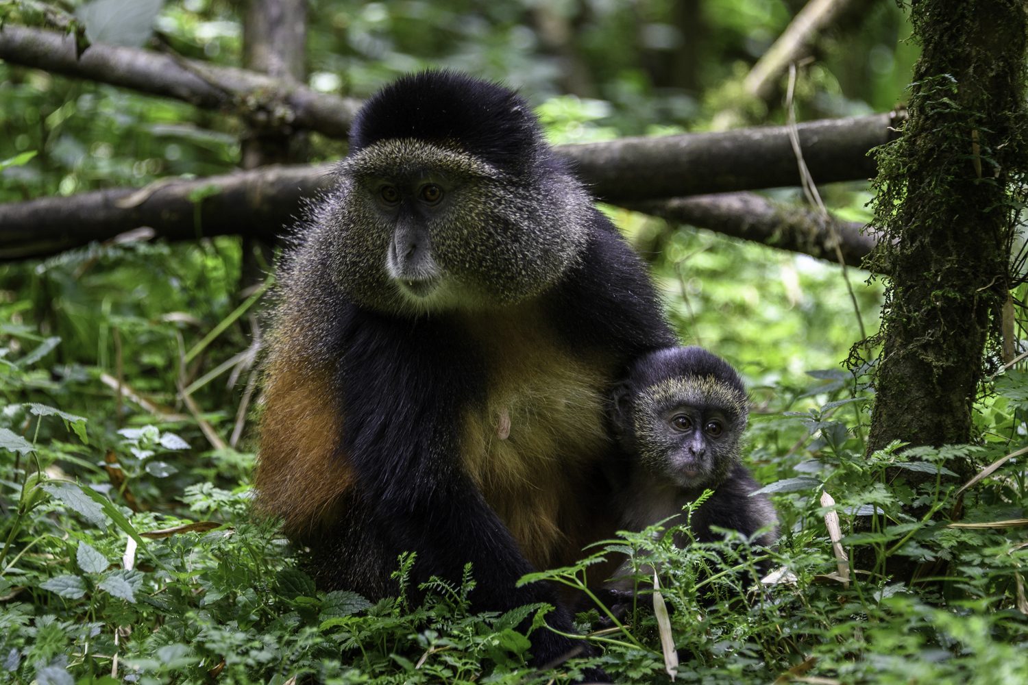
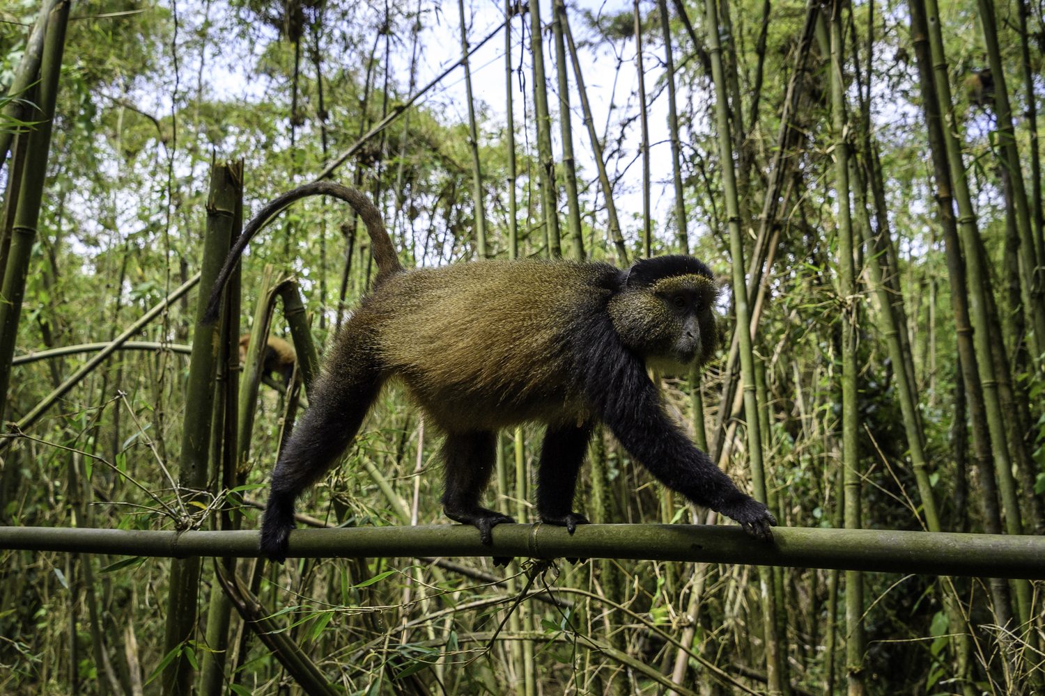
The ordinary trails are the place to meet the other residents. Along the paths, for example, you may meet the long-nosed colobus moving through the crowns, family groups of blue duikers, the shy of the trees and, with patience and a quiet, golden and other monkeys. The forest is not shy of its own mystery; the rangers will share that they are loaded with the habits of the animals they have followed for a lifetime, and their eyes find the movement that a visitor would miss. Do not be surprised to spend an hour which to grow nothing but then everything, all from the same spot of the trail.

Nyungwe’s nick-name among the park rangers is the forest of the big forest, and it is earned: the trails of the national park are the only way to be empty of crowds. You will share the forest with the trackers, with monkeys and birds, and with very little else; this is a forest of immense age and perfectly satisfying riches that has grown used to the occasional, respectful visitor.

Planning the Walking Days

Above all, make the walking days the heart of your plans: Nyungwe forest trails and waterfalls are the reason to linger. A day of the trails covers sixteen to twenty kilometres if you combine the canopy bridge with the Isumo trail, or the forest loop with the sunset; a full day around the base of the canopy and the headquarters covers the ground a visitor rarely finds. The park is walker friendly and the rangers are superb; the challenge is the choice, and the memory.

Please be ready for the season of the forest. Nyungwe’s altitude, above 1,600 m in its trails up to 2,950, brings rain almost every the day, and the visibility in the forest is limited to the arms of the hour. The layout: plan a proper fit, to arrive at the trail head at the hour of open, with your rain jacket; they walk with your head up. The falls and the streams are best in the morning, the truer of the afternoon may beat the planets over the canopy.

The practical fact is superb: a single entrance fee covers your time in the park, permits are sorted by your operator, the ranger instructs the trail and goes with you, and the trails are secure. The park also offers a lodging at the gate and in the near forest, so a walker can take two or three full days in the park and sleep in the rim of the forest, waking to the chimpanzees on the boundary of the canopy.

What to Bring on the Nyungwe Forest Trails

  • Sturdy walking shoes with a good grip; the trails are rooty and often wet
  • A rain jacket, and a dry layer, whatever the forecast
  • Long trousers and insect repellent for the forest
  • Plenty of water and energy snacks for the long days
  • A camera with a zoom for the birds, the monkeys and the canopy
  • Binoculars, a compact swiss army knife, and a sense of adventure

The seasoned walker of Nyungwe will not mind that the answer is alive with rain; the water is indeed the forest’s strongest asset, and the trails reward those who walk in the open, warm jacket. The forest bag follows the advice of the rangers, and the forest itself is the joy of the walking.

Weather, Seasons and the Walking Days

Nyungwe receives rain in every month of the year; however, these forest trails and waterfalls are walkable year-round with good timing. The drier stretches fall between June and September and again in the short dry pause of December, when the trails hold their shape and the forest opens to the light. In the rains, which concentrate around March to May and October to November, the paths are slippery and the river crossings rise, but the waterfalls are at their loudest and the forest is a brilliant loud green, and the rangers simply route the day around the downpour.

Whichever season you choose, start early. The rangers open the trails at dawn, the morning is the coolest for climbing, and the primate groups, which feed in the early hours, are most visible in the first hours of light. Carry rain gear whatever the season, take a second bottle of water, and let the guide set the pace. The forest is forgiving of extra time and unforgiving of bad preparation, and the reward for patience is measured in birds, monkeys and the quiet of the great canopy.

The day trails described on this page are the heart of a Nyungwe visit, and they combine naturally with the park’s signature experiences. The Nyungwe National Park destination guide puts the whole forest in context, and the two-day Nyungwe chimpanzee tracking safari, in addition, adds the best of the forest’s wildlife days to your trail plans. Let our team plan the walking days for you, so the timing of the park, the camps and the seasons works in your favour.

Bringing It All Together

Nyungwe is the climactic part of any Rwanda itinerary, and the trails are its beating heart: the waterfall trails, the canopy bridge, the swamp forest, the summit, the chimpanzees encountered along the way are the summit of the whole western journey. Many visitors travel straight from the park to the Congo River Nile lake of the trail and the lakes; few stretch to go from the volcanoes to the forest and the Kivu shore in one trip. For a specialised time in the forest, the two-day Nyungwe chimpanzee safari combines the tracking with the best trails, and the full country is covered in our eight-day Rwanda best adventure safari, which gives Nyungwe the two things the forest really deserves: time and mileage.

You can afford to travel the park in a version of the name is long and old and green. Give it at least a couple of days; take the rangers’ advice; and be prepared, above all, for the canopy of the great forest, which is the hardest of any in Africa on a walking scale. The trails of Nyungwe are the finest walking in Rwanda, and the forest that holds them is close to the best in the story of the continent. Entry fees and trail news are published by Rwanda’s official tourism board.

The Musanze Caves: Underground Rwanda

The volcano country of northern Rwanda is famous for what rises above the ground: the great cones of the Virunga chain and the mountain gorillas that live in their forests. But beneath this same landscape lies a different kind of wonder, hidden in the dark. The Musanze Caves are a network of volcanic tunnels formed by the lava flows of the Virunga volcanoes, and a guided walk into their cool darkness is one of the most atmospheric experiences in the country.

These are lava tubes. When the mountains erupted in the distant past, rivers of molten rock poured across the land. The surface cooled into a crust while the centre stayed liquid and drained away, leaving long natural tunnels behind. The Musanze system is among the largest and best preserved of its kind in the region. It runs for a considerable distance beneath the farmland and forests at the foot of the park.

The caves were known to local people for generations as a place of shelter and legend. They opened to visitors only in recent years, and quickly became a favourite stop on the northern circuit. This guide covers the geology, the legends, the tour itself, the wildlife of the underground and how to combine a visit with the mountains and gorillas above. For the practical details of the area, see our Musanze caves page and the Volcanoes National Park destination guide.

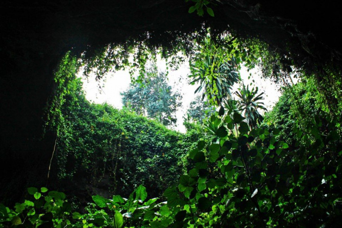
Entrance to the basalt tubes of the Musanze Caves

The Musanze Caves: Tunnels Born of Fire

The Musanze Caves are a textbook volcanic formation. When one of the nearby cones of the Virunga chain erupted, lava streamed down the slopes in rivers. The rivers lost heat on the surface and hardened into a crust, while the molten centre continued to flow beneath. When the eruption ended and the liquid drained away, an open tunnel remained under the hardened crust. This lava tube is roughly circular in section, and sometimes tall enough to stand up in.

The main system opened to visitors runs for around two kilometres beneath the foothills. It shows all the signatures of its volcanic birth. Look for smooth, glassy rock on the walls, irregular floors of solidified stone, and roofs that curve like the inside of a wave. In places the roof has collapsed, opening skylights through which trees reach down and shafts of light fall onto the cave floor.

Because the tubes formed underground, they stay remarkably stable. The temperature inside is cool and constant year round. The air is still and damp, and the sounds of the forest above recede into a deep silence. The geology of the Virunga chain is young by the standards of the earth. Standing in the caves, you are inside one of the most recent chapters of the range’s story. The same volcanic forces that built the mountains also hollowed out their feet.

Legend and Memory in the Musanze Caves

The caves carry more than geology. For the people of the region they have long been a place of refuge and story. They were a shelter in times of conflict, a cool storeroom for the harvest, and a hideaway in the wars that rolled across the hills. The tunnels were part of the landscape of memory long before they became a tourist attraction. The rangers who lead visits are proud to tell the stories their grandparents told them.

Some of the lore is pure legend. Villagers say the tunnels run all the way to the shores of Lake Kivu, or that they connect to the Congo. Travellers are told of the people who once sheltered here for weeks at a time. Like all good legends, these are impossible to prove and impossible to resist. Standing in the darkness at the end of a tunnel, the idea that it might go on forever feels entirely plausible.

In more recent memory the caves played a sobering role. During the genocide against the Tutsi in 1994, many people hid in these tunnels seeking safety, and some did not survive. A visit to the caves today is therefore also a place of remembrance, and the guides speak of it with gravity. It is a reminder that the landscape of Rwanda is woven into the country’s history, in both its light and its dark.

Touring the Musanze Caves Beneath the Volcano

Entering the Musanze Caves at the foot of the volcanoes

A visit begins at the entrance to the caves, where rangers brief the group, hand out helmets and headlamps, and lead you down a short path to the mouth of the tunnel. The transition is immediate. One moment you are in the green, warm daylight of the foothills. The next you are in the cool, still air of the underground, guided only by the pools of light moving ahead of you.

The walk itself is a genuine cave experience rather than a museum one. The floor is uneven stone, and the roof is close in places and high in others. The light of the headlamps picks out the textures of the lava rock and the occasional drip of water. The route is well maintained and safe, and the rangers manage the pace. Most visits last about an hour, which is enough time to feel the scale of the place without feeling rushed.

For guests who want more, some sections of the cave system are more adventurous, requiring stooping and careful footing. The guides will tailor the route to the group’s comfort. A few reminders make the experience better for everyone. Stay with the group, avoid touching the fragile walls, and keep your camera flash away from the bat colonies. The creatures of the cave are its true residents.

Bats and the Life of the Caves

The most famous residents of the Musanze Caves are the bats. Colonies roost in the ceilings of the tunnels, clinging to the rock in dense clusters. They are usually quiet and invisible in the dark, yet their presence is unmistakable. Listen for the faint high-pitched calls, the occasional sound of wings, and the signs they leave on the floor. The rangers know where the colonies hang and will point them out without disturbing them.

The bats are not the caves’ only life. The tunnels support a small ecosystem of their own. Cave insects, spiders and fungi live on the wet rock. Mosses and ferns gather beneath the skylights where sunlight falls through. This underground world is fragile, which is why the park asks visitors to stay on the route and keep hands off the rock. Every visitor who passes through leaves the cave a little different, and the park works hard to keep the impact small.

There is also, simply, the atmosphere. The caves are cold, dark and still in a way that few places on the surface can match. For the hour you are inside, the world above becomes a distant idea, with its hills, its animals and the noise of travel. Many visitors say the silence is what they remember: a silence so complete that you can hear your own heartbeat and the drip of water from the roof.

Musanze Caves: Practical Information for Visitors

The Musanze Caves sit on the outskirts of Musanze town, in the same hill country as the Volcanoes National Park gates. They are easily reached from Kigali, with a drive of roughly two or three hours along good roads. The drive is a pleasant introduction to the northern highlands. The Rwanda Development Board manages the park and the caves. The caves operate during daylight hours, and the park rangers recommend a visit in the morning, when the light is at its best and the site is quiet.

Entry to the caves requires a modest fee and a guided visit, and the ranger, the helmet and the headlamp are all included in the price. Booking is straightforward, through a licensed operator or at the site itself. Arrive early in the day in the high season. The visit suits families and travellers of all ages: the walking is easy, the cave is cool, and the reward is a memory of the underground.

Because the caves sit at the foot of the volcanoes, they combine naturally with everything else on the northern circuit. A classic day pairs the caves with a walk to one of the nearby crater lakes, with an afternoon drive past tea and eucalyptus, or with the golden monkey trek when those are running. The region’s tour operators, including our team, package the caves easily into a full agenda of the northern trails.

Whoever you travel with, the Musanze Caves fit easily into the day. The Musanze Caves tour needs no booking months ahead, unlike gorilla permits. You can simply arrive in the morning and join the next group. It is one of the most relaxed add-ons on the northern circuit.

What to Wear and Bring

  • Sturdy walking shoes, because the cave floor is uneven
  • Long trousers and a long-sleeved shirt, because the rock is rough and the cave is cool
  • A warm layer, as the temperature underground is noticeably colder than outside
  • A spare torch or headlamp, even though one is provided
  • Your camera, for the skylights and the entrance, without a bright flash inside
  • Cash or card for the entry fee, the guide’s tip and the market in town

A visit to the cave is not a strenuous activity: it is an hour of easy walking in the dark, so there is no need for hiking boots or special gear. The main requirements are comfortable shoes, a warm layer and an open mind. Leave your expectations of polished corporate cave tours at home; this is a raw, honest, ordinary underground world, and that is exactly why it is worth visiting.

Geology Below the Frozen Lava

The Musanze Caves are lava tubes. This type of cave forms when a river of molten rock flows downhill and crusts over on the surface while the interior continues to move. When the eruption that helped build the Virunga chain halted, the empty tube was left behind. It is a long, cathedral-like corridor of smooth basalt, with dripper walls, smooth floors and occasional skylights where the roof collapsed. These lava tubes are among the longest in East Africa, and walking through one is a rare chance to see the anatomy of a volcano from the inside.

The tubes follow the slope of the volcano, so the descent is gradual. The floor is mostly firm rock rather than mud, which is why the walk suits families. In places the chamber widens into great vaulted rooms, and in others you must duck beneath low arches. The guide will point out the markings of the flows, the rounded boulders rolled along by the moving lava, and the patches of broken rock that tell you how the eruption ended. It is geology you can literally walk through.

The caves sit on the edge of Volcanoes National Park, and they make a perfect counterpoint to the mountains above them. If you are also planning the climbs of the park, the mountain hiking guide on this site covers Bisoke, Karisimbi and the rest of the volcanoes, and the gorilla permits page explains how to book the trek at the same park gate. A morning in the caves and a day on the mountains is one of the fullest ways to see the Virunga chain.

Who the Caves Suit Best

The Musanze Caves are unusual in the park circuit because they ask nothing of your fitness. You do not need to climb, camp or cover long distances. The walking tour lasts about half an hour. It suits families, senior visitors and anyone returning from a hard day on the slopes. The cave floor is uneven in places, so sure shoes and a rested day help. The route is short, dry and under cover, which makes it a brilliant option when jungle weather interrupts the mountains.

Because the caves are so close to the town of Musanze, they slot easily into any northern circuit. Pair them with the twin lakes of Bulera and Ruhondo above the town, or with a day on the volcano trails, and you have a rounded day of close contact with the country above and below the ground. We can arrange the cave guide, the transfers and the permits together with your whole northern itinerary, and our team is happy to plan a day that fits the pace of your holiday.

Combining the Caves With the Mountains

The caves make a perfect piece of a northern itinerary built around the volcanoes and the gorillas. A two-day gorilla trekking tour can be paired with a cave visit on an off day. Travellers hiking the volcano trails, whether Bisoke, Karisimbi or Sabyinyo, will find the caves a welcome contrast. Where the mountains test your lungs, the caves exercise your imagination. The two experiences sit within an hour of each other, and together they show the full scale of the volcano country.

The twin lakes of Bulera and Ruhondo are close by, offering a quiet afternoon afloat to balance the dark of the caves. The tea estates and farmland of the surrounds are a landscape in themselves. For visitors working out the details of a full northern trip, our mountain hiking guide covers the climbs in depth. Our gorilla trekking packages put the great wildlife days in place with the logistics handled.

The caves ask very little of their visitors and give a great deal back. They are quick to visit, simple to arrange and unlike anything else in Rwanda. This is a genuine walk into the underworld of the Virunga chain, complete with bats, legend and the long silence of the rock. Add them to your northern circuit, go down with your headlamp, and come back up with a story. For official visitor information, see the Visit Rwanda tourism board. Contact our team if you would like help planning the day.

Cycling in Rwanda: The Land of a Thousand Hills by Bike

Cycling in Rwanda is an invitation rather than a warning: the country calls itself the Land of a Thousand Hills, and every hard-won summit repays the rider. The country’s roads climb and fall through an endless landscape of green ridges, tea plantations, lakes and volcanic peaks, and every hard-won summit is repaid with a view that would be the highlight of most cycling trips anywhere in the world. Add smooth, well-maintained roads, light traffic away from the main highways and a cool, dry climate at altitude, and you have one of Africa’s finest cycling destinations.

Rwanda has also embraced cycling as a culture. The Tour du Rwanda has grown into one of the continent’s major stage races, professional teams train in the hills between seasons, and village children line the roads when riders pass. Everywhere you ride you are met with enthusiasm: local riders fall in alongside you for a stretch, farmers pause to wave from the fields, and the country’s own cyclists are proud to share the roads they love.

This guide covers the best of cycling in Rwanda: the signature routes, what the riding really feels like, the seasons and conditions, the packing list, and how to combine a cycling holiday with the country’s wildlife highlights. For the full picture of the lake you will ride beside, our Lake Kivu destination guide has everything you need.

Cycling in Rwanda works for every level of rider, from first-timers on the lakeshore to racers chasing the Tour du Rwanda’s climbs. This guide covers the routes, the seasons, the hire options and the practicalities, and it is the closest thing to a complete cycling Rwanda handbook you will find. Whether you want a single day in the saddle or a full two weeks, the hills are waiting.

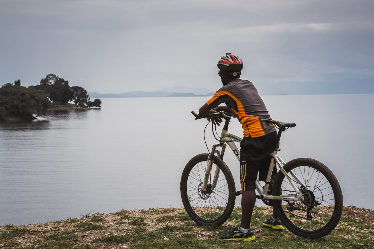
Cycling in Rwanda on the Congo Nile Trail towards Lake Kivu

Why Rwanda Is Made for Cycling

Start with the roads, which are the first reason cycling in Rwanda is exceptional: Rwanda has invested heavily in its road network over the past two decades, and the quality of its main routes is exceptional for the region: smooth, well-drained, well-marked and safe to ride. Away from the major arteries, quiet district roads thread through the hills and valleys, and on the slopes behind the lakes and volcanoes the traffic all but disappears, leaving you with tarmac, hills and silence. For a cyclist this is the difference between a pleasant ride and a memorable one.

Then add the altitude, which is the second reason cycling in Rwanda feels so good. Most of Rwanda sits between about 1,400 and 1,800 metres above sea level, which means cool air, strong sun and remarkably comfortable riding temperatures. The climbs are hard, but the descents are fast and shady, and even at midday the hills provide pockets of shade and breeze. It is a country made for cycling in the way other countries are made for sailing or skiing, and riders who come for the wildlife often leave converted to the wheel.

Finally, add the scale. Rwanda is small enough that you can cross most of it in a few days of pedalling, connecting the volcanoes of the north, the lakes of the west and the rainforest of the south by road, yet big enough that touring never feels rushed. Every stage ends in a village or town with a guesthouse, food and cold water, and every morning brings fresh tarmac and new hills.

Cycling Rwanda’s Congo Nile Trail by Bike

Cycling the Congo Nile Trail beside Lake Kivu

The Congo Nile Trail is the showpiece of cycling in Rwanda: roughly 227 kilometres of rolling, lake-facing riding between Rubavu in the north and Rusizi in the south, with the lake as your companion the whole way. The route follows the shore of Lake Kivu through tea fields, fishing villages and forest, and the lake is your companion the whole way, its blue water appearing and disappearing through the green. Most cyclists plan for four to six days on the trail, with daily stages of between forty and sixty kilometres.

The riding sits in a sweet spot, which is why most cyclists who try cycling in Rwanda start on the northern half of the trail: demanding enough to feel like an achievement, manageable enough for a touring holiday. The hills are short and stiff rather than long and gradual, the surfaces mix smooth tarmac with firm earth, and the reward is a rhythm that few long-distance routes can match. On good days you spin along the lakeshore with the islands and the Congolese hills mirrored in the water; on hard days you grind up a ridge and are handed the whole valley in return. Both kinds of day end at a village bed, a cold drink and a swim.

The trail’s overnight stops have grown up with it: guesthouses and beach camps welcome riders, luggage can be transferred between stages, and local guides know every climb. Many riders tackle the northern half of the route, which offers the most dramatic scenery and the easiest logistics, and leave the full length for a later, longer trip. The trail is best ridden slowly rather than fast, because the tea pickers, the fishermen and the lakeside villages are what make it memorable.

Cycling Routes Across Rwanda

North of the lake, cycling in Rwanda reaches its most dramatic landscapes around the Virunga volcanoes, where the roads around Musanze climb through the hills at the foot of the peaks, with the cones of Bisoke, Sabyinyo and Karisimbi rising above the farmland. These are some of the most beautiful riding roads in Africa, and they lead naturally to Volcanoes National Park, whose official website covers the park’s attractions, where the same forests hold the mountain gorillas. A day in the saddle here is a day spent in the shadow of the chain’s great peaks.

Around Kigali, cycling in Rwanda has its cultural heart: the hills roll without mercy, and the capital has become the centre of Rwandan cycling culture: weekend pelotons, training camps and a growing network of riders. The roads climbing out of the city are the training ground for the country’s professionals, and the descents into the tea-scented valleys to the north reward anyone willing to earn them.

To the south, the roads between the Nyungwe forest and the southern shores of Kivu combine forest climbs, tea country and a warm lakeside finish, while the gentler terrain of the east offers easier spins for riders building their confidence. The whole country is, in effect, one great route sheet, and the days you spend in the saddle connect the country’s landscapes better than any other way of travel.

What Cycling in Rwanda Is Really Like

The rhythm is the first thing a newcomer to cycling in Rwanda absorbs, and it is why Rwanda’s official tourism board markets the country as a cycling destination. There are no Alpine passes and no desert headwinds; instead the road rolls over ridge after ridge in short, sharp climbs and welcome descents, and the trick is to pace yourself to the day rather than fight it. A route that looks relentless on paper becomes manageable once you settle into the cadence of the hills.

The welcome on the road is one of the great gifts of cycling in Rwanda. You are greeted at every village: children sprint alongside you for a few hundred metres, farmers stop work to wave, and drivers give you generous room. Local riders will fall in beside you for a stretch, and in the market towns your arrival is an event. For a visiting cyclist, Rwanda is one of the most welcoming countries in the world in which to turn the pedals.

Be ready for the small realities of the terrain: the strength of the sun at altitude, the cool rush of the descents and the afternoon build-up of rain in the hills. Riders new to Africa are often surprised by how little traffic they encounter; the real demands are the sun, the climbs and your own legs. Dress for the morning cool, protect yourself from the midday sun, and you will find the riding as comfortable as it is beautiful.

Bike Hire and Practicalities for Cycling Rwanda

You do not need to bring your own bike for cycling in Rwanda, because hire quality has improved greatly as the country’s cycling scene has grown. Kigali, Musanze and the towns along Lake Kivu all have hire bikes, and the Congo Nile Trail has operators who deliver well-maintained mountain bikes to Rubavu and collect them at the end of the route. The quality of hire bikes has improved greatly as the country’s cycling scene has grown, and a decent mountain bike is the right tool for most of the trail.

Support is available at every level of cycling in Rwanda. Self-guided riders carry their own luggage or use the transfer services of the guesthouses along the trail; supported riders travel with a vehicle that carries the bags, provides spares and water, and has a guide who handles the logistics. The supported option is popular with first-timers who want the riding without the planning, and it lets you cover more ground in less time.

Two good habits will serve you well: Rwanda drives on the right and the roads are shared with motorbikes and minibuses, so ride defensively and single-file in the hills, and the Rwanda Development Board publishes the trail conditions each season; and the sun at altitude burns quickly, so carry sunscreen and drink constantly. Water can be refilled at almost every village, bananas and grilled plantains are the fuel of the road, and at the end of the day there is usually a lake within reach.

When to Ride

The dry seasons, roughly January to February and June to September, are the best months for cycling in Rwanda, offering the best riding conditions: firm trails, clear mornings and reliable views of the hills and lakes. The Congo Nile Trail is at its most enjoyable in these months, when the surfaces are dry and the swimming is perfect at the end of the day. It is also when the country’s own racing season is at its peak, so you may share the roads with training groups.

In the rainy seasons the trails are muddier and the afternoons bring regular showers, but the country is at its greenest and the hills are quieter. Many experienced riders enjoy the wet-season riding precisely because the roads are empty and the landscape is vivid; a good rain jacket and a willingness to get muddy are all it takes. For most riders, though, the dry months are the safest bet.

Whichever season you choose, the mornings are the golden hours: the air is cool, the views are clear and the roads are quiet. Plan your riding for the early part of the day, take a break through the hottest hours, and use the late afternoon for shorter loops or a swim. Rwanda’s altitude keeps the climate mild all year, and there is rarely a month when the riding is not worthwhile.

What to Pack for the Roads

  • Cycling shorts and jerseys with pockets for food, phone and a light layer
  • Helmet and fingerless gloves, for the fast descents and the strong sun
  • A waterproof shell for the afternoon showers of the hills
  • Sun cream, arm sleeves and a cap for the exposed climbs
  • Two bottles, because the climbs are long and the villages are not always close
  • Spare inner tubes, a pump and a multi-tool
  • Leg warmers for the cool mornings at altitude
  • A small lock and a power bank for the evenings
  • Cash for bananas, grilled food and guesthouse beds

Pack small and ride light; everything unnecessary is extra weight on the climbs. The essentials above cover both the supported and the self-guided trip, and the local shops will supply whatever you forget. Bring a good attitude and a sense of humour: the hills of Rwanda give back exactly what you invest in them, and riders who embrace the climbs are rewarded with the country’s best views.

Etiquette, Safety and the Character of the Roads

The mountain roads of Rwanda are shared, and the etiquette of cycling in Rwanda takes minutes to learn. Cyclists ride on the right, pass on the left, and ride single file when a vehicle appears, which on the Congo Nile Trail is constantly on the descents. Villages are busy with people, bicycles, motos and market stalls, so slow down and sound a polite warning before you reach a crowd. Schoolchildren love to shout greetings, and the friendliness of the road is one of the great gifts of riding in Rwanda, but it also means you must keep your eyes up at all times.

The big descents are where most accidents happen. The gradients on sections of the trail let you comfortably reach high speeds, and with potholes, gravel and the occasional herd of cows, that is a speed to resist. Brake early, take the corners wide, and always hold your position between heavy trucks, which share these routes. Plan each day so you climb in the cool of the morning and take the long downhill in the afternoon, when the light is warm and the traffic on the lakeshore road is at its quietest.

For the full Lake Kivu experience in the saddle, the Lake Kivu destination guide on this site describes every stage of the lake, and the six-day Rwanda gorilla trekking and Lake Kivu safari ends where the riding begins. Whether you come for a single stage or ride the whole trail end to end, book your fully supported ride with our team and we will handle the transfers, the luggage and the good guesthouses that make the hills a pleasure rather than a punishment.

Combining Cycling With Gorillas, Lakes and Forests

Cycling in Rwanda is also the perfect skeleton for a wider safari. The country is small and the roads are good, so a riding trip can be built around the wildlife: the Congo Nile Trail by bike, then a short transfer to Volcanoes National Park for gorilla trekking, then south to the rainforest of Nyungwe. For travellers who want both the riding and the animals, our six-day Rwanda gorilla trekking and Lake Kivu safari strings the trail and the lake together, and the eight-day Rwanda best adventure safari adds the volcanoes and Nyungwe to the mix.

The classic combination is a few days on the trail followed by a day with the gorillas: the saddle legs are an excellent warm-up for the walking, and the wildlife days provide a welcome rest for the wheels. In the north, the climbs around Musanze bring you to the park gates; in the south, the forest roads of Nyungwe are themselves worth riding. The lake, the volcanoes and the rainforest are all within reach of the pedals.

Whatever your plan, measure your fitness honestly and start smaller than you think you need. The support is there when you want it, from the trail operators and the guesthouses to our own team, and the hills make every day a story. Contact our team to book a fully supported ride, and give yourself the time to enjoy the Land of a Thousand Hills at the speed it deserves.

Kayaking Lake Kivu: Paddling Africa’s Highest Lake

There are lakes, and then there are lakes you paddle. Kayaking Lake Kivu puts you in the second kind — one of Africa’s great lakes, a vast inland sea of more than 2,700 square kilometres sitting at an altitude of around 1,460 metres in the western arm of the Rift Valley. Its water is clear, cool and remarkably calm, its shoreline is a maze of islands, bays and forested peninsulas, and its shores are ringed by the green hills that make Rwanda the Land of a Thousand Hills. For a kayaker, it is close to paradise.

Kivu is unusual among Africa’s great lakes in almost every way. It is one of the highest great lakes on the continent — at nearly 1,500 metres above sea level, it sits far above the lowland lakes of the east — and its position in the volcanic rift means its deep waters hold dissolved gases that bubble up in places, a reminder of the geology beneath. The lake has more than a hundred islands, from tiny rocky outcrops to the large island of Idjwi, and its shoreline is shared between Rwanda and the Democratic Republic of Congo.

This guide covers everything you need to know about kayaking Lake Kivu: the best paddling bases, the routes and islands, what you will see along the way, and the official lake guide from Visit Rwanda’s tourism siteay, and how to combine a kayaking trip with the rest of a Rwanda safari. If you are planning a full holiday around the lake, our Lake Kivu destination guide and the six-day Rwanda gorilla trekking and Lake Kivu safari are the best places to start.

Kayaking Lake Kivu: A Great Lake at High Altitude

Lake Kivu belongs to the family of African great lakes — the chain that includes Victoria, Tanganyika and Malawi — but it stands apart from them in almost every way. It is by far the highest of the great lakes, sitting at roughly 1,460 metres in the western branch of the East African Rift, and it is one of the most deeply embedded in its landscape: the hills rise directly from its shores, and the lake fills what is in effect a volcanic basin between the Congo and Nile watersheds.

The lake’s size is hard to grasp from the shore. At more than 2,700 square kilometres it is one of the largest lakes on the continent, stretching about ninety kilometres from its northern end at Rubavu to its southern outlet at Rusizi. Its islands number well over a hundred, and its shoreline — shared between Rwanda and the DRC — runs to hundreds of kilometres of bays, beaches and peninsulas. On its western side the hills of the Congo rise steeply from the water, and the lake has the feel of a mountain lake magnified to a scale that defies the word.

For paddlers, the geography is a gift. For example, the lake’s position in the hills shelters much of its water from the strong winds of the open rift, so its surface is frequently calm — glassy in the mornings, rippled in the afternoons. Its water is clear and clean, drawn from the hills and the springs of the rift, and it stays cool at altitude, which makes swimming and paddling comfortable through the middle of the day. This is not a lake you battle; it is a lake you glide across.

Why Kayaking Lake Kivu Means Paddling Between Islands

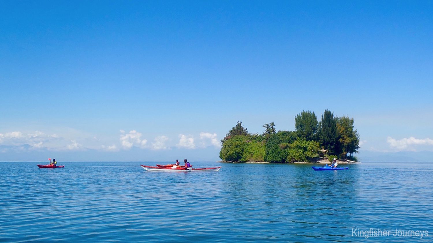
Kayaking Lake Kivu: kayakers paddling the calm waters near Rubavu

Kayaking Lake Kivu moves at the lake’s own pace, which is exactly why it is the perfect way to experience the lake. From a kayak you can slip between the islands, follow the shoreline into coves that are invisible from the road, and approach the lake’s fishing villages the way the lake’s own people do — across the water, quietly. Within an hour of launching, the road and its noise are gone, and the lake becomes a world of water, birds and hills.

The lake’s islands, meanwhile, are the paddler’s playground. Most are uninhabited or lightly settled, covered in forest or grass, and they make perfect destinations for a picnic paddle — launch in the morning, cross a channel, swim off an island beach, paddle back in the late afternoon. The larger islands have villages with their own rhythms: coffee washing stations, banana groves, children who paddle their own small boats. Meeting them from the water is one of the great pleasures of the lake.

Kayaking on Kivu is accessible to everyone. The lake’s calm waters suit beginners, while its size and its many islands give experienced paddlers room to plan real expeditions. Local operators along the lake offer kayaks and guides, and trips range from a two-hour morning paddle to multi-day island-hopping expeditions with camping on the islands themselves. The paddling is gentle; the memories are anything but.

Where to Paddle: Rubavu, Kibuye and the Islands

The best kayaking Lake Kivu has to offer starts in two places. At the northern end, the town of Rubavu — known to everyone as Gisenyi — has a long beach and calm, shallow water that is ideal for a first paddle, with views across the lake to the Congolese town of Goma and, on clear days, the volcanic cones of the Virunga range behind it. A morning paddle at Rubavu, looking across the water to another country, is a gentle introduction to the lake.

The true heart of Kivu kayaking is Kibuye, the town also known as Karongi, in the middle of the lake’s Rwandan shore. Kibuye sits on a peninsula of hills covered in forest, with islands scattered around it and some of the calmest water on the lake. The paddling here is superb: you can cross to the island of Napoleon Hat, circle the pine-forested islands offshore, or simply follow the shoreline’s coves and cliffs. Operators in Kibuye run guided kayak trips, and it is the base for most of the lake’s overnight kayak expeditions.

Multi-day kayaking Lake Kivu is a genuine expedition. A two or three-day route from Kibuye paddles south along the shore, camping on beaches and island forests, meeting fishing villages along the way and finishing at the southern towns of the lake. The pace is set by wind and weather — mornings are calm, afternoons can be breezy — and the guides who run these trips know the lake’s moods. For paddlers who want the full experience, this is the trip to plan for.

Wildlife and Landscapes From the Water

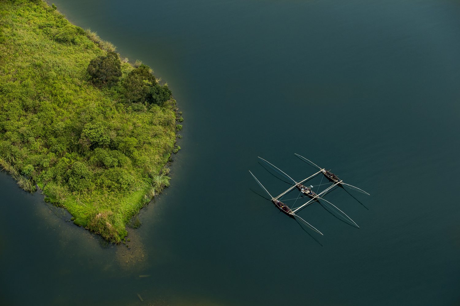
Singing fishermen rowing across Lake Kivu

The lake’s wildlife is visible from a kayak in a way it never is from the shore. Fish eagles sit in the trees along the shore and launch over the water; herons and cormorants work the shallows; flocks of weavers and sunbirds move through the lakeside vegetation. The birdlife of Kivu is rich, and a kayak is the perfect platform for watching it — silent, slow and level with the water.

The landscapes change constantly as you paddle. In the north, the hills are steep and the shore is rocky; in the middle, forested peninsulas and islands break the water; in the south, the hills ease back and the lake opens out. Tea plantations climb the slopes above the lake, their green terraces meeting the blue water, and villages of neat brick houses sit in the folds of the hills. Every bay has its own picture, and every hour of paddling brings a new one.

The people of the lake are part of the landscape too. Fishermen set out in the evenings in dugout canoes, their silhouettes black against the sunset; on some stretches you will see the famous singing fishermen, paddling in unison and singing as they row. From a kayak, you are part of the lake’s traffic — welcome in the villages, greeted from the shore, part of a water-world that has its own customs and its own life.

Islands to Visit: From Tiny Rocks to Idjwi

The islands of Lake Kivu are one of its great attractions, and from a kayak they are all within reach. Small rocky islands rise from the water like green hats, covered in forest and busy with birds; larger islands are farmed and settled, their villages connected to the mainland by boat. A paddle around any of them takes you through water that is completely yours, with the hills of the mainland on one side and the island forest on the other.

The largest island in the lake is Idjwi, which lies on the Congolese side of the water and is one of the largest lake islands in Africa. It is not a typical kayak destination from the Rwandan shore — the crossing is long and the border must be respected — but it is visible from many paddling routes, a long green mass that anchors the western horizon. Within the Rwandan side of the lake, the paddling islands are smaller, closer and easier, and they are the ones most trips visit.

Island stops are where the lake reveals its best side. A beach landing, a swim in the clear water, a picnic under the trees, the silence of a lake with no roads — then a lazy paddle back as the afternoon breeze builds. The islands give Kivu kayaking its structure: you paddle from island to island, and each one is a small adventure in its own right.

When to Go Kayaking Lake Kivu: Seasons and Conditions

Kayaking Lake Kivu is a year-round activity, but the best conditions follow the seasons. In the dry periods — roughly January to February and June to September — the mornings are calm and clear, the water is at its most inviting, and the views of the hills and islands are at their sharpest. In the rainy seasons, however, the lake is still paddlable, but the afternoons bring more frequent showers and the wind can pick up quickly.

The Daily Rhythm of Kayaking Lake Kivu

The daily rhythm of the lake matters more than the calendar. Mornings on Kivu are almost always calm — the classic time to launch — while afternoons often bring a breeze that builds from the south. Experienced paddlers plan their crossings for the morning, use the afternoons for swimming, beaches and island stops, and respect the lake’s moods: Kivu is gentle, but it is still a great lake, and the wind can change in minutes.

Whatever the season, the essentials are simple. The lake’s altitude keeps its water cool, so a light wet suit or a rash vest is comfortable for long swims; the sun at 1,460 metres is strong, so cover up and carry water. Your operator will brief you on conditions before every trip, and the guides keep a close eye on the weather.

All of the lake’s established kayak routes can be arranged through local operators, and travellers who prefer everything pre-booked can fold a kayaking day into a wider itinerary — from a half-day paddle at Kibuye to a multi-day island expedition with camping on the lake. Indeed, the lake is a year-round paddling destination, and the calm of its waters has a way of becoming the calmest part of any Rwanda holiday. To lock in your dates and your guide, book your kayaking trip with our team, or simply contact us and we will fit the lake into your plans.

What to Bring for a Kayaking Trip

Kayaking Kivu does not require much, but the right kit makes the trip better. In addition, operators provide the kayaks, paddles, safety equipment and guides; what you bring is personal:

  • A swimsuit and a towel — you will swim
  • Rash vest or light layer for sun protection on the water
  • Waterproof bag for your phone, camera and valuables
  • Sun hat, sunglasses with a strap, and high-factor sunscreen
  • At least two litres of water, and snacks for the island stops
  • Sandals or water shoes for the beach landings
  • A dry set of clothes for after the paddle
  • Cash for village purchases and tips

Travel light on the water — the kayaks have limited dry storage — and trust the guides to handle the logistics. The lake will do the rest.

Combining Kayaking Lake Kivu With Gorillas and the Trail

Lake Kivu is the centrepiece of western Rwanda, and it combines effortlessly with the country’s other great experiences. The lake is the heart of the Congo Nile Trail, the long hiking and cycling route that follows its shore from Rubavu to Rusizi, and a kayak trip is the perfect complement to a trail journey — a day on the water after days on the hills, or a morning paddle before a day of cycling.

To the north, the volcanoes of the Virunga chain rise beyond the lake, and the gorillas of Volcanoes National Park are a few hours’ drive from the lakeshore. A classic combination is a two-day gorilla trekking tour followed by a few days at the lake — the quiet of the water after the drama of the forest. To the south, the forests of Nyungwe hold chimpanzees and the canopy walkway, and the southern lakeshore makes a natural gateway to them.

The complete western Rwanda journey — volcanoes, lake and forest — is covered in our eight-day Rwanda best adventure safari, and for travellers who want the lake front and centre, the six-day Rwanda gorilla trekking and Lake Kivu safari builds a full holiday around it. Whatever you plan, leave the lake at least a full day: one paddle, one swim, one sunset. It will be the calmest day of your trip.

The Congo Nile Trail: Rwanda’s Great Long-Distance Trek

Rwanda suits long-distance travel better than almost any country in Africa, and its finest expression is the Congo Nile Trail — a route of roughly 227 kilometres that runs along the western edge of the country, following the shore of Lake Kivu from the lakeside town of Rubavu in the north to Rusizi in the south. The trail threads through tea plantations, fishing villages and forest, climbs above the lake on old tracks and footpaths. Delivers some of the most spectacular lake-and-mountain scenery in Africa.

The name says everything about the landscape. The trail runs along the ridge that separates the Congo basin — whose waters flow west into the mighty Congo River — from the Nile basin, whose rivers run east and north toward the White Nile. Standing on the trail, you are on the water divide of a continent: behind you the hills drain toward the Atlantic, ahead of you they drain toward the Mediterranean. Few long-distance routes anywhere have a story quite like that.

Walk or cycle the Congo Nile Trail in stages, with overnight stops in lakeside villages, guesthouses and beach camps along the way. It is the kind of journey that suits a long weekend, a slow week, or the southern leg of a bigger Rwanda itinerary. This guide covers the route, the practicalities and the highlights — and if you want to build it into a larger holiday, our six-day Rwanda gorilla trekking and Lake Kivu safari strings the trail’s northern section into a complete journey.

What Is the Congo Nile Trail?

The Rwanda Development Board developed the Congo Nile Trail as Rwanda’s great long-distance route: a signposted corridor running from the northern lakeshore at Rubavu — the town the whole world knows as Gisenyi — down the entire length of Lake Kivu to Rusizi at the southern end, where the Ruzizi River spills out of the lake toward Lake Tanganyika. In total the route measures about 227 kilometres. Walkers, mountain bikers and, increasingly, road cyclists use it on the sections where the route follows tarmac.

The trail does not follow a single engineered path. For much of its length it follows existing roads, tracks and footpaths — the lanes that fishing communities, tea workers and market traders have used for generations — linked by newer signposted sections that were cut to keep the route close to the lake. This is part of its charm: you are not walking a purpose-built trail so much as travelling the working landscape of western Rwanda, moving exactly as the people of the lake do.

Most trail users split the route into manageable daily stages, each ending in a community that has learned to welcome them. Some sections hug the shoreline, passing beaches and fishing villages. Others climb high above the lake for panoramic views, then drop back to the water. The result is a journey with a rhythm: climb, descend, lake view, village, repeat. After a few days on the trail you will know the hills of western Rwanda the way the people who live in them do.

Hiking or Cycling the Congo Nile Trail: Choosing Your Pace

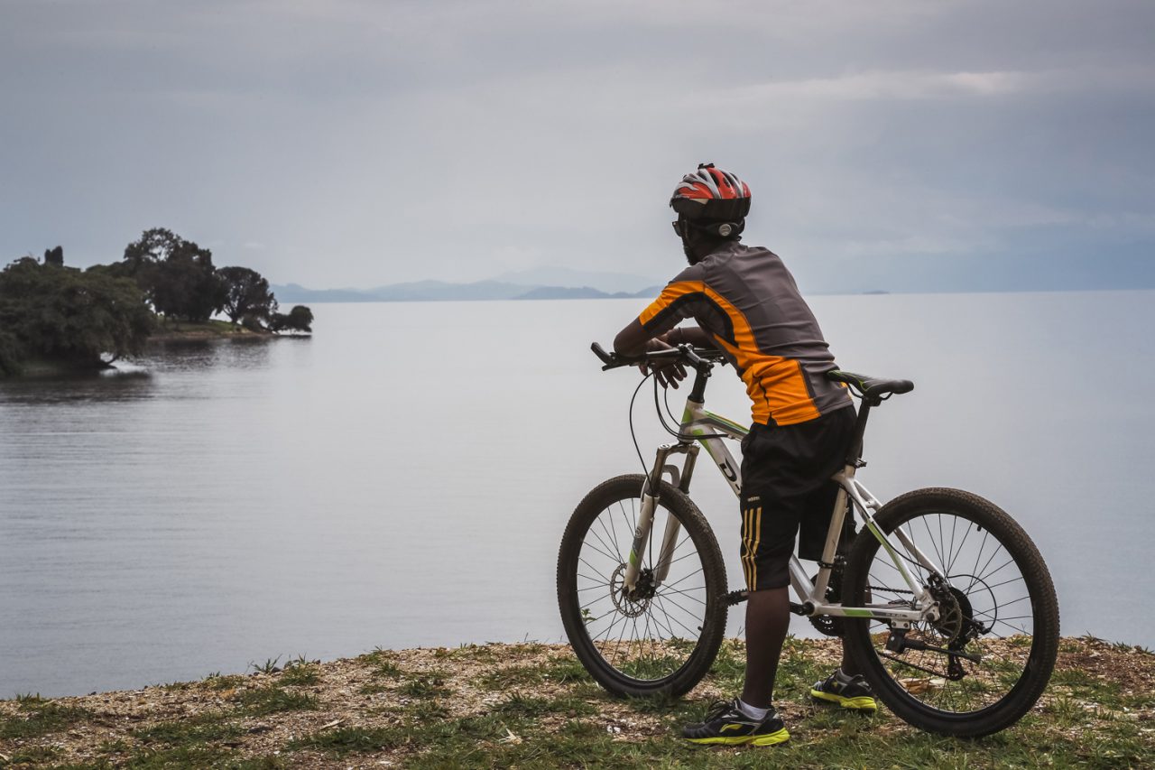
Cycling the Congo Nile Trail above Lake Kivu

The Congo Nile Trail works beautifully at two speeds. Walkers cover the full route in about a week to ten days, with daily stages of roughly 20 to 30 kilometres. Cyclists — the trail’s most passionate constituency — can ride the entire length in four to six days. Fit riders complete it faster. Both versions share the same route, the same villages and the same views. The difference is simply how much of the landscape you feel in your legs.

Walking has the advantage of intimacy. At walking pace you notice the small things: the tea pickers on the hillsides, the children waving from the schoolyard, the fishermen mending nets at the lake’s edge. The trail’s daily stages are short enough that you arrive in each overnight stop with time to swim, eat well and talk to the people you meet. For most first-time visitors, walking the northern sections of the trail is the perfect introduction to Rwandan hospitality.

Cycling covers far more ground and adds its own drama. The trail’s hills are long and the road surfaces vary — smooth tarmac in places, rough earth and rock in others — which makes a mountain bike the standard choice. The reward is the endless unfolding of the lake as you ride: one viewpoint after another, each bend in the road revealing a new island, a new bay, a new angle on the blue water below. Many riders combine the trail with the wider cycling culture of Rwanda. Our cycling guide can help you plan it.

Whichever pace you choose, the trail’s structure is the same: start in Rubavu, finish in Rusizi (or the reverse). Let the villages along the way look after you. Operators and guesthouses along the route arrange bike hire and porters for walkers. A luggage transfer service moves your bags between overnight stops so you ride or walk light.

Lake Kivu: The Water at the Heart of the Congo Nile Trail

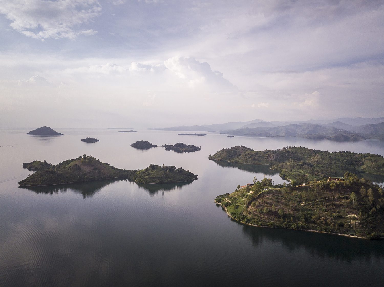
Lake Kivu and its many islands seen from the air

Lake Kivu is the constant companion of the Congo Nile Trail, and no other route in Africa follows a lake quite like it. Kivu is one of the great lakes of the continent, stretching more than 2,700 square kilometres across the western rift. It sits at an altitude of roughly 1,460 metres — high enough that its water is always cool and clear. High enough that the lake feels more like a mountain reservoir than a tropical lake. Islands, bays and beaches dot its shoreline. Green hills ring its deep blue water.

The lake’s setting is extraordinary. On its western shore, across the water in the DRC, rise the forests of the Congo basin. To the north, on clear days, the volcanoes of the Virunga chain appear on the horizon. The trail rides the ridge between this lake and the hills behind it. Means the views change constantly: one moment the lake fills the frame, the next you are deep in a valley of tea or bananas. It is a landscape of constant surprise.

The lake is also a working lake, and the trail passes through the communities that live on its water. Fishermen still push out at dusk in dugout canoes. Women wash clothes on the beaches. Cargo boats move between the lakeside towns. At some villages you will see the singing fishermen, who paddle in unison and sing as they row — a tradition that has become famous far beyond the lake’s shores. The Congo Nile Trail is not a wilderness route in the mountain sense. It is a journey through a living lakeside world. That is very much the point.

Highlights Along the Congo Nile Trail

The trail’s rewards are spread along its entire length, but a few places stand out. The route maps published by Rwanda’s official tourism board are the best place to start planning stages. Rubavu, at the northern end, is the classic starting point: a busy lakeside town with beaches, a lively promenade and views across the lake to the Congolese town of Goma, with the volcanoes of the Virunga chain lifting the horizon behind it. A swim in the lake at Rubavu, looking across the water at another country, is the perfect way to begin.

Further south, the trail climbs through the tea country that blankets the hills above the lake. These are some of the most beautiful landscapes in Rwanda: endless green terraces of tea, hedged with trees, with the blue line of the lake below. The plantations are working farms. The trail passes through them respectfully — pickers at work, the smell of drying leaves from the processing factories. Long views across the ridged hills toward the water.

Midway along the route, the town of Kibuye — also called Karongi — is the trail’s most celebrated stop. Set on a peninsula of forested hills, with beaches, islands and some of the best sunset views in Rwanda, Kibuye is where many travellers pause for an extra day, hiring a kayak or a boat to explore the lake’s islands. The town also holds the Genocide Memorial that remembers the people who died here in 1994, a sobering and essential part of any visit to western Rwanda.

At the southern end, the trail reaches Rusizi, where the lake narrows and its waters begin their long journey out through the Ruzizi River toward Lake Tanganyika. The town is a frontier place, on the edge of the DRC and Burundi. The sense of journey’s end is strong: you have followed the lake from its northern shore to its outlet. The water you have watched for a week is about to leave Rwanda for good.

Where to Stay on the Trail

The Congo Nile Trail is notable for the quality of its overnight stops. Along the route you will find a mix of lakeside guesthouses, beach camps and homestay-style accommodation run by the communities the trail passes through — many of them established specifically to welcome trail travellers. The standard varies from simple to genuinely comfortable. The welcome is consistently warm. The food is consistently good: fresh fish from the lake, beans, plantains and the rice for which western Rwanda is known.

Reserving accommodation ahead of time is recommended at the popular stops, especially in the high season. It is easy to do through operators who know the trail. If you are walking, a luggage transfer service means you can travel with a daypack while your main bag waits at the next guesthouse. If you are cycling, most guesthouses offer secure storage and basic bike repairs. A support vehicle can be arranged for the full route.

The trail also rewards a little flexibility. Some of the best nights on the route are unplanned: a fisherman who offers a boat ride, a village that invites you to a ceremony, a beach camp that turns out to be the highlight of the trip. Leave room in your plan for the lake to make you an offer.

When to Go and What to Know

The Congo Nile Trail can be walked or cycled in any month. The dry seasons — roughly January to February and June to September — offer the most comfortable conditions. In the rainy seasons the trail is muddier and the views less reliable, though the hills are greener and the lakeside is at its most lush. Either way, the trail’s elevation — much of it between 1,400 and 1,900 metres — keeps the walking climate mild, with warm days and cool nights.

For hikers, a reasonable level of fitness is all the trail demands. The daily stages involve genuine climbing. The pace is yours to set. The route is well within the reach of anyone who enjoys a full day of walking. Cyclists should be comfortable with long climbs and technical descents on mixed surfaces. A mountain bike is the honest choice for most of the route, though sections on the northern end have been surfaced for road bikes.

Carry cash for village purchases, travel with a basic first-aid kit and a filter or purification method for water. Expect the weather to change a few times a day. The essentials are straightforward:

  • Comfortable, broken-in footwear for hiking; a well-serviced mountain bike for cycling
  • Sun protection, a hat and sunscreen — much of the trail is exposed
  • A rain jacket; afternoon showers happen year-round on the lake
  • Water bottles and purification tablets or a filter
  • Light clothing for the days and a warm layer for the evenings
  • A swimsuit — the lake’s beaches and bays are part of the experience
  • Cash, a small repair kit for cyclists, and a headlamp for the guesthouses

Combining the Trail With Gorillas and Nyungwe

The Congo Nile Trail sits at the centre of Rwanda’s greatest travel circuit. To the north lie the Virunga volcanoes and the gorillas of Volcanoes National Park. To the south-west, beyond Rusizi, rise the mountains of Nyungwe, home to chimpanzees and the canopy walkway. And the trail itself threads between them along the lake. A journey that combines the trail with the country’s wildlife highlights is one of the great itineraries of East Africa.

The classic southern route runs from Kigali to the volcanoes, then west to the lake for the trail’s northern stages, then south through Nyungwe to the Kivu coast. It can be walked or cycled over a week to ten days, with gorilla trekking and chimpanzee tracking woven in. For travellers who want the trail without the full logistics, our eight-day Rwanda best adventure safari covers the volcanoes, the lake and Nyungwe with expert guides and support throughout.

However you plan it, the Congo Nile Trail rewards the traveller who takes the time to follow it properly. The lake, the hills, the villages, the tea, the singing fishermen — this is Rwanda’s slowest, most human adventure. The memories it leaves are among the most enduring the country offers. Plan your stages, pack for the hills and start at the lake.

Mount Sabyinyo: Where Three Countries Meet

Mount Sabyinyo is the strangest and most spectacular of the Virunga volcanoes — a mountain whose summit you share with three countries at once. Standing 3,645 metres high at the junction of the borders of Rwanda, Uganda and the Democratic Republic of Congo, its summit is split into a series of jagged, tooth-like peaks that give the mountain its name. Sabyinyo comes from the Kinyarwanda word for old man’s teeth, and the description fits: the summit ridge looks like a broken jawbone of stone, gnawed by weather and time.

This is not a gentle mountain. Where Bisoke offers a steady forest climb and Karisimbi a long expedition, Sabyinyo is a steep, technical scramble that demands hands as well as feet, a head for heights and a healthy respect for rock. It is also one of the most rewarding hikes in Volcanoes National Park, with views that take in three nations, the full sweep of the Virunga chain and, on clear days, the smoke of Nyiragongo rising from the Congo basin.

This guide covers everything you need to know about climbing Sabyinyo: the route and the scramble, the border landscape, the wildlife, the practicalities of permits and guides, and how to combine the climb with gorilla trekking. To see the full range of hikes we run in the region, start with our mountain hiking guide.

Mount Sabyinyo: One Summit, Three Countries

The defining feature of Mount Sabyinyo is where it sits. The mountain stands on the tripoint where the borders of Rwanda, Uganda and the DRC meet, and its summit ridge actually carries the boundary line — the official border follows the crest of the mountain’s three main peaks. Standing on the top, you are in three countries at once, with rangers’ posts on three sides and three national parks meeting at the summit: Rwanda’s Volcanoes National Park, Uganda’s Mgahinga Gorilla National Park and the DRC’s Virunga National Park.

This tri-border position makes Sabyinyo one of the most sought-after summits in Africa. There are few places in the world where a hiker can stand in three countries simultaneously, and none quite like this — the summit is genuinely wild, with no monuments, no flags, just rock, wind and the extraordinary geography of the boundary. The views are equally extraordinary: to the west, the great mass of Karisimbi and the distant smoke of Nyiragongo; to the east, the cones of Gahinga and Muhabura; and far below, the green valleys of three countries.

The mountain’s geology is part of its character. Sabyinyo is one of the oldest volcanoes in the Virunga chain, long extinct and heavily eroded, and it is precisely that erosion that created the jagged teeth of the summit. Where younger volcanoes like Bisoke still show smooth, conical profiles, Sabyinyo has been weathered into a hardened core of rock — a volcanic ruin that looks ancient even by the standards of a range that is itself young in geological terms.

The Climb Up Mount Sabyinyo: A Steep Scramble

The summit ridge of Mount Sabyinyo

Climbing Sabyinyo is unlike the other volcano hikes in Rwanda. The lower sections follow the familiar pattern — farmland, then bamboo forest, then Hagenia woodland — but where Bisoke’s trail is a steady grind and Karisimbi’s is a long, graded expedition, Sabyinyo ends in a serious scramble. The final assault on the teeth involves steep rock faces, exposed ridges and sections where you climb with hands and feet, using fixed ropes and chains to haul yourself up the worst of it.

The climb is usually done in a single day, and it is not for the faint-hearted. Fit and experienced hikers manage it in around eight to ten hours round trip, but the pace is set by the group, and the technical sections on the upper mountain are slow going. A head for heights is genuinely important: some of the traverses between the teeth sit on exposed ledges, and the guides will take their time bringing the group through. If the weather turns — and it can, at any moment — the scramble becomes significantly harder.

The summit itself is the payoff. The teeth are interconnected, and you reach the highest point by scrambling across from peak to peak, each one with its own view. The official summit sits on the tripoint, and the guides make sure you get the full experience: photographs on the border, views across three countries, and the odd sensation of standing on a boundary that divides a mountain but not its people — the communities on all three sides share the same Virunga landscape and, at lower altitudes, the same gorillas.

The descent is its own adventure. Coming down the scramble is slower than going up, and the lower forest trail, which felt easy in the morning, feels interminable on tired legs. Plan for a long day, start early and let the porters carry the weight — you will be glad of every extra kilogram they shoulder by the time you reach the trailhead.

Views From Mount Sabyinyo: The Virunga Panorama

No climb in the chain offers better views than Mount Sabyinyo. Because the summit sits at the eastern edge of the volcano chain’s high peaks, the panorama opens up in every direction: the whole sweep of the Virunga range to the west, the Ugandan volcanoes to the north-east, and the vast, cultivated green of the Albertine Rift valley falling away to the east. On the clearest days you can see the blue glint of Lake Kivu on the southern horizon and, far to the west, the ever-smoking crater of Nyiragongo.

The view of Nyiragongo is a particular draw. The DRC volcano’s active lava lake glows at night, and on clear evenings the red shimmer is visible from the Sabyinyo ridge — a reminder that this chain of mountains is not a museum of extinct geology but a living volcanic system. From the summit, Karisimbi’s 4,507-metre massif dominates the western skyline, and the teeth of the border mountain sit beneath it like a smaller, fiercer cousin.

Below the summit, the landscape tells the story of the border. On the Rwandan side, the forest of Volcanoes National Park runs down toward the twin lakes of Bulera and Ruhondo; on the Ugandan side, the bamboo slopes of Mgahinga; on the Congolese side, the rolling forest of Virunga National Park. In all three, the same mountain gorillas roam across the boundary as if the line did not exist — the tripoint is, in a very real sense, the heart of the gorilla habitat that spans the three countries.

Photographers should carry a telephoto lens and expect to work quickly, because the views are at their sharpest in the first hours of the morning, before the clouds begin to climb the flanks of the mountain. It is also worth remembering that Sabyinyo’s summit is a working meeting point of the natural world — rangers on all three sides watch the mountain, and the forest below is protected by three national parks at once. Few peaks anywhere combine geology, geography and history quite like it, and standing on the teeth you feel the weight of all three.

Wildlife on Mount Sabyinyo’s Slopes: Gorillas and Golden Monkeys

Mountain gorilla in the bamboo forest of the Virunga volcanoes

Mount Sabyinyo’s lower slopes are rich in wildlife, and the approach through the forest is often as memorable as the summit. The mountain sits on the edge of the gorilla country, and gorilla groups on the Ugandan side of the border are sometimes seen near the trail in Mgahinga; on the Rwandan side, the volcano’s forest holds its own gorilla families, and fresh signs of their presence — flattened vegetation, dung, torn bamboo — are a common sight for hikers.

Golden monkeys are the star performers on Sabyinyo’s slopes. These striking primates — golden-orange fur, black limbs, delicate faces — live in the bamboo zone that wraps the mountain, and troops of them are frequently encountered in the lower forest. They are among the most photogenic animals in the Virunga chain, and watching a troop of twenty or thirty of them move through the bamboo, chattering and leaping, is a highlight of the approach climb.

Birds add another layer to the forest soundtrack. The mountain’s altitude range, from farmland at the base to moorland at the top, creates a series of habitats that attract an array of species, from the crowned hornbills that boom through the Hagenia forest to the sunbirds that work the giant lobelias at altitude. Hikers who keep their eyes open on Sabyinyo come down with sightings to rival many a dedicated birding safari.

Mount Sabyinyo Practicalities: Permits and Timing

As with the other volcano hikes in Rwanda, climbing Mount Sabyinyo requires a permit issued through the Rwanda Development Board and booked in advance through a licensed operator. Numbers on the mountain are limited each day, and the scramble means the park manages the flow of climbers carefully; in the peak season, permits for Sabyinyo can sell out well ahead of time. The gorilla permits page explains the wider system, and our team can arrange the mountain permit as part of your itinerary.

A ranger guide is mandatory and essential. The scramble sections are technically demanding, the weather is unpredictable, and the forest holds gorillas, buffalo and elephant. The guides know the mountain intimately — every handhold, every weather pattern, every short cut — and they carry the ropes and safety kit that make the teeth climbable. Groups are small, and the guides pace the climb to suit the slowest member.

Porters are available at the trailhead and, on Sabyinyo, they earn their money. The scramble is physically demanding, and a porter carrying your daypack lets you use your hands properly on the rock sections. There is also a practical point: the lower forest trail is long, and having your water, snacks and spare layers on someone else’s back for the descent makes the final hours far more pleasant. Hire a porter, tip them well, and treat the mountain as a full-day expedition.

What to Pack for Sabyinyo

Sabyinyo combines the demands of a forest hike with the technicalities of a scramble, and the packing list reflects both. The essentials:

  • Hiking boots with excellent grip — the rock sections reward solid footwear
  • Waterproof jacket and trousers; the forest is wet and the teeth are exposed
  • Gloves, preferably with grip — they protect your hands on the ropes and rock
  • Long trousers and a long-sleeved shirt to protect against vegetation and sun
  • Warm mid-layer for the summit, where the wind is constant
  • At least two litres of water and substantial snacks
  • Sun hat, sunscreen and sunglasses — the summit sun is strong at 3,645 metres
  • A headlamp, in case the descent runs late into the afternoon
  • Your passport — the border summit makes it genuinely useful
  • Cash for guide and porter tips

Leave anything non-essential at your hotel in Musanze. The climb is a long day with technical sections, and every extra item in your pack is a burden on the scramble. Travel light, move steadily and keep your hands free for the rock.

Combining Mount Sabyinyo With Gorilla Trekking

Mount Sabyinyo is a superb hike in its own right, but it sits in the middle of the world’s best gorilla country, and the two experiences belong together. A gorilla trek in Volcanoes National Park paired with the Sabyinyo climb gives you two completely different ways of experiencing the same forest — one on your knees, one on the summit — and the combination is one of the great two-day itineraries of East Africa.

The standard structure is a three-day Rwanda gorilla trekking safari: a day with the gorillas, a rest evening in Musanze, and a full day on Sabyinyo. The mountain is also a natural partner for the region’s other highlights — the twin lakes of Bulera and Ruhondo lie at its foot, and the golden monkeys of the bamboo zone can be trekked on a separate visit. For hikers with time, adding the Bisoke crater lake climb or the two-day Karisimbi expedition completes the volcano set.

Whatever your itinerary, book the permits early and let the guides set the pace. The mountain has no patience with rushed plans, and the border summit rewards those who come prepared. Contact our team to plan the climb, and take your time on the teeth — there is no view like it anywhere in the Virungas.

Is Mount Sabyinyo for You?

Mount Sabyinyo is the most challenging day hike in Rwanda, and that is precisely its appeal. If you want a steady forest stroll, Bisoke or the golden monkey trails will serve you better; if you want a scramble with ropes, exposed ridges and a summit you share with three countries, Sabyinyo is in a class of its own. It demands a reasonable level of fitness, a head for heights and a tolerance for the weather the mountain makes.

It repays every bit of effort. The border summit, the teeth, the views across three nations — this is hiking with a story attached, and it is one of the experiences that stays with you long after the scratches heal. Plan properly, respect the mountain, and you will come down from Sabyinyo with the rarest of souvenirs: a photograph of yourself in three countries at once.

Climbing Mount Karisimbi: Rwanda’s Highest Volcano

Climbing Mount Karisimbi means taking on the highest point in Rwanda, a great extinct volcano whose summit rises 4,507 metres above the Virunga chain and, on clear days, looks down over the whole of northern Rwanda into Uganda and the Democratic Republic of Congo. Unlike its neighbour Bisoke, Karisimbi is not a day trip. The climb takes two days and one night, with a camp at 3,700 metres beneath the summit, and it is the most serious and the most rewarding hike in Volcanoes National Park.

Karimbi, as the mountain is known locally, is the second largest of the eight Virunga volcanoes, and its upper slopes carry a rare alpine ecosystem of giant lobelias, moorland and cold nights. The two-day format makes the climb tougher to fit into a short itinerary, but it also makes it safer and far more enjoyable: you gain altitude gradually, sleep in the mountain forest, and walk the final ridge in the first light of dawn, when the summit is often clear and the view stretches across three countries. This guide covers everything you need to know about climbing Mount Karisimbi: the route, the permits, the camp and the cost.

Dawn light over the volcanic peaks of Volcanoes National Park, Rwanda

Why Climb Mount Karisimbi

Bisoke gives you a crater lake in a day. Climbing Mount Karisimbi gives you Rwanda’s highest point, a night under the stars of the high Virunga, and a summit sunrise that hikers describe for the rest of their lives. Where the lower forest trails of the park are all about the gorillas, Karisimbi is about the mountain itself: the changing vegetation zones, the silence above the clouds, and the physical achievement of climbing more than 1,400 metres to the roof of the country.

The mountain is extinct, the remains of an old volcano that once stood far higher than today’s summit, and its name means “white shell” in Kinyarwanda, a reference to the cap of ice that historically covered the peak. The ice is long gone, but the summit still feels arctic in the early morning, and the upper slopes hold a landscape of giant groundsels, lobelia rosettes and mossy rock that is found nowhere else in Rwanda. On a clear day you can see the smoking cone of Nyiragongo, Mount Nyiragongo’s active crater in the Congo, and the whole sweep of the Albertine Rift.

Climbing Mount Karisimbi also passes through the richest wildlife habitat in the park. The bamboo and Hagenia forest of the lower slopes is the territory of mountain gorillas, and while the trekking route stays on the trail, you are walking through the same forest the gorillas call home. Golden monkeys, blue monkeys and black-and-white colobus all live along the route, and the birdlife is exceptional, including the Rwenzori turaco and the handsome francolin.

Mount Karisimbi Fast Facts

  • Elevation: 4,507 metres, the highest point in Rwanda
  • Location: Volcanoes National Park, on the border with the Democratic Republic of Congo
  • Duration: two days, one night, with the camp at 3,700 metres
  • Trailhead: Karisimbi gate, reached by four-wheel-drive from Kinigi
  • Distance: roughly 11 kilometres from trailhead to camp, and about 4 kilometres from camp to the summit
  • Difficulty: the hardest day hike available in the park; altitude and cold are the main challenges
  • Best for: experienced hikers and anyone who wants Rwanda’s highest summit

Alpine moorland and volcanic ridge below the summit of Mount Karisimbi

How the Two-Day Route for Climbing Mount Karisimbi Works

Climbing Mount Karisimbi is organised by the Volcanoes National Park office and must be booked in advance, with a guide and ranger escort required throughout. Day one starts early at the Karisimbi gate, reached by four-wheel-drive from Kinigi over a rough track that becomes impassable in heavy rain. From the gate you walk up through farmland fringes and into the bamboo zone, which gives way around 2,700 metres to a dense, moss-draped Hagenia forest where the giant trees are the size of cathedrals.

The forest thins around 3,300 metres, and the trail climbs through open clearings of alpine flowers before reaching the Karisimbi campsite at 3,700 metres, a small clearing with basic shelters and a cooking area, perched on the shoulder of the mountain. The walk from the gate to the camp covers about 11 kilometres with 1,100 metres of ascent and takes most hikers five to seven hours. Porters, available at the gate, carry tents, food and personal gear, and are essential for a comfortable climb.

The Night at 3,700 Metres

The night at 3,700 metres is the coldest night you will spend in Rwanda. Temperatures drop below freezing after sunset even in the dry season, and the camp sits above the cloud, with views over the dark cone of Bisoke and the lights of Musanze far below. This night of altitude is a deliberate part of the plan: it lets your body acclimatise before the final push to the summit.

Day two of climbing Mount Karisimbi begins early, usually around 3:30 a.m. The route from camp to the summit covers about 4 kilometres but climbs 800 metres, and in the dark it is a slow, steady grind over volcanic rock and moorland. The vegetation disappears entirely above 4,000 metres, leaving bare slopes of scree and lava rubble. Marked by a cairn and a small sign, the summit arrives in four to five hours, in time for the sunrise.

The Summit

The summit of Karisimbi is a broad, flat crater rim rather than a pointed peak, with views that are among the most famous in East Africa. To the north, the jagged triple summit of Sabyinyo and the flat plateau of Gahinga mark the border with Uganda; to the west, the Congo basin stretches out flat and green to the horizon; and to the south, the lakes and terraces of Rwanda fall away towards the Virunga foothills. The sun rising over all of it, with the cold wind on your face, is the moment the two days of effort are about.

Hikers usually spend 30 to 45 minutes at the top, taking photos and resting, before the long descent. The way down retraces the route to camp, where a meal and a rest break are welcome, and continues the same day all the way to the gate. The full descent takes five to seven hours, and most hikers are back at Kinigi by late afternoon. The total distance over the two days is roughly 25 to 30 kilometres, with more than 2,000 metres of accumulated ascent and descent.

Permits, Guides and Costs

Climbing Mount Karisimbi requires a two-day hiking permit issued by the Rwanda Development Board, and unlike the single-day Bisoke permit it covers the overnight on the mountain. Prices vary by nationality and change from year to year, so confirm the current rate when you book; as a guide, foreign visitors should budget several hundred US dollars for the permit, plus guide fees, park fees and the services of porters, which are arranged at the gate in cash.

The climb must be booked through the park office or a licensed operator, and it cannot be attempted independently. Your booking includes the mandatory guide and ranger escort, and most operators bundle transport, the four-wheel-drive transfer to the gate, and the services of a cook. Because the camp is basic and carries no permanent staff beyond the guides, everything for the night is carried up on the first day, which is why porters are so valuable.

Permits for climbing Mount Karisimbi are limited to a handful of hikers per day and sell out well ahead during the dry seasons, so plan months in advance. The park also offers the longer and more technical Gahinga and Muhabura routes on the Ugandan side, but for Rwanda’s highest summit, Karisimbi is the classic. If you are combining the climb with gorilla trekking, book both through the same operator so the permits and the dates line up, and check the gorilla permits page for current guidance on the trek itself.

Best Time for Climbing Mount Karisimbi

The window for climbing Mount Karisimbi comfortably is the same as for the rest of the park: the main dry season from June to September, and the shorter dry spell in December and January. In the rains, from March to May and again in November, the track to the gate becomes difficult or impossible for vehicles, the trail turns to deep mud, and the summit is often clouded in. Even in the dry season, be prepared for afternoon storms and near-freezing nights at the camp.

The early summit start matters because the mountain builds its own weather: mornings are usually clear, while cloud moves in over the upper slopes by mid-morning. Starting the final climb before dawn maximises your chance of a clear summit view and gets you down off the highest ground before the wind and storms pick up. A flexible itinerary with a spare day is worth having, so a weather delay does not wreck the whole plan.

Fitness, Altitude and Safety

Climbing Mount Karisimbi is a serious undertaking. The ascent from the gate to the camp is long and continuous, the second day adds 800 metres of altitude, and the total elevation gain is greater than any other route in the park. Hikers should be comfortable with full-day hill walking and should have done some training with elevation gain. Anyone who is out of shape will find the second day very hard.

Altitude sickness is the main risk. The camp at 3,700 metres is high enough to affect anyone, and the summit at 4,507 metres is well above the altitude at which symptoms become common. Headache, nausea, poor sleep and shortness of breath are all signs to take seriously, and the guides are trained to identify them. If symptoms are severe, the correct response is to descend, and the guides will make that call. Plan for a rest day at lower altitude after the climb, drink plenty of water, and never be ashamed to turn back; the mountain will still be there.

Packing for Karisimbi

  • A sleeping bag rated for sub-zero conditions, or a four-season bag plus liner
  • A warm sleeping mat; the camp ground is cold and hard
  • Base layers, a fleece, and a down or synthetic jacket for the camp and summit
  • A waterproof shell and rain trousers; weather changes fast above the forest
  • Sturdy boots with good tread and ankle support, worn in before the trip
  • Headlamp with spare batteries, essential for the 3:30 a.m. start
  • Water bottles or a bladder with at least three litres of capacity
  • High-energy food: nuts, chocolate, dried fruit and lunch items for both days
  • Sun protection, including high-factor sunscreen and sunglasses, even in winter
  • Cash for porters and gratuities at the gate

Porters carry the bulk of the camping gear, so your personal daypack should hold only the day’s essentials. Layer clothing for the second day: it will be below freezing at the summit start but warm by the time you reach the forest on the way down. The difference in temperature between the gate and the summit can be more than twenty degrees.

Combining Karisimbi with the Rest of the Park

Climbing Mount Karisimbi is a physical investment, so it makes sense to build a sensible order into your itinerary. Most visitors climb the volcano either first, while legs are fresh, or last, after the gorilla trek and the other day hikes. The mountain hiking guide on this site compares all the routes in the park, including the one-day Bisoke climb and the short Muhabura walk, so you can match the difficulty to your schedule.

The classic northern-Rwanda itinerary pairs the Karisimbi climb with a gorilla trek and a day on the twin lakes of Bulera and Ruhondo, which offer canoe trips and village walks in the shadow of the volcanoes. For visitors with more time, the three-day Rwanda gorilla trekking safari can be extended into a full hiking week, and the mountain’s position close to the park headquarters makes it easy to add to any itinerary based in Musanze.

Frequently Asked Questions About Climbing Karisimbi

How fit do I need to be for climbing Mount Karisimbi? Fit enough for a full day of continuous climbing with altitude. Regular hill walking and stair climbing in the months before the trip are the best preparation.

How cold does it get at the camp? The camp at 3,700 metres regularly drops below freezing at night, and the summit can be colder with the wind. A proper sleeping bag is essential.

Is the climb safe? With guides, rangers and the acclimatisation night, the climb is managed safely for prepared hikers. Altitude is the main risk, and it affects everyone differently.

Can I see gorillas and climb Karisimbi on the same trip? Yes, and many visitors do. Book both permits through one operator so the dates line up, and give yourself a rest day after the climb.

Do I need my own tent and sleeping bag? Porters carry the group gear, and most operators supply tents. Your own warm sleeping bag is strongly recommended.

Book Your Karisimbi Climb

Climbing Mount Karisimbi is a genuine expedition, and it deserves proper planning: permits, a guide, porters, warm gear and an itinerary with a spare day. Get those right, and you will stand on the roof of Rwanda, watching the sun clear the Virunga chain, with the whole country below you.

We organise Karisimbi climbs with permits, guides, porters, transport and the mountain camp all arranged in advance, and we can combine the climb with gorilla trekking and the rest of the north. Contact our team to plan your dates, and we will take care of the logistics while you train for the summit. Karisimbi is patient with those who are prepared, and the reward, a sunrise over three countries from 4,507 metres, is worth every step of the climb.

Hiking Mount Bisoke: The Crater Lake Volcano

Hiking Mount Bisoke to the crater lake is the most famous climb in Volcanoes National Park. The cone is perfectly symmetrical, and its summit hides a deep blue crater lake. The lake is reached after a long but rewarding single-day climb from the park headquarters at Kinigi. At 3,711 metres, Bisoke is not the tallest of the Virunga chain, which shares the border of Rwanda, Uganda and the Democratic Republic of Congo. It is, however, the most climbed. The trek takes a single day, and the view over the neighbouring peaks and the dark water of the crater lake is one of the most striking sights in East Africa.

Hiking Mount Bisoke is demanding. The trail climbs more than 1,000 vertical metres through dense mountain rainforest. The thin air at the summit will slow even fit hikers to a steady shuffle. But the effort is the point. This guide covers the trail in detail, the permit costs, and how to pack. It also explains how to combine the climb with a gorilla trekking safari on the same trip, so you can plan the day with confidence.

Hiking Mount Bisoke to the crater lake takes one full day. The crater lake at the summit of Mount Bisoke is roughly 400 metres across, the highest in the Virunga range. Hiking Mount Bisoke rewards you with a crater rim view over five other volcanoes. That crater lake view is the reason the mountain is so popular.

Hiking Mount Bisoke: the cone over the bamboo forest, with the crater lake hidden at the summit

Why Hiking Mount Bisoke Is Rwanda’s Favourite Climb

There are eight major volcanoes in the Virunga range, and six of them lie inside Rwanda’s Volcanoes National Park. Gorilla trekking brings most visitors to the park, but the volcanoes themselves are a growing attraction in their own right, and Bisoke is the entry point for most hikers. The reasons are practical as much as scenic. The trailhead is easy to reach from Kinigi, and the climb takes a single day. You do not need to camp on the mountain to see the crater lake.

The summit rewards hikers with a spectacle that few mountains in Africa can match. The crater at the top of Bisoke holds a lake roughly 400 metres across. Its water is a deep green-blue that looks almost black beneath the rim walls. On a clear day, the lake sits in shadow while the surrounding peaks catch the sun. The wind whips spray from the surface far below. The whole view, from the terraced hills of Rwanda to the flat green mass of the Congo basin, is worth every steep metre of the climb.

Bisoke is also one of the best places in the park to encounter the montane forest and its wildlife. The lower slopes are bamboo thickets where golden monkeys move in noisy troops. Higher up, the trail crosses Hagenia forest draped in moss, where colobus monkeys leap between branches and the rare mountain gorillas sometimes visit. The volcano is sacred to local people. The Rwandan side of the mountain is protected as part of the national park, a UNESCO World Heritage Site along with the other Virunga volcanoes.

Hiking Mount Bisoke: Fast Facts

  • Elevation: 3,711 metres above sea level
  • Location: Volcanoes National Park, northern Rwanda, about 90 minutes by road from Musanze town
  • Trailhead: Nyabigingo gate, also known as the Bisoke trailhead, near Kinigi
  • Distance: roughly 6 to 8 kilometres round trip, depending on the route taken
  • Duration: 5 to 7 hours up and 2 to 4 hours down, usually 7 to 10 hours in total
  • Difficulty: steep and demanding; altitude, not distance, is the main challenge
  • Summit feature: a crater lake roughly 400 metres across, the highest lake in the Virunga range

Hikers on the muddy trail below the Bisoke crater rim

Planning Your Mount Bisoke Hike

You organise the climb through the Volcanoes National Park office in Kinigi, and you must book it in advance. You cannot simply turn up at the gate and start walking. Every visitor needs a hiking permit. Because the number of permits is limited each day, availability can run out weeks ahead during the high season. Most visitors book through a licensed tour operator who handles the permit, the guide and the transport in one package.

The trailhead is at Nyabigingo, on the edge of the park. From Kinigi it is a short drive, and your driver will wait at the gate while you hike. You set out early, usually around 7 a.m. The climb takes most of the day, and the descent should be completed before dusk. At least one armed ranger accompanies each hiker as part of the park’s anti-poaching programme. You can also hire a porter at the gate for a modest fee to carry your pack.

Hiking Mount Bisoke: The Ascent Step by Step

The ascent follows a narrow trail that is muddy for most of the year. You climb through the bamboo zone first, where the stems arch overhead and the path can be slippery even in the dry season. Then you enter Hagenia forest, whose gnarled trees are draped in moss and lichen. The forest grows thinner as you rise. In the final section, above about 3,400 metres, you walk through open meadows of giant lobelia and groundsels that look as though they belong to a different planet. The last push to the rim is a steep, rocky scramble that demands care.

From the rim, the crater lake is a short walk around the edge. Most hikers spend 30 to 60 minutes at the top, taking in the view and eating lunch, before starting the descent. The way down is hard on the knees, and the mud makes it slow. Plan for it to take nearly as long as the climb. The full day, from gate to gate, usually runs between 7 and 10 hours.

Hiking Mount Bisoke: What to Expect at the Crater Lake

The crater lake at the summit of Bisoke is the reason most people make the climb, and it does not disappoint. The water sits in a bowl formed by the collapsed mouth of the volcano, ringed by sheer cliffs that drop from the rim to the surface. Its colour changes with the light, from deep blue to almost black. Cloud often covers part of the lake, which only adds to the atmosphere.

There is no path down to the water, and visitors may not descend into the crater. The national park protects the lake, and the rim is the only viewpoint. The crater lake is the destination, and hiking Mount Bisoke is the journey that earns it. This crater lake sits at the summit of Mount Bisoke, reached after hours of steady hiking through the forest. Standing on the rim is one of the great moments of a Rwandan trip, with the wind coming off the water and the other volcanoes of the Virunga chain around you. On very clear days you can see Mount Karisimbi to the southwest and the smoking summit of Nyiragongo in the Democratic Republic of Congo to the north.

Permits and Costs for Hiking Mount Bisoke

The Rwanda Development Board issues the hiking permit for Mount Bisoke, and it is separate from the gorilla trekking permit. It is far cheaper, but the price varies by nationality and residency status. The park has adjusted its fee structure several times in recent years, so confirm the current rate when you book. As a general guide, foreign visitors should expect the permit to cost several hundred US dollars per person for the day.

On top of the permit, budget for a guide and a porter if you want one. Most package bookings include guides, and in practice they are mandatory. Porters cost a small fee paid in cash at the gate. The drive to and from the trailhead, a packed lunch, plenty of water, and park entry arrangements are normally bundled into the tour price. That is why most visitors book the climb as part of a wider package, such as a two-day Rwanda gorilla trekking tour that pairs the volcano with the park’s gorillas.

Bisoke permits are limited and sell out during the dry seasons, so book well in advance, ideally two to three months ahead for peak dates. The park office at Kinigi opens early on hiking mornings, and permit holders must present identification at the gate before the group departs.

Best Time for Hiking Mount Bisoke

You can climb the mountain all year round, but the two dry seasons are the best windows. The main dry season runs from June to September, with the clearest skies and the driest trails. The shorter dry season in December and January is also good. During the long rains from March to May and the short rains in November, the trail turns to deep mud. Visibility drops, and the summit is more often hidden in cloud.

Even in the dry season, weather on Bisoke changes fast. Mornings are usually clear, with clouds building over the summit by late morning, which is why the early start matters. Temperatures at the trailhead sit in the high teens during the day. On the summit, the wind and altitude can make it feel close to freezing. Rain can arrive at any time of year, and a good rain jacket is non-negotiable.

Packing for Hiking Mount Bisoke

  • Sturdy, worn-in hiking boots with good grip for the mud and loose rocks
  • A warm layer: fleece or a lightweight down jacket for the summit wind
  • A waterproof jacket and trousers; rain is possible all year
  • At least two litres of water; there is no reliable source on the trail
  • High-energy snacks and a packed lunch to eat at the crater rim
  • Sun protection: the sun is intense at altitude even in cloud
  • A headlamp in case the descent runs late
  • Cash for the porter and any gratuities at the gate

Keep the pack light. The porter will carry most of the weight, but you carry what you need for the day. Every extra kilo is felt on the climb. Trekking poles help enormously with the mud and the descent, and many hikers wish they had brought them.

Fitness and Altitude

Hiking Bisoke is a serious physical effort. The 1,000-metre elevation gain from the trailhead to the rim is continuous, with no flat sections to recover on. The altitude above 3,500 metres thins the air dramatically. Hikers who are new to mountain walking should train with regular hill work beforehand and expect to move slowly in the upper section.

Altitude sickness can affect anyone. The common symptoms are headache, nausea and shortness of breath, and if they become severe the only reliable cure is to descend. Take the climb at a steady pace, drink plenty of water, and tell your guide immediately if you feel unwell. The rangers carry basic first aid and can radio the gate in an emergency. There is no shelter and no road on the mountain, so fitness and preparation are your best protection.

Combining the Climb with Gorilla Trekking

Most visitors to Volcanoes National Park come for the mountain gorillas. Bisoke is the perfect companion to a trekking safari because both activities start from Kinigi. The gorilla groups most often visited by tourists, including the Sabyinyo and Amahoro families, roam the forest on the lower slopes of the very volcanoes you will climb. Seeing the gorillas one day and the summit of their home the next is a memorable way to understand the park.

Gorilla permits are expensive and strictly limited, so plan the two activities together. The gorilla permits page on this site explains the current prices and how booking works. Our mountain hiking guide covers all the other volcanoes in the park, from the short Mugabura day hike to the two-day Karisimbi climb. You can build the right combination for your fitness and your schedule. If you want to extend the trip, the twin lakes of Bulera and Ruhondo lie just below the volcanoes. They make a calm and beautiful third day in the north.

For most itineraries, the standard advice is to book the gorilla trek first and the hike second. Tired legs from the mountain should not spoil the encounter with the gorillas. Both bookings should be made through a licensed operator. Permits are released for sale on a rolling basis, so the earlier you confirm your dates, the better.

Frequently Asked Questions

Can beginners hike Mount Bisoke and reach the crater lake? Fit, determined beginners can make it, but it is a hard day. Hiking Mount Bisoke to the crater lake takes most of the day and plenty of water. If you are unsure, train with hill walks beforehand and book a porter to lighten your pack.

How long does the hike take? Most hikers complete the round trip in 7 to 10 hours, with roughly an hour at the summit.

Do I need a gorilla permit for the climb? No. Bisoke requires its own hiking permit, which is separate and cheaper. The gorilla trek is a different activity.

Is the crater lake safe to swim in? No. The national park protects the lake, and there is no path down into the crater. The rim is the only viewpoint.

Can I climb Bisoke and Karisimbi in one trip? Yes, with enough days. Karisimbi is a two-day climb, so plan at least three nights in Musanze for the two mountains.

Book Your Mount Bisoke Hike

Mount Bisoke rewards planning. Book your hiking permit early, arrive at the gate before seven in the morning, and let the mountain set the pace. The crater lake that waits at the top has been a landmark of the Virunga range for millennia, and the view from its rim is one of the finest in Rwanda. Every hiking Mount Bisoke story ends with that crater lake view, and the hike earns it.

We organise Bisoke climbs as part of hiking and gorilla itineraries, with permits, guides, porters and transport all arranged in advance. Contact our team to plan the details, and let us take care of the paperwork while you focus on the summit. A permit in hand is the difference between a plan and a climb, and the crater lake is worth the effort. For official park updates, check the Volcanoes National Park website and the Visit Rwanda tourism board.